Valescure Valley

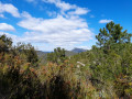
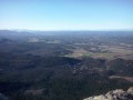
A shaded route near Roquebrussanne offering beautiful views of the surrounding mountains.

Details

20629596
Creation:
Last update:
Last review:
  • Walking
    Activity: Walking
  • ↔
    Distance: 3.68 mi
  • ◔
    Average duration: 2h 30 
  • ▲
    Difficulty: Easy

  • ⚐
    Back to start: Yes
  • ↗
    Ascent: + 912 ft
  • ↘
    Descent: - 912 ft

  • ▲
    Highest point: 2,139 ft
  • ▼
    Lowest point: 1,204 ft

Photos

Description of the walk

Head towards the sign.
The route is marked with yellow markings as far as the Jas d’Agnis.

(S/E) Follow the path up the Vallon de Valescure. You’ll come to a three-way junction.

(1) Turn left and continue to the next junction.

(2) Turn right and you’ll come out onto a wide track.

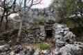
(3) Cross it and continue straight ahead to reach the Jas d’Agnis (an old sheepfold).

(4) Take a barely marked track on the left, heading south-east. At the next junction, carry straight on and follow the course of a wide track which bends to the left.

(5) Carry on straight ahead, ignoring the path coming from the right. You’ll reach a three-way junction.

(6) Turn left and continue straight down to the finish (S/E).
Waypoints

  1. S/E : mi 0 - alt. 1,227 ft - Parking near the pumping station
  2. 1 : mi 1.12 - alt. 1,608 ft - T-junction, turn left
  3. 2 : mi 1.41 - alt. 1,837 ft - T-junction, turn right
  4. 3 : mi 1.76 - alt. 2,106 ft - Track junction
  5. 4 : mi 1.89 - alt. 2,126 ft - Jas d’Agnis, start of the track
  6. 5 : mi 2.11 - alt. 2,116 ft - Junction, straight on
  7. 6 : mi 2.39 - alt. 2,008 ft - Three-way junction, on the left
  8. S/E : mi 3.68 - alt. 1,227 ft - Same as D

Notes

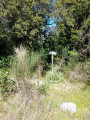
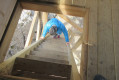
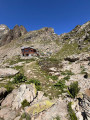
You can park your car at the end of the tarmac road, near the pumping station: do not park near the sign (photo 1) as the land is private.

Don’t forget your water bottle, as there are no accessible water points along the route.

The terrain is very rocky and requires good walking boots.

Reviews and comments

4.5 / 5
Based on 2 reviews

Reliability of the description
4.5 / 5
Ease of following the route
4.5 / 5
Route interest
4.5 / 5
llcm83
llcm83

Overall rating : 4.3 / 5

Date of your route : Feb 09, 2025
Reliability of the description : ★★★★★ Very good
Ease of following the route : ★★★★☆ Good
Route interest : ★★★★☆ Good
Very busy route : No

A pleasant walk with a lovely view; do make sure you wear proper walking shoes, though. I should point out that after the sheepfold there’s a fenced-in paddock with sheep, and we found ourselves face to face with five large Patou dogs – quite a daunting moment, but we managed to carry on our way calmly. So do take care between points 4 and 5.

Machine-translated

Bergamote
Bergamote

Overall rating : 4.7 / 5

Date of your route : Sep 19, 2023
Reliability of the description : ★★★★☆ Good
Ease of following the route : ★★★★★ Very good
Route interest : ★★★★★ Very good
Very busy route : No

A lovely walk with varied terrain, a stunning view not to be missed and a few climbs.
Suitable footwear is essential for tackling the stony ground, both on the way up and down.
It’s very pleasant in good weather as part of the route is shaded by vegetation.

Machine-translated

Other walks in the area

For more walks, use our search engine .

The GPS track and description are the property of this route's author. Please do not copy them without permission.