Moisson Forest Circular Walk

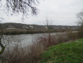
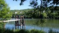
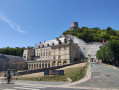
After walking through the Moisson Forest, you’ll be treated to a beautiful view of the keep at the Château de la Roche-Guyon. Then, as you walk along the Seine, you’ll enjoy the view of the Seine Hills Nature Reserve on the opposite bank.

Details

31615133
Creation:
Last update:
Last review:
  • Walking
    Activity: Walking
  • ↔
    Distance: 5.96 mi
  • ◔
    Average duration: 2h 45 
  • ▲
    Difficulty: Easy

  • ⚐
    Back to start: Yes
  • ↗
    Ascent: + 56 ft
  • ↘
    Descent: - 56 ft

  • ▲
    Highest point: 118 ft
  • ▼
    Lowest point: 52 ft
  • ⚐ Country: France
  • ⚐
    Area: Vexin
  • ⚐ City: Moisson (78840)
  • ⚑
    Start/End: N 49.073379° / E 1.670122°
  • ❏
    IGN map(s): Ref. 2113ET
  • Hour-by-hour weather

Photos

Description of the walk

Parking is available in the small car park on Place Parion-Nicolle, opposite the town hall.
Another car park nearby at Place Georges Pain.

(S/E): Opposite the town hall, follow the road to the right. Pass the Chemin du Bois Beauceron on your left. Shortly afterwards, turn left into the Passage du Petit Pignon (bus stop). Ignore a path on the left. At the next junction (at No. 3), continue straight ahead, then turn left at the following T-junction.

(1) At the end, turn right onto Chemin des Barrières. At the end of the street, first turn right then left and head down Allée du Jamborée. At the next Fork in the road, go left then take Chemin des Rêles.

(2) Pass through a metal gate and follow thePR® (yellow markings). At the Fork in the road immediately ahead, head slightly to the left. Continue along this path for about 1 km until you reach a T-junction.

(3) Turn left (sign for the Boucle de Moisson Nature Reserve) then immediately turn right onto thePR® (yellow markings). Further on, after a right-hand bend and a very gentle climb, you’ll reach a junction.

(4) Carry on straight ahead, ignoring thePR® which branches off to the left. At a Fork in the road, take the left-hand path until you reach a junction with a forest track.

(5) Then turn right. Carry on straight ahead, ignoring all side paths, until you reach the D124.

(6) Cross the road carefully and follow it to the right along a wide verge.

(7) After about 300 m, turn left onto a path. Walk alongside a field on your left. At the end of the field, you’ll reach a T-junction with a small road.

(8) Head left towards the Seine. Turn right immediately and follow the Promenade des Roches Blanches (tarmac). Walk alongside the river on your left and ignore all the streets on your right. At the end of the tarmac, continue along a path for about 250.

(9) Turn onto thefirst path on the right, between two fences. You’ll come out onto the Chemin de la Grande Vallée; follow it as it continues. At the end, turn left onto the Route de Lavacourt. Ignore the Chemin du Murger on your right. About fifty metres further on, take a path on the right at the corner by an old transformer.

(10) At the crossroads, continue to the right along a wide track. At the next Fork in the road, turn right onto Chemin du Bois Beauceron, heading towards the church, and rejoin the tarmac road. Pass by the school and first turn right then left to return to the starting car park (S/E).


Waypoints

  1. S/E : mi 0 - alt. 62 ft - Car park at Place Parion-Nicolle
  2. 1 : mi 0.21 - alt. 75 ft - Chemin des Barrières
  3. 2 : mi 0.38 - alt. 72 ft - Metal barrier
  4. 3 : mi 1.09 - alt. 98 ft - T-junction – ‘Boucle de Moisson’ sign
  5. 4 : mi 1.59 - alt. 118 ft - Junction
  6. 5 : mi 2.01 - alt. 102 ft - Junction – Forest road
  7. 6 : mi 3.02 - alt. 59 ft - D124 road
  8. 7 : mi 3.2 - alt. 62 ft - Path starts on the left
  9. 8 : mi 3.89 - alt. 56 ft - T-junction - Seine [la]
  10. 9 : mi 5.14 - alt. 56 ft - Junction - Seine [la]
  11. 10 : mi 5.58 - alt. 69 ft - T-junction
  12. S/E : mi 5.96 - alt. 62 ft - Car park at Place Parion-Nicolle

Notes

Worth a visit

(6) View of the keep at the Château de la Roche-Guyon.
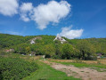
Views of the Seine Hills Nature Reserve between (6) and (9).
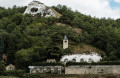
Saint-Léger Church.
The Ballonnière and JamboréeMuseum

Nearby: Île de Loisirs des Boucles de Seine.

Always be cautious and plan ahead when you're outdoors. Visorando and the author of this route cannot be held responsible for any accidents occurring on this route.

The GR® and PR® markings are the intellectual property of the Fédération Française de Randonnée Pédestre.

Reviews and comments

4.8 / 5
Based on 2 reviews

Reliability of the description
5 / 5
Ease of following the route
5 / 5
Route interest
4.5 / 5
COCHARDMOD
COCHARDMOD

I'm happy for you!

Machine-translated

ealet
ealet

Overall rating : 4.7 / 5

Date of your route : Sep 01, 2023
Reliability of the description : ★★★★★ Very good
Ease of following the route : ★★★★★ Very good
Route interest : ★★★★☆ Good
Very busy route : No

A lovely walk with plenty of variety (passing through villages, along a forest path and then a path running alongside the Seine, with a lovely view of the Château de la Roche-Guyon)
The route is well described and easy to follow
Thank you to the author for sharing this

Machine-translated

COCHARDMOD
COCHARDMOD

Thank you!

Machine-translated

Nicole6495
Nicole6495
• Edited:

Overall rating : 5 / 5

Date of your route : Apr 30, 2023
Reliability of the description : ★★★★★ Very good
Ease of following the route : ★★★★★ Very good
Route interest : ★★★★★ Very good
Very busy route : No

A superb walk. And at the end of the route, there’s a view of a nature reserve.

Machine-translated

Other walks in the area

For more walks, use our search engine .

The GPS track and description are the property of this route's author. Please do not copy them without permission.