The banks of the Seine starting from Haute-Isle

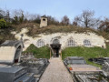
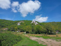
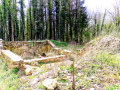
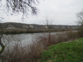
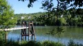
This circular route along the banks of the Seine will take you past the region’s many cave dwellings, through some lovely woodland and along a short stretch beside the Seine.
The route could probably be improved, particularly on the return leg, which, for my liking, follows the D913 a bit too closely; unfortunately, I wasn’t able to stay along the banks of the Seine.

Details

68101985
Creation:
Last update:
Last review:
  • Walking
    Activity: Walking
  • ↔
    Distance: 6.04 mi
  • ◔
    Average duration: 3h 10 
  • ▲
    Difficulty: Moderate

  • ⚐
    Back to start: Yes
  • ↗
    Ascent: + 420 ft
  • ↘
    Descent: - 420 ft

  • ▲
    Highest point: 492 ft
  • ▼
    Lowest point: 52 ft

Photos

Description of the walk

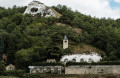
Park in a small car park almost opposite the troglodyte church at Haute-Isle (do pop in for a look),

(S/E) With your back to the church, take the D913 on your right.

(1) Just past the town hall, turn onto the first uphill road on the right (Chemin du Village). At the end of the tarmac road, continue along a footpath.

(2) Follow theGR®2to the right (red and white markings), up a steep climb. You’ll reach flat ground near the D100; continue along the marked path.

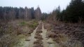
(3) Turn left and stay on the edge of the woodland in the Coteaux de la Seine Nature Reserve.

(4) At the next junction, carry on straight ahead, staying on the edge of the woodland along theGR® and passing the Mantes-Chérence airfield on your left.

(5) Continue along theGR®, ignoring all turn-offs to the left, and head downhill. Further on, you’ll come to the tarmac road and end up at the corner of Vétheuil cemetery.

(6) Turn slightly to the right, leaving the cemetery on your right and then the church on your left. After a right-hand bend, you’ll join the D913 (Rue Claude Monet).

(7) Cross the road carefully and take Rue du Pontceau opposite. Turn immediately right into Rue de la Seine.

(8) At the end, turn right onto a path running parallel to the Seine (leave theGR®). A little further on, take a sharp right into Rue du Port.

(9) Join the D913 and follow it to the left, taking care. Walk along this road for some time until you reach the hamlet of Chantemesle.

(10) Leave the D913 and turn left onto Ruelle de la Rive. Turn right immediately and continue alongside the Seine along Chemin de l’Abbaye.

(11) At the end of the tarmac road, continue along a path. At the end of this, turn right and you’ll soon come to a junction you passed at the very start of the walk, opposite the town hall.

(1) Cross the D913 with care and head straight for the car park of the troglodytic Church of the Annunciation (S/E).

Waypoints

  1. S/E : mi 0 - alt. 72 ft - Car park at the - Église de l'Annonciation (Haute-Isle)
  2. 1 : mi 0.04 - alt. 72 ft - Town Hall – Junction of the circular loop
  3. 2 : mi 0.43 - alt. 243 ft - Junction – GR2
  4. 3 : mi 0.98 - alt. 449 ft - Junction
  5. 4 : mi 1.51 - alt. 492 ft - Junction before the aerodrome
  6. 5 : mi 2.6 - alt. 469 ft - Junction after the aerodrome
  7. 6 : mi 3.27 - alt. 138 ft - Cemetery - Église Notre-Dame (Vétheuil)
  8. 7 : mi 3.36 - alt. 95 ft - Crossing the D913
  9. 8 : mi 3.45 - alt. 59 ft - Junction - Seine [la]
  10. 9 : mi 3.69 - alt. 85 ft - D913 road
  11. 10 : mi 5.2 - alt. 69 ft - Chantemesle
  12. 11 : mi 5.6 - alt. 56 ft - Road – Track
  13. S/E : mi 6.04 - alt. 72 ft - Car park at the - Église de l'Annonciation (Haute-Isle)

Notes

There’s a bit of an incline, particularly just after the start; be careful as the ground can be slippery in wet weather.
The route could probably be improved towards the end, as this section runs largely along the D913 (which isn’t too busy on Sundays).

Worth a visit

Always be cautious and plan ahead when you're outdoors. Visorando and the author of this route cannot be held responsible for any accidents occurring on this route.

The GR® and PR® markings are the intellectual property of the Fédération Française de Randonnée Pédestre.

Reviews and comments

4.4 / 5
Based on 3 reviews

Reliability of the description
5 / 5
Ease of following the route
4.3 / 5
Route interest
4 / 5
Gilles490
Gilles490

Overall rating : 4.3 / 5

Date of your route : Aug 25, 2025
Reliability of the description : ★★★★★ Very good
Ease of following the route : ★★★★☆ Good
Route interest : ★★★★☆ Good
Very busy route : No

Could the (very long) section on the D913 between points 9 and 10 be replaced by the parallel path that follows the banks of the Seine?

Machine-translated

User 12015660

Overall rating : 4.7 / 5

Date of your route : Jul 28, 2025
Reliability of the description : ★★★★★ Very good
Ease of following the route : ★★★★☆ Good
Route interest : ★★★★★ Very good
Very busy route : No

The return journey involves following the D913; the hard shoulder is very narrow, there’s heavy traffic and cars are travelling fast – it’s dangerous,
What a shame

Machine-translated

ealet
ealet

Overall rating : 4.3 / 5

Date of your route : Jan 20, 2025
Reliability of the description : ★★★★★ Very good
Ease of following the route : ★★★★★ Very good
Route interest : ★★★☆☆ Average
Very busy route : No

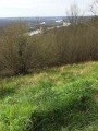
A route with many highlights: the churches at Vetheuil and La Haute-Isle (a cave church), and beautiful views over the Seine valley; but it has one major drawback: on the return journey, from point 9 to point 10, you have to follow the D913; the hard shoulder is very narrow, there’s heavy traffic and cars are travelling fast – it’s dangerous,
a shame

Machine-translated

Other walks in the area

For more walks, use our search engine .

The GPS track and description are the property of this route's author. Please do not copy them without permission.