Country:
 City:
City:


Park in the car park at the Kœnigsmacker Sports Centre.
(S/E) Join Rue du Stade (D2) and follow it, turning left. Continue to the junction with Rue de Thionville.
(1) Turn right onto it towards the village, then cross at the pedestrian crossing opposite the bank. Walk along the pavement, keeping to the right, then turn left down Rue du Moulin. At Moulin Borens, continue to the right along the Canner to reach the junction with Rue de la Gare.
(2) Turn left, then right before the D654 bridge to head towards the gardens and ponds. You’ll come to a junction: please be careful, as these are private ponds with unprotected edges.
(3) Turn left and stay on the path running alongside the D654, which takes you round Koenigsmacker.
(4) Turn right to cross the field, walk up Rue des Prés to Rue de Trêves and turn right.
(5) Once you reach the Foyer Rural, cross at the pedestrian crossing and head up the road opposite towards Saint-Hubert Church, then go back down towards Rue d’Oudrenne (D62). Turn left onto it and follow the pavement towards Oudrenne after crossing at the pedestrian crossing so that you are facing the same direction as the traffic.
(6) Leave the road and turn right into the housing estate via Rue du Château d’Eau.
(7) At the entrance to the Bois de Kœnigsmacker, take the track on the right to walk alongside it. Ignore the forest track on the left and continue straight on: the woods contain numerous military structures which are still protected and off-limits for your safety.
(8) Veer slightly to the left, let a path branch off to the right, and carry on to the next junction.
(9) Head straight on through Im Sank, then first turn right then left in succession to reach the edge of the woods at a place called Breitholz.
(10) Turn left to follow the edge of the woodland, then veer off to the right to join the D62, which is called Rue de la Tuilerie here.
(11) Head right towards the village of Oudrenne, walking carefully alongside the road, which further on becomes Rue de la Liberté.
(12) Look out for the path on the right which you’ll take later. Carry on straight ahead for 60 metres, then turn left onto Rue Saint-Jean. At the next junction, take Rue de la Fontaine on the left and follow the pavement to the town hall.
(13) Turn right onto Rue Haute, then right again onto Rue du Moulin. Turn right at the three-way junction and continue to the end of the cul-de-sac.
(14) Turn right to cross the small bridge over the Ruisseau d’Oudrenne, then head left and follow the stream. At the end of the path, turn right to head back up towards the D62 (Rue de l’Europe).
(15) Turn right again towards the village and carry on until you reach the junction with the D255b. Go straight on, crossing the junction carefully, and continue along the road until you reach a fork you passed on the way out.
(12) Take the track on the left towards the Bois de Kœnigsmacker.
(16) Enter the woods and keep going in the same direction, ignoring the paths branching off to the left, until you reach the junction at the 224-metre mark.
(17) First turn right then left to follow a path which curves further to the right and leads to another junction.
(18) Turn right and follow the path, which winds its way uphill before reaching a star-shaped junction.
(19) Take the second path on the left, which runs diagonally, and continue to the blockhouses – military structures that are still protected and off-limits for your own safety.
(20) Continue along the left-hand route, leave the woods and head for the Cité des Officiers.
(21) Head to the right, skirting the small peak of the Nonnenberg.
(22) Take the path on the left to enter the Bois de Koenigsmacker and head uphill until you reach a junction. Turn right at a 90° angle, pass the highest point and continue straight on until you reach the main path called Klingelberg.
(23) Carry on to the left until you reach the cross.
(24) Take the track on the left towards the Saint-Roch Chapel and follow it to the chapel.
(25) Head down towards Koenigsmacker and join Rue de la Chapelle, at the corner by the school.
(26) Turn left onto Avenue du Père Scheil, then turn left again onto Rue Saint-Martin.
(27) Turn left again to go round the back of the housing estate and its houses.
(28) Turn right to head back towards the D2 (Rue du Stade).Cross the road carefully to reach the sports hall car park straight away (S/E).
 Visorando Member
 Easy
Easy 
 Difficult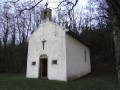
 Association / Club / Walk leader