


Circular route from Kehl to Offenburg


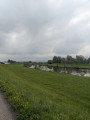
A lovely ride through the beautiful villages along the Rhine between Kehl and Offenburg. The route follows cycle paths separated from traffic for almost the entire journey and is very well signposted throughout.
Details
Creation:
Last update:
–
–
Last review:
–
–
-
 Activity: Touring/Gravel
 -
 Distance: 24.26 mi
 -
 Duration according to the author: 2.5 hrs
 -
 Difficulty: Moderate
 -
-
 Back to start: Yes
 -
 Ascent: + 62 ft
 -
 Descent: - 62 ft
 -
-
 Highest point: 515 ft
 -
 Lowest point: 436 ft
 Country:
 City:
City:


Photos

Waypoints
- S/E : mi 0 - alt. 453 ft - Rhin (fleuve)
- 1 : mi 1.09 - alt. 449 ft - Kinzig
- 2 : mi 2.11 - alt. 459 ft - Neumühl
- 3 : mi 3.41 - alt. 466 ft - Kork
- 4 : mi 6.01 - alt. 479 ft - Alte Kinzig
- 5 : mi 11.66 - alt. 492 ft - Kinzig Kinzig
- 6 : mi 16.33 - alt. 472 ft - Fork
- 7 : mi 16.73 - alt. 479 ft - Hohnhurst
- 8 : mi 19.77 - alt. 472 ft - Eckartsweier
- 9 : mi 21.75 - alt. 456 ft - Fork
- 10 : mi 22.65 - alt. 453 ft - Roundabout
- S/E : mi 24.26 - alt. 453 ft - Rhin (fleuve)
Other walks in the area
Cycling on both sides of the Rhine from Strasbourg
 Visorando Member18.15 mi
+49 ft
-49 ft
2 hrs
Visorando Member18.15 mi
+49 ft
-49 ft
2 hrs
 Easy
Easy
 Departure from Strasbourg (Bas-Rhin)
A beautiful bike ride of nearly 30 km starting from the Stade de la Meinau in Strasbourg. It will take you through the Neuhof forest, up along the Canal d'Alsace on the French side, then back along the German bank, following the Old Rhine to the Jardin des Deux Rives, which straddles the Rhine and the border between Strasbourg and Kehl.
The route favours cycle paths and trails that are closed to vehicles.
The three rivers south of Strasbourg
 18.20 mi
+33 ft
-33 ft
3 hrs
Easy
Departure from Strasbourg (Bas-Rhin)
18.20 mi
+33 ft
-33 ft
3 hrs
Easy
Departure from Strasbourg (Bas-Rhin)
Starting from Strasbourg, explore the peaceful banks of the Ill and observe its wildlife. Follow the dark waters of the mysterious Schwarzwasser as it winds its way through the heart of the Neuhof Forest. Finally, criss-cross the paths of the Rhine Tortu, which undulate to the gates of the city.
Between water and forest, set your sights on unspoilt, peaceful nature, yet so close to the hustle and bustle of the city.
Along the water in Strasbourg
22.44 mi
+52 ft
-52 ft
1h 55
Easy
Departure from Strasbourg (Bas-Rhin)
A cycle ride around Strasbourg on flat paths, starting from Place d'Haguenau, which will take you along the Rhône-Rhine Canal, through the Neuhof Forest, up along the Alsace Canal on the French side, then return via the German bank, following the Old Rhine to the Jardin des Deux Rives, straddling the Rhine and the border between Strasbourg and Kehl.
Discover the Haguenau Forest of Exceptional Beauty®
 Tourist office23.00 mi
+151 ft
-167 ft
3 hrs
Moderate
Departure from Haguenau (Bas-Rhin)
Tourist office23.00 mi
+151 ft
-167 ft
3 hrs
Moderate
Departure from Haguenau (Bas-Rhin)
This cycle route will take you through varied landscapes, between pine and oak trees, to discover some of the riches of the undivided forest of Haguenau. You will walk through the heart of this forest, which was awarded the Forêtd'Exception® label in January 2020, and along the way you can enjoy its lakes and be surprised by its legends and heritage.
For more walks, use our search engine .
The GPS track and description are the property of this route's author. Please do not copy them without permission.

