Country:
 City:


The walk starts from Saint-Germain-au-Mont-d’Or railway station. There’s parking nearby if you’re coming by car.
(S/E) Take the Chemin des Carrières, walking alongside the houses on your left. Then turn right to cross the meadow and head towards the Place de l’Esplanade, then the town hall near the roundabout.
(1) Go round the town hall on the left and follow Avenue de la Résistance.
(2) Turn left onto the steps leading up to the tower. Once at the top, turn right onto Rue de l’Église. Cross Rue du 8 Mai 1945 and continue straight ahead onto Rue du Lavoir. Keep left twice in succession, then turn right onto Chemin de la Bouvière.
(3) Leave the road and take the path on the left, which soon bends to the right. Ignore two paths on the left, follow the third for about a hundred metres, then turn right to reach the edge of the woods.
(4) Carry on straight ahead, skirting the field on your left.
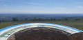
(5) Carry on straight ahead, ignoring the path leading down to the left, until you reach the Croix de Rampau information board, which offers a lovely view if there isn’t too much fog in the morning.
(6) Carry on straight ahead along the road leading to Poleymieux, pass the Tour Risler, then turn left until you reach the fork.
(7) Look out for the path on the right, which you’ll take later, and carry on straight ahead along the Chemin de la Péronière.
(8) At the junction, head straight on along the Chemin de Planchamp. The road appears to be on private property but in fact simply leads down towards the church.
(9) Walk past the church, then keep left at the Fork in the road that appears shortly afterwards to follow the Chemin de la Péronière. Keep left again at the emergency services centre and return to the junction you passed earlier.
(8) Turn right, heading in the opposite direction to your outward journey, and return to the fork you passed on the way there.
(7) Leave the street and turn left onto the Chemin du Pavé. At the road, turn left, then right at an acute angle to follow the Chemin de l’Ancienne Église. Turn left, then cross the four-way junction and continue straight on for about a hundred metres.
(10) Take the path on the left, with rocks, which climbs very steeply through the undergrowth.
(11) There’s no need to enter the Pavillon’s grounds; simply turn left to walk alongside the fence and the shed (wooden building). Turn left again at the next junction and head uphill towards the military base.
(12) Continue along the path on the left until you come out onto a road.
(13) Follow it to the left, skirting the military grounds, until you reach a junction of roads and paths.
(14) Take the path opposite, which continues in line with the road. You’ll reach the junction with the geological trail.
(15) Carry on straight ahead: simply follow the signs for “Chasselay”. You’ll reach the Plantin orientation point and head straight down, passing close to the Château du Plantin on your right. You’ll then reach the D16.
(16) Do take a stroll through Chasselay – the medieval gates and arches are truly beautiful. To do so, cross Rue du Promenoir (D16) and head towards the church. Walk past the porch, leave Rue du Général Macon on your right, then turn right onto Rue du Grand Fossé. At the end, turn right twice to walk past the church’s chancel, then turn left to rejoin Rue du Promenoir.
(17) Cross this main road carefully to join Rue Genevreant opposite. Leave Rue des Darbonnières on your right, then Rue des Auges on your left as you round the bend.
(18) Turn left onto Chemin de Poleymieux; this tarmac road then becomes a track.
(19) Go straight on to negotiate the bend, then turn left to reach the end of the tarmac road called Chemin de la Collonge. Turn right, go straight on at the junction, then take a sharp left-hand bend and join another junction.
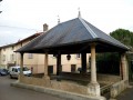
(20) Turn left, then right about fifty metres further on. Follow the track as it curves to the right, then turn left. Turn left again about a hundred metres further on and then continue in the same direction until you reach a crossroads (wash house).
(21) Turn left immediately. The path is rather pleasant in clear weather as it offers a panoramic view of the plain and you can make out Mont Blanc on your right.
(22) At the three-way junction, keep left towards Les Hautannes.
(23) Turn right onto the path leading downhill to rejoin the streets of Saint-Germain. Head towards Rue Jean-Louis Renardon, follow it to the right and pass a street on your left.
(24) Turn left into the next street, called Passage Claude Grand. Cross Rue du 8 mai 1945 and continue straight on along Avenue de la Résistance until you reach the junction you passed on the way there.
(2) Turn left onto Rue du Parc: this is not private property, even though it may appear to be. You’ll come to the town hall.
(1) Head straight ahead to Place de l’Esplanade, then turn slightly left to follow Chemin des Carrières and return to the car park and then the station (S/E).

 Visorando Member



 Easy