


 Country:

 City:
City:


Marked footpaths and short sections on tarmac roads.
Car park at Carteret harbour, 100 m from the Hôtel La Marine, starting point of the walk.
(S/E) Walk along the Promenade Abbé Lebouteiller towards Plage de la Potinière.
(1) Turn right onto the Route de la Corniche (the first road on the right, near the Restaurant Le Russel), which winds uphill, then follow this road along the upper reaches of the village, overlooking the magnificent beaches and the Crique de la Potinière.
(2) At a small car park and picnic area, head down to Plage de la Potinière and back again to admire the pretty blue beach huts. Head back up.
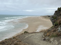
(2) Follow the Chemin des Douaniers to the left, which overlooks the beach (stunning views), towards the long and magnificent Vieille Église Beach. Walk round Carteret Lighthouse (which overlooks the path) and arrive at the foot of the ruins of Saint-Germain Church.
(3) Continue through the dunes, following the GR® markings (white/red) to avoid walking too far in soft sand.
(4) At the junction of the paths, continue along the GR®.
(5) At this junction, head towards the village of Hattainville, reaching it via Rue des Mielles – continue straight on.
(6) Turn right onto Rue de la Cohue and ignore the streets on either side (there’s a bench at the corner of Rue de la Cohue and Rue de Bas) to cross the village along this road (D201) towards Barneville-Carteret.
(7) On leaving the village, follow a small path on the right which takes you above the D201. Head uphill and walk gently along the dunes on your right. You’ll rejoin the D201, Avenue des Douits, at this point.
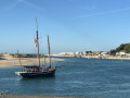
(8) Head downhill along the road leading to Carteret. At the Stop sign, turn right, then immediately right again, towards the harbour (among other destinations), then take the first street on the left to reach the Hôtel La Marine (S/E).

 Visorando Member
 Moderate
 Association / Club / Walk leader
 Difficult
