Circular walk through the Sallertaine Marshes

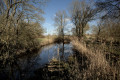
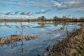
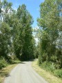
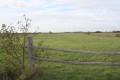
The village of Sallertaine and its marshes. Not always accessible during very wet periods – check beforehand. It’s a feast for the eyes on windless mornings. It’s like walking on a mirror. There aren’t many paths; this route is mainly tarmac.

Details

34479904
Creation:
Last update:
Last review:
  • Walking
    Activity: Walking
  • ↔
    Distance: 8.02 mi
  • ◔
    Average duration: 3h 40 
  • ▲
    Difficulty: Moderate

  • ⚐
    Back to start: Yes
  • ↗
    Ascent: + 13 ft
  • ↘
    Descent: - 13 ft

  • ▲
    Highest point: 23 ft
  • ▼
    Lowest point: 3 ft
  • ⚐ Country: France
  • ⚐ City: Sallertaine (85300)
  • ⚑
    Start/End: N 46.859581° / W 1.958582°
  • ❏
    IGN map(s): Ref. 1125OT
  • Hour-by-hour weather

Photos

Description of the walk

Park in the church square in Sallertaine.

(S/E) Walk past the church, then turn left into Rue du Pélican. Walk past the entrances to the Vaulieu Garden, follow the path alongside the cemetery and, at the Groies crossroads, you’ll reach the junction with the Route de la Vilatte.

(1) Take the road straight ahead. Note that this road is tarmacked; it has little traffic in winter and a few tourists in summer. Walk through the marshes until you reach the houses at Fief de la Villatte.

(2) Carry on straight ahead until you reach the Y-junction just before Rochefort.

(3) Turn right onto a small track. Please note that this track is impassable when there is a great deal of water; it is advisable to check conditions beforehand. Pass the hamlet known as Le Payement, then leave the path leading to Les Cétrées on your left. Turn left onto the track lined with reeds, where there are plenty of birds. You will reach the tarmac cycle path.

(4) Turn left onto it and follow it as far as the D205 expressway.

(5) Turn left onto the road running parallel to the D205 expressway and continue to a junction at the end of the marshes.

(6) Turn left, then left again at the houses in La Tremblaie. Keep left onto Rue de la Guerinière, pass the houses in La Guerinière and reach a Y-junction by the marshes.

(7) Turn right onto Chemin des Cotrelles – it’s a pleasant, shaded little path. Head away from the marshes again to reach the Jaulonnières crossroads.

(8) Turn left onto Route de la Rive, another small, shaded road; do watch out for cars, though. Pass the hamlets of La Rive and La Merlatière to reach the junction with the D71a.

(9) Turn left onto it with care – this is also the Route de la Féniçière – and carry on until you enter Sallertaine at the junction with Rue de Verdun.

(10) Turn right onto it, pass the town hall and continue left, still on Rue de Verdun, to return to the church car park (S/E).

Waypoints

  1. S/E : mi 0 - alt. 16 ft - Car park at Sallertaine Church
  2. 1 : mi 0.72 - alt. 13 ft - Les Groies crossroads
  3. 2 : mi 1.18 - alt. 7 ft - Fief de la Villatte
  4. 3 : mi 1.75 - alt. 7 ft - Start of the footpath
  5. 4 : mi 2.44 - alt. 7 ft - Cycle path
  6. 5 : mi 3.36 - alt. 10 ft - Express route
  7. 6 : mi 4.49 - alt. 10 ft - End of the marshes
  8. 7 : mi 5.25 - alt. 10 ft - La Guerinière
  9. 8 : mi 5.74 - alt. 13 ft - Route de la Rive
  10. 9 : mi 7.16 - alt. 16 ft - Rue Fénicière
  11. 10 : mi 7.68 - alt. 13 ft - Rue de Verdun
  12. S/E : mi 8.02 - alt. 16 ft - Car park at Sallertaine Church

Notes

(S/E) Toilets in the car park.

Worth a visit

Reviews and comments

3.9 / 5
Based on 3 reviews

Reliability of the description
4.7 / 5
Ease of following the route
4.3 / 5
Route interest
2.7 / 5
kartavan
kartavan

Overall rating : 4 / 5

Date of your route : Jun 13, 2026
Reliability of the description : ★★★★★ Very good
Ease of following the route : ★★★★☆ Good
Route interest : ★★★☆☆ Average
Very busy route : No

A walk with far too much tarmac, on roads that were supposedly quiet.
That wasn’t really the case on the day, when we came across more than forty cars between the 2nd and the 3rd on the road out of SALLERTAINE.
I wouldn’t recommend this walk.

Machine-translated

Jean Paul C1.
Jean Paul C1.
• Edited:

Hello, it’s true that there are a lot of tarmac tracks, but this is mentioned in the description. As for cars, we’re in a tourist area, near the coast. So on a long weekend in May, it gets quite busy. As I’m from the area, I usually go there in winter and/or autumn when there’s plenty of water and few people about. Kind regards

Machine-translated

Ftexier
Ftexier
• Edited:

Overall rating : 4 / 5

Date of your route : May 11, 2024
Reliability of the description : ★★★★☆ Good
Ease of following the route : ★★★★☆ Good
Route interest : ★★★★☆ Good
Very busy route : No

A cycle route, but also lovely to walk through the marshes. Very little shade.

Machine-translated

Dieulangard
Dieulangard

Overall rating : 3.7 / 5

Date of your route : Apr 22, 2024
Reliability of the description : ★★★★★ Very good
Ease of following the route : ★★★★★ Very good
Route interest : ★☆☆☆☆ Very disappointing
Very busy route : No

Hello, thank you for the high standard of your services. However, we were very disappointed with this walk: too much tarmac, the constant background noise of traffic, and not the best view of the marsh…
We can’t wait for the next walk to help us forget this one.
Kind regards, B. Dieulangard from

Machine-translated

Other walks in the area

For more walks, use our search engine .

The GPS track and description are the property of this route's author. Please do not copy them without permission.