Country:

 City:
City:


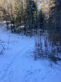
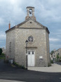
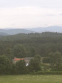
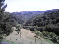
The route starts from the car park at Mars Town Hall.
(S/E) Heading south-east, join the Route du Pont de Mars (D15), cross it carefully and take Rue de Jean de Mars opposite. Keep to the right at the Fork in the road, then continue along the small road, ignoring the side paths as you pass through the hamlet of Jean de Mars.
(1) At the bend, do not take the gravel track but continue straight on along the forest track, cross the small tributary of the Lignon, then keep left onto the Chemin des Rases.
(2) At the junction, turn left onto the Chemin de Perrette and ignore the turn-off to the right at the hamlet of La Chabanas.
(3) Turn left where you meet the Route du Brus, and cross the Route du Mezenc (D151) with care. The forest track meets the Route de Saint Romain, onto which you’ll turn right.
(4) At the Fork in the road, leave the tarmac road and take the forest track on the left, which leads downhill. Continue in the same direction until you reach the tarmac Chemin du Gueyt, and pass the Gueyt house on your left. Cross the first junction with the Chemin de Chabrias and continue straight ahead onto the Chemin de la Carrière. Pass the La Luminière house on your left, then, after 50 m, take the path running along the edge of the forest on the left.
(5) At the junction with Rue du Bouchet, turn left and follow the sign for Mars 5.2 along the tarmac-surfaced Chemin de Pireyre Haut. Pass the Maret house on your left.
(6) Turn left onto the grassy path when you reach a small seasonal stream.
(7) Turn right onto the cross-path to join the tarmac-surfaced Chemin de Chabrias. As you approach the Route de Saint-Agrève, take the path on the right to go round the Duprenne house, then turn left onto the Route de Saint-Agrève for about a hundred metres before turning right onto the tarmac-surfaced Chemin du Château de Montréal.
(8) Pass the Château de Montréal on your left, taking the grassy track. This track goes round the pylon, roughly following the contour lines. To do this, it crosses the hamlet of Montréal on a tarmac section, then continues along the Chemin du Riche, branching off to the left just before the end of the hamlet. This grassy track is followed by a gravel track, the Chemin de Bauche, which passes the first house of the same name on the right, then the Saliques farm on the left.
(9) Turn left onto the Route des Saliques, a cross-road, then take the tarmac Chemin de Puissant on the right. Cross the small stream, then keep left at the Fork in the road, leaving the tarmac behind in favour of a gravel track.
(10) Leave the gravel track and head along a barely visible path that leads into the forest on the left. This path becomes tarmac as you approach a house, becoming the Chemin du Sagnas. Stay on this path, turning left at the junction. It crosses the Route du Golfe at Branches de Mars. Ignore the turn-off to the right, then keep to the right onto the Allée de la Mairie to return to the starting point (S/E).


 Visorando Member
 Moderate
 Difficult