Circular Château in Villers-Cotterêts

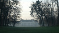
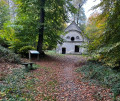
A circular route of approximately 8 km around the Château de la Langue Française and its park. A mix of parkland and woodland. The route passes the Ermitage Saint-Hubert, the Tourelle, the Faisanderie and the nursery, before returning to the château.

Details

n°111747053
Creation:
Last update:
Last review:
–
  • Walking
    Activity: Walking
  • ↔
    Distance: 4.86 mi
  • ◔
    Average duration: 2h 25 
  • ▲
    Difficulty: Easy

  • ⚐
    Back to start: Yes
  • ↗
    Ascent: + 213 ft
  • ↘
    Descent: - 213 ft

  • ▲
    Highest point: 650 ft
  • ▼
    Lowest point: 440 ft

Photos

Description of the walk

Park at the Grand Bosquet car park.

(S/E) Head due north, join the GR® 11A, continue along the park, pass through an old stone gate and arrive at the tunnel under the N2.

(1) Go through the tunnel, follow the Allée Royale straight on and arrive at the Penthièvre crossroads.

(2) Turn slightly left, cross the Route de Chavigny and head slightly to the right towards the Ermitage Saint-Hubert at Étang Malva.

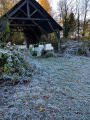
(3) Walk under the hermitage (where you can take a break) and continue south-east to reach the Laie de Saint-Hubert.

(4) Follow it to the right, pass the Carrefour Demoustier and continue to the Route de Chavigny.

(5) Turn left onto it and follow it for about 300 m.

(6) Turn right onto the Route de Villers-Cotterêts at Cœuvres, pass the Carrefour de la Berthe and, at the junction, turn off onto the Laie de Saint-Hubert, heading due south.

(7) At the T-junction, turn right and continue to the tunnel under the N2.

(1) Go through the tunnel and, once again, through the old stone gate. Turn right and follow the wall. Walk past the watchtower and head towards the Faisanderie.

(8) Turn left towards the Maison Forestière de la Pépinière.

(9) Turn right to head back towards the château, walking along the right-hand side of the Petit Parc, then turn left to walk past the château and finally turn right towards the Grand Bosquet car park (S/E).

Waypoints

  1. S/E : mi 0 - alt. 440 ft - Grand Bosquet car park - Château de Villers-Cotterêts, Cité Internationale de la Langue Française
  2. 1 : mi 0.8 - alt. 459 ft - Tunnel under the N2
  3. 2 : mi 1.39 - alt. 525 ft - Penthièvre crossroads
  4. 3 : mi 1.86 - alt. 643 ft - Hermitage of Saint-Hubert
  5. 4 : mi 2.06 - alt. 614 ft - Laie de Saint-Hubert
  6. 5 : mi 2.23 - alt. 554 ft - Route de Chavigny
  7. 6 : mi 2.4 - alt. 502 ft - Road from Villers-Cotterêts to Coeuvres
  8. 7 : mi 2.89 - alt. 505 ft - T-junction
  9. 8 : mi 3.91 - alt. 459 ft - La Faisanderie
  10. 9 : mi 4.03 - alt. 453 ft - Maison Forestière de la Pépinière
  11. S/E : mi 4.86 - alt. 440 ft - Grand Bosquet car park - Château de Villers-Cotterêts, Cité Internationale de la Langue Française

Notes

Car park nearby

Worth a visit

Always be cautious and plan ahead when you're outdoors. Visorando and the author of this route cannot be held responsible for any accidents occurring on this route.

The GR® and PR® markings are the intellectual property of the Fédération Française de Randonnée Pédestre.

Other walks in the area

For more walks, use our search engine .

The GPS track and description are the property of this route's author. Please do not copy them without permission.