Route du Bois d’Hez: Ry d’Hez and Quatre Chênes

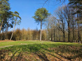
A walk through woods and fields around Villers-la-Ville Abbey. This route takes you through the beautiful Bois d’Hez (covered in bluebells in April), as well as the natural habitat of beavers (if you take a short detour to the Ry du Marais des Chiens) and the lovely ‘Plateau des 4 Chênes’, from where you can see Sart-Dames-Avelines and Baisy-Thy in the distance. Towards the end of the route, you’ll also walk alongside the wall of the Abbey Farm.

Details

102091700
Creation:
Last update:
Last review:
  • Walking
    Activity: Walking
  • ↔
    Distance: 4.60 mi
  • ◔
    Average duration: 2h 20 
  • ▲
    Difficulty: Easy

  • ⚐
    Back to start: Yes
  • ↗
    Ascent: + 266 ft
  • ↘
    Descent: - 266 ft

  • ▲
    Highest point: 499 ft
  • ▼
    Lowest point: 331 ft

Description of the walk

The walk starts from the car park of the restaurant ‘Le Chalet de la Forêt’.

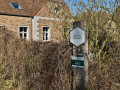
(S/E) As you walk up the road to the left of the chalet (towards Baisy-Thy), you’ll find the entrance to a woodland path on your right. Go through the gate and follow the path straight on (despite several junctions) until you reach the Ry d’Hez. Towards the end of this very long path, the trail is quite steep as it winds through a pretty little ravine.

(1) The path then joins another path (path 83), which you should take to the left. The route continues through the undergrowth to the hamlet of Le Fosty and joins a short cobbled road.

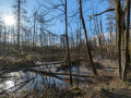
(2) At this point, you’ll need to walk carefully along the main road to the right, then cross it diagonally to the left to rejoin the route. You’ll pass a poetry spot (100 metres after the start of the path) and carry on your way. A fairly steep path on your left takes you into a sandpit. But before that, if you feel so inclined, you can extend your walk along the Ry d’Hez to its junction with the Ry du Marais des Chiens and observe the beavers’ handiwork.

(3) Turn back. The fairly steep path you need to follow is now on your right. Take this path through the sand and undergrowth and head up to a high plateau offering a rather impressive view of the surrounding area.

(4) As you emerge from the trees, follow the path to the left, then turn onto a tarmac road which serves as a cycle path (junction point) on your right. Follow this long tarmac road, leaving the Ry Saint-Bernard path on your left, to easily reach the spot known as ‘Les 4 Chênes’.

(5) At the ‘4 Chênes’, follow the Drève des 4 Chênes (to the left) to return to your starting point.

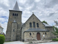
(6) Along the way, you’ll come across the Sainte-Apolline Chapel and walk alongside the abbey’s surrounding wall.

(S/E) At the car park, if you feel like it, you can take the very narrow, steep path to the right of the restaurant “Le Chalet de la Forêt”. It offers a lovely view of the abbey.

(7) Then head back to the car park (S/E).

Waypoints

  1. S/E : mi 0 - alt. 361 ft - Car park
  2. 1 : mi 1.19 - alt. 371 ft - Trail No. 83
  3. 2 : mi 1.75 - alt. 371 ft - Route
  4. 3 : mi 2.05 - alt. 361 ft - Ry du Marais des Chiens
  5. 4 : mi 2.65 - alt. 466 ft - Emerging from the trees
  6. 5 : mi 3.41 - alt. 476 ft - Les 4 Chênes
  7. 6 : mi 4.02 - alt. 436 ft - Chapel of Saint Apolline
  8. 7 : mi 4.51 - alt. 377 ft - Viewpoint over the - Ancienne Abbaye de Villers
  9. S/E : mi 4.6 - alt. 361 ft - Car park

Notes

The path can be muddy in wet weather. Wear ankle boots and avoid pushchairs

Worth a visit

Bois d’Hez: a magnificent woodland home to a wide variety of species. In April, you can admire fields of hyacinths here.

Ry d’Hez: it originates in Sart-dames-Avelines and flows for 6 km before joining the Thyle. The Ry d’Hez used to power the Moulin du Fosty. At the junction with the Ry du Marais des Chiens, you can see the work of the beavers.

Beavers: have been back in the region for over 15 years. In some parts of the woodland, they have built veritable lagoons, which are quite a pleasure to watch but which make several sections of the path difficult to navigate.

The Four Oaks: an ancientlocality where Saint Bernard of Clairvaux once passed through (although there were different oaks there at the time). These oaks are over 20 metres tall and have been replanted from generation to generation. They gave their name to the Villers-la-Ville Scout Unit (the ‘Four Oaks’ troop). At the foot of one of the oaks stands the small oratory of Sainte-Marie-Médiatrice, dating from 1975. In the distance, you can see Sart-Dames-Avelines and Baisy-Thy.

Chapel of Saint Apolline: patron saint of dentists, she is invoked to relieve toothache.

View of Villers-La-Ville Abbey: visit their website.

Other walks in the area

For more walks, use our search engine .

The GPS track and description are the property of this route's author. Please do not copy them without permission.