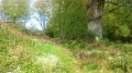
Circular walk around Le Moutier d’Ahun

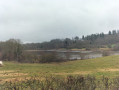
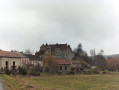
A short, easy walk offering views of the beautiful village of Le Moutier d’Ahun, its church and its old ‘Roman bridge’ over the Creuse, then through the countryside to Chantemille Castle and the village of Ahun with its church featuring a remarkable apse.

Details

n°30900743
Creation:
Last update:
Last review:
  • Walking
    Activity: Walking
  • ↔
    Distance: 6.80 mi
  • ◔
    Average duration: 3h 35 
  • ▲
    Difficulty: Easy

  • ⚐
    Back to start: Yes
  • ↗
    Ascent: + 515 ft
  • ↘
    Descent: - 509 ft

  • ▲
    Highest point: 1,509 ft
  • ▼
    Lowest point: 1,125 ft

Photos

Description of the walk

Park just on the other side of the “Roman bridge” from the village of Moutier-d’Ahun.

(S/E) Cross the bridge heading back up towards the village. Take the second alleyway (Rue de la Bergerie) on the right, running parallel to the main street. At the end of the alleyway, turn right onto the small road. Follow this very narrow road for 800 metres. It then turns into a forest track. Keep going straight on. The track overlooks the River Creuse in places. This track leads onto a small road. Continue to the right, downhill, until you reach the hamlet of Chantemille.

(1) Leave the hamlet’s houses on your right and continue along the track, which climbs through the woods and leads to the hamlet of Les Granges.

(2) Walk through the hamlet, ignoring the road on the left. The short road turns into a track. At the end of this track, take the road on the right and carry on straight ahead. Pass Clameyrat (a large farm). The small road joins the D18.

(3) Cross the road and carry on straight ahead along the track until you reach the hamlet of Félinas.

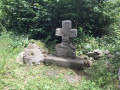
(4) In the hamlet, turn left. 100 metres further on, look out for the cross (on the left) and turn left, then immediately right. Walk alongside the pond. Continue along the track.

(5) At the end of the path, turn sharply right. Pass La Cassière, a large farm, and continue along the path.

(6) Just before the D942 road – which is very visible and busy – turn left onto a track which, further on, narrows and joins the D18.

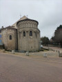
(7) At the end of this track, at a place called Le Mas du Theil, take the road on the right which leads up towards the cemetery in the village of Ahun. Enter the village and follow the main street, Grande Rue, to the left. Walk round the church to admire the apse.

(8) Then follow the D13 to the left; it winds down the hill, passing the health centre and the police station (Route du Moutier) – the only slightly tedious stretch of the route.

(9) Just before the Moutier cemetery, turn onto the narrow path that descends steeply; ignore the wider one that leads back up towards the fields. Pass the town hall, come out onto the church square, head down the main street towards the bridge and cross it to reach the car park (S/E).


Waypoints

  1. S/E : mi 0 - alt. 1,145 ft - Roman Bridge car park. Cross the - Creuse (rivière)
  2. 1 : mi 1.67 - alt. 1,135 ft - Chantemille, castle
  3. 2 : mi 2.1 - alt. 1,335 ft - Les Granges
  4. 3 : mi 2.74 - alt. 1,434 ft - D18
  5. 4 : mi 3.55 - alt. 1,460 ft - Félinas
  6. 5 : mi 4.16 - alt. 1,503 ft - Turn right
  7. 6 : mi 4.67 - alt. 1,499 ft - Junction before the D942
  8. 7 : mi 5.42 - alt. 1,407 ft - Le Mas du Theil
  9. 8 : mi 5.98 - alt. 1,463 ft - Saint-Sylvain Church
  10. 9 : mi 6.48 - alt. 1,309 ft - Short path before the cemetery
  11. S/E : mi 6.8 - alt. 1,145 ft - Roman Bridge car park

Worth a visit

Visit to the Moutier d’Ahun (admission fee applies).
Visit to the Church of Saint-Sylvain in Ahun (free).

Reviews and comments

3.7 / 5
Based on 3 reviews

Reliability of the description
3.7 / 5
Ease of following the route
4.3 / 5
Route interest
3 / 5
mamekiki
mamekiki

I’ve been trying for a long time to create a route ‘around’ the Moutier d’Ahun; I’ve gone round and round in all directions along the right bank of the Creuse, trying to work out a way back. I’ve tried I don’t know how many times, but I haven’t found anything that’s feasible all the way through, or that doesn’t end up taking a road to get back.(I did find a way across the meadows, involving jumping or crawling under barbed wire.)
When it’s not meant to be, it’s not meant to be.
So I ended up following an existing route from the Ahun Tourist Office.

Machine-translated

Charenton
Charenton

Overall rating : 2.3 / 5

Date of your route : Apr 14, 2024
Reliability of the description : ★★☆☆☆ Disappointing
Ease of following the route : ★★★★☆ Good
Route interest : ★☆☆☆☆ Very disappointing
Very busy route : No

I thought the circular route would be more centred around Moutier d’Ahun (start and finish) – it was very disappointing to walk through the village of Ahun along a busy road. The scenery wasn’t particularly pleasant.
I endured the walk rather than enjoyed it. It didn’t really take me ‘away’...

Machine-translated

mamekiki
mamekiki

I don’t think I’m mistaken, but the difficulty of the walks on Visorando is rated according to their length and elevation gain.
It’s true that there’s a fairly steep section of the path after Chantemille. You just need to take your time, stop and set off again once you’ve caught your breath (at least, that’s what I do, as I’m like an asthmatic snail on any incline, even a short one).

Machine-translated

Charles2375
Charles2375

Overall rating : 4.3 / 5

Date of your route : Feb 18, 2024
Reliability of the description : ★★★★☆ Good
Ease of following the route : ★★★★☆ Good
Route interest : ★★★★★ Very good
Very busy route : No

The route is very beautiful and well worth the detour, with magnificent views, but contrary to what is stated, it is not ‘easy’!
Hikers (some of whom may have heart or breathing problems) should be warned that there are some particularly steep climbs.
These difficulties may also mean the walk takes longer than expected.
It was also raining, which made the ‘tractor tracks’ a bit tricky.
That’s about it.

Machine-translated

rumbaya
rumbaya

Overall rating : 4.3 / 5

Date of your route : Jan 28, 2024
Reliability of the description : ★★★★★ Very good
Ease of following the route : ★★★★★ Very good
Route interest : ★★★☆☆ Average
Very busy route : No

An easy, well-marked route, the main points of interest on which are the abbey church at Moutier-d’Ahun and the village of Ahun.

There are a few sections through woodland at the start of the walk, which are rather pleasant. From marker 2 onwards, there is a succession of roads and tracks through cultivated fields, which is a little monotonous.

The pond after Felinas was dry when we passed it.

Finally, you can avoid the D13 between markers 8 and 9 by taking the small, traffic-free road running parallel to it.

Machine-translated

balou17
balou17
• Edited:

A lovely walk through the fields. Very little woodland; far too many gravel or tarmac roads

Machine-translated

Other walks in the area

For more walks, use our search engine .

The GPS track and description are the property of this route's author. Please do not copy them without permission.