Ponds and crosses around Cressat

A relatively easy route, comprising around 80 per cent paths.
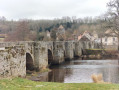
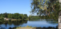
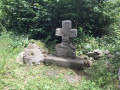
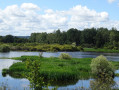
Don’t miss the market town and its surrounding villages, its church, its ponds, its wayside crosses and its paths lined with low stone walls.

Details

20643903
Creation:
Last update:
Last review:
  • Walking
    Activity: Walking
  • ↔
    Distance: 6.54 mi
  • ◔
    Average duration: 3h 20 
  • ▲
    Difficulty: Moderate

  • ⚐
    Back to start: Yes
  • ↗
    Ascent: + 394 ft
  • ↘
    Descent: - 364 ft

  • ▲
    Highest point: 1,798 ft
  • ▼
    Lowest point: 1,572 ft

Description of the walk

Park near La Paillote, facing the pond on the right towards the wooden house.

(S/E) Walk round the pond, take the path downhill, then walk down to the left, along the roadside in the grass for about a hundred metres. Cross the D990 with care and take the path opposite. Follow this path to the end. You’ll reach thefirst cross.

(1) Turn left, then walk through the village of Montbarteix, following the road until you reach a small stone bridge.

(2) Turn onto the path on the right, stay on this path and continue until you reach the edge of a meadow, where you turn right. Carry on until you reach the railway bridge.

(3) Turn right onto a wide, carriageable track lined with hedgerows. Join the D990 again.

(4) Follow it carefully to the left for a few metres, then cross the road to take the path opposite, to the right of thefirst house. At the next junction, stay on the path on the right. Cross a stream and you’ll emerge at the entrance to Le Theil. Turn right and head towards the village square, where you’ll find a lime tree and a wrought-iron cross. Continue straight on along the road ahead and you’ll soon come to a crossroads with a pond.

(5) Here you have two options:
- keep to the right on the road, walk past the Cressat cemetery and you’ll then come to the pond and the Paillote car park:/A:,
- cross the road and head straight ahead (as shown on the map); stay on this path, turning left at the next crossroads. Walk along the edge of the meadow. Then continue along the main path until you reach another road.

(6) Turn right onto this road, carry on until you reach two bends before the village of La Bussière. Leave the road at thesecond bend and turn right; start a short climb, then cross the next road. Walk past a water tower and carry on until you reach the road, which you should cross. Continue on and walk alongside a woodland before rejoining the D13.

(7) Follow it to the right for about a hundred metres and cross it – be careful as it’s a busy road – then take thefirst path on the left. Walk through the village of Villalier to reach the house built on a rock.

(8) Turn right towards the D13, cross it carefully and take the small road opposite, just past thesecond house. Take the path on the right and follow it straight on. You’ll then join the D990; turn right until you reach Cressat Town Hall.

(9) Continue right along Route du Capitaine Moure, pass the church and carry on until you reach the lake. Turn slightly left to return to the Paillote car park (S/E).


Waypoints

  1. S/E : mi 0 - alt. 1,673 ft - La Paillote car park in Cressat
  2. 1 : mi 0.79 - alt. 1,624 ft - 1st cross
  3. 2 : mi 1.14 - alt. 1,572 ft - Stone bridge
  4. 3 : mi 1.73 - alt. 1,631 ft - Tunnel under the railway line
  5. 4 : mi 2.26 - alt. 1,670 ft - D990 junction
  6. 5 : mi 2.99 - alt. 1,739 ft - Crossroads (optional)
  7. 6 : mi 3.55 - alt. 1,739 ft - Road junction
  8. 7 : mi 4.62 - alt. 1,601 ft - D13 junction
  9. 8 : mi 4.94 - alt. 1,624 ft - Villalier
  10. 9 : mi 6.15 - alt. 1,729 ft - Cressat Town Hall
  11. S/E : mi 6.54 - alt. 1,673 ft - La Paillote car park in Cressat

Reviews and comments

4.6 / 5
Based on 3 reviews

Reliability of the description
5 / 5
Ease of following the route
4.7 / 5
Route interest
4 / 5
clodch
clodch

Overall rating : 4.3 / 5

Date of your route : Nov 03, 2024
Reliability of the description : ★★★★★ Very good
Ease of following the route : ★★★★☆ Good
Route interest : ★★★★☆ Good
Very busy route : No

A relatively easy and well-maintained route. Best done during the dry season … and at the end of the walk, do visit the village of Cressat with its church, fountains and so on …

Machine-translated

NLEV
NLEV

Overall rating : 4.7 / 5

Date of your route : May 15, 2023
Reliability of the description : ★★★★★ Very good
Ease of following the route : ★★★★★ Very good
Route interest : ★★★★☆ Good
Very busy route : No

This route, designed for walkers, can also be tackled by mountain bikers. However, the climb up to the water tower is tough on a bike; I therefore recommend that mountain bikers tackle the route in the opposite direction, as the climb is then much gentler!!!

Machine-translated

Cressat gym
Cressat gym
• Edited:

Hello,
This route was signposted in September 2022.
Yellow markers start from the Paillote de Cressat.

Enjoy your walk.
Cressat Gym

Machine-translated

Brigittedn
Brigittedn

Overall rating : 4.7 / 5

Date of your route : Jul 15, 2022
Reliability of the description : ★★★★★ Very good
Ease of following the route : ★★★★★ Very good
Route interest : ★★★★☆ Good
Very busy route : No

A easy route. The lovely Paillote pond. In the village of Montbarteix, there’s a small lake where you can have a picnic in the shade. Le Theil, a pleasant hamlet. A peaceful walk best done in the morning during a heatwave.

Machine-translated

Other walks in the area

For more walks, use our search engine .

The GPS track and description are the property of this route's author. Please do not copy them without permission.