Country:

 City:
City:


Park in the car park at Foncine-le-Bas, Rue des Douanets, before the River Saine.
(S/E) Head left, cross the viaduct over the River Saine and reach a junction. Then turn left onto the old tram line and follow it to a Y-junction.
(1) Keep left on this road. Walk alongside the stunning Gorges de la Saine and go through the tunnel. Continue through this magnificent landscape on theGR®559A, marked in white and red. Cross the Ruisseau d’entre Côtes and carry on until you reach, further on, a junction with a tarmac road, near Les Planches-en-Montagne.
(2) Turn right onto Rue du Paradis and you’ll come to a hairpin bend.
(3) Head slightly to the right to enter the forest. You’ll soon reach a junction; keep to the right to follow the left bank of the Ruisseau de Poutin. At the next fork, keep left, staying on the left bank of the Ruisseau de Poutin. Cross the stream and head towards the edge of the meadows.
(4) Continue to the right, at the foot of the scree slopes. At the end of a curved section in the woods, look out for a path with a ‘private property’ sign – be careful here: no entry.
(5) From here, you’ll be walking by sight. Follow the narrow track heading south-west for about a hundred metres. After the boulders on the left, in a small valley, head straight up the slope. At the top, head north-east down the slope towards the stream. Cross it wherever you can and join the marked path on the other bank.
Note for this section: this slightly tricky part of the route is necessary to avoid a long detour. You can use the app to help you find the easiest route.
(6) Turn left onto theGRP®, heading north-east. Pass by the Grotte de la Mine d’Or (or Trou du Diable) and the Waterfall des Orpailleurs. Continue until you reach a lovely clearing where a charming hunting lodge is situated.
(7) Carry on across the meadow, enter the forest and cross the Ruisseau d’entre Côtes; you’ll soon reach a junction with a forest track branching off to the right.
(8) Turn right onto theGR®509, marked in white and red. Walk a few metres along the road to reach the start of the path leading to the Bulay viewpoint.
(9) Climb the steps on the left to reach the viewpoint. Enjoy the view, then head back, veering slightly to the left onto theGR® 509 and the GTJ. At the junction with the road, keep left on theGR®. At the cross-country ski trail car park, continue along theGR®. You’ll reach the junction with the nature trail.
(10) Turn right onto theGR® to reach the Belvédère de la Roche Fendue viewpoint.
(11) Continue to the right, then turn sharply 90° to the right onto the GR®. Head down through the forest to reach a four-way junction at the Belvédère de Couillou viewpoint.
(12) Cross the road and head uphill straight ahead to reach the radio mast and a developed area.
(13) Return to the previous crossroads.
::12: Turn right back onto theGR®, walk past a farm and reach the entrance to the hamlet of Les Ruines.
(14) Leave theGR® here and turn left (south-west) onto a shaded path between the hedges. You will then enter a pasture. Follow this path through the meadows, then through the copses. Go through the gate and head downhill to find a path near the Source du Leat de la Ruine.
(15) Here you can turn right to reach this spring; please check carefully that it is accessible. Then continue along the left bank of this stream. At the waterfall, as the slope becomes too steep, move away from the stream and head south. Continue to the left to return to the tram line junction you passed on the way out.
(1) Turn right and follow the route you took on the way there in the opposite direction, heading back to the car park on Rue des Douanets (S/E).


 Visorando Member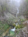
 Easy
Easy 
 Moderate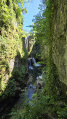
 Tourist office
 Association / Club / Walk leader