


A circular walk starting from the Plein Soleil campsite in Nonceveux


Nonceveux is one of the must-visit starting points for walkers, lovers of panoramic views and nature enthusiasts wishing to explore the hills of the Condruz Ardennes.
Details
Creation:
Last update:
Last review:
–
–
-
 Activity: Walking
-
 Distance: 5.63 mi
-
 Average duration: 3h 10
-
 Difficulty: Moderate
-
-
 Back to start: Yes
-
 Ascent: + 643 ft
-
 Descent: - 627 ft
-
-
 Highest point: 814 ft
-
 Lowest point: 469 ft
-
 Country:
Belgium
-
 Area: Massif des Ardennes
-
 City:
Aywaille
-
 Start/End: N 50.466518° / E 5.728559°
-


 Hour-by-hour weather


Waypoints
- S/E : mi 0 - alt. 489 ft - Nonceveux
- 1 : mi 0.6 - alt. 512 ft - Amblève (rivière) - Belgique
- 2 : mi 2.74 - alt. 663 ft - Rocher du Promontoire
- 3 : mi 3.13 - alt. 620 ft - Hé de Han
- 4 : mi 4.64 - alt. 545 ft - N633 - Amblève (rivière) - Belgique
- S/E : mi 5.63 - alt. 479 ft - Nonceveux
Other walks in the area
From Chefna to Ninglinspo
 Visorando Member10.53 mi
+1,893 ft
-1,883 ft
6h 30
Moderate
 Departure from Aywaille (Province de Liège)
The Valley of Legends via Chefna and Ninglinspo. Between legend and torrent.Ideal for dogs, with plenty of water sources, rivers and streams.
The Ninglinspo and the Charmille du Haut-Marais
 5.55 mi
+873 ft
-866 ft
3h 20
Moderate
Departure from Aywaille (Province de Liège)
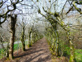
The Ninglinspo is that Walloon stream described by some tourist organisations as ‘mountainous’ and which all Belgians and Dutch people rush to come and admire. So, yes, certainly, it is picturesque and as wild as you could wish for, with footbridges, waterfalls and glacial potholes known as the Baths of the Naiads, Diana, Hermes, the Otter, the Stag, etc... but frankly, there is nothing mountainous about it.Above all, go for a walk there during the week, as weekends, public holidays and school holidays are best avoided if you appreciate peace and nature.The second main point of interest is the arbour planted in themid-19th century on the edge of his Haut-Marais estate. Despite being partially destroyed—by more than 40%—after German tanks passed through in 1940, it remains the longest in Europe, still stretching for 573 metres.
From Ninglinspo to Chefna
 10.41 mi
+2,067 ft
-2,057 ft
6h 35
Moderate
Departure from Aywaille (Province de Liège)
A tributary of the Amblève and 3.5 km long, with an average gradient of 7.5%, the Ninglinspo is one of the few torrents in Belgium. Come and discover this valley, which was coveted by gold prospectors in the last century, and walk in a landscape worthy of the highest mountain rivers. With its waterfalls and "baths", the Ninglinspo will offer you an unforgettable moment of relaxation. As for the Chefna, less popular with tourists, it will take you away from it all with its wild side.
Remouchamps - Stoumont
 10.35 mi
+2,077 ft
-1,444 ft
6h 35
Moderate
Departure from Aywaille (Province de Liège)
This stage ofthe GRP® 571 starts in Remouchamps, passes through Sedoz and Fonds de Quarreux close to the Amblève, follows the Chefna stream to the border of the Sources Nature Park and descends into the valley to finish in Stoumont.
Between Remouchamps and La Reid, off the beaten track
 11.51 mi
+1,434 ft
-1,434 ft
6h 30
Moderate
Departure from Aywaille (Province de Liège)
Like the Porallée, this circular hike is located between the villages of Remouchamps and La Reid. Sometimes in the heart of forests, often along cascading streams or among high marshes, this circular hike is full of peaceful places. It offers remarkable panoramic views, connected by sometimes very old paths, passing through Vieux Chera, Hautregard and Ménobu.
On the heights of the Amblève, starting from Aywaille
 11.65 mi
+1,663 ft
-1,644 ft
6h 50
Moderate
Departure from Aywaille (Province de Liège)
Set off to explore the countryside and forests on the heights of the Amblève around the centre of Aywaille, passing in particular through the Goiveux Former Quarries Nature Reserve, the Warnoumont Forest, the Florzé ridge path, the hamlets of Lillé and Martinrive, the former quarries at Chambralles and the meadows of Cwimont.
The area around Aywaille, following the Amblève river
3.32 mi
+108 ft
-121 ft
1h 35
 Easy
Departure from Aywaille (Province de Liège)
5km route for the ADEPS 2026 walk. It offers the chance to explore the area around Aywaille whilst walking along the Amblève.A treasure hunt is included as part of this activity.This route is suitable for pushchairs.
Septroux circular loop
6.58 mi
+951 ft
-958 ft
3h 50
Moderate
Departure from Aywaille (Province de Liège)
A superb walk around Aywaille. It takes you through the region, passing by magnificent spots and offering a circular route around Septroux.
The views are breathtaking, ensuring you'll take home some memorable souvenirs.
For more walks, use our search engine .
The GPS track and description are the property of this route's author. Please do not copy them without permission.

