Country:
 City:
City:


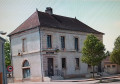
Park in the car park of the Arc-sur-Tille village hall (the ASSET), located behind the town hall.
(S/E) Set off towards the Town Hall, then walk past the fire station and continue straight ahead along Rue de la Mairie to the junction by the church, after crossing Rue de La Cras.
(1) Carry on straight ahead, carefully cross Rue de Genlis and then Place du 19 Mars 1962, before continuing along Rue de la Rigole.
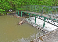
(2) Cross the bridge over the Tille and head straight on, leaving Rue du Dos d’Âne on your left. Continue to the next junction of tarmac roads, at a fibre-cement pole for a medium-voltage power line (No. 21E).
(3) Turn right, continue for about 200 m before turning left at the next junction. Head straight down the tarmac track, cross the Vernoy stream, go through the poplar copse and turn left at the T-junction at the end. Join the D961, ignoring a track branching off to the right.
(4) Cross this main road safely after a slight bend to the left.
Take the tarmac path leading off on the other side. Pass under a medium-voltage power line. At the end of a long straight stretch, continue along the same path, which bends sharply to the right and then climbs slightly, until you reach the first junction of tracks.
(5) Turn left onto a grassy track towards the forest. Enter the woods, following the same track in the same direction. At the next T-junction, turn right (there is a large agglomerated concrete marker and a smaller stone one). Head for the next crossroads of tracks, ignoring all side paths. Continue straight ahead.
(6) At this junction, on the left, there are two stone markers placed side by side. Continue along the same path, ignoring the three side paths. Follow the edge of a clearing, keeping to the left. At the next junction, there are again two stone markers and a third one lying on the ground (marked ‘28’ on a tree).
(7) Turn right and follow the path straight ahead, despite any obstacles (fallen trees). Just before a visible crossroads, a Fork in the road has opened up through the vegetation; keep to the right. When you reach a dead end at a perpendicular track, turn right then immediately left (for 5 m). Follow this woodland track until you come out onto a wide, gravel-surfaced white track, at the edge of the woodland and field on the right. Cross a stream at this point. Take the white track.
(8) Walk slightly uphill to a T-junction. Turn right to continue along an identical white track. Follow it all the way until you reach the D961, thus leaving the woodland.
(9) Cross this road carefully. Opposite, on the other side, take the field track. Follow this path to Lamblin Haut farm, which can be seen from a long way off, slightly to the left.
(10) Walk through the grounds, with the farmhouse on your right and agricultural sheds on your left. Continue along the same path, across the fields, heading towards a copse in the distance, situated slightly to the left. Once you reach the woodland, follow the path to the left until you come to a T-junction.
(11) Turn right onto a tarmac road. Follow it straight ahead until you reach Remilly-sur-Tille, the first houses of which can be seen in the distance. Cross a stream. Arrive in Remilly and head down Rue de la Corvée to the left until you reach a tree-lined square.
(12) Turn right onto the Chemin des Vignes to leave Remilly (cycle route). The tarmac road turns into a dirt track. Take the bend to the left, then carry on straight ahead, ignoring a path branching off to the right. Go round the bend to the right and continue straight ahead until you reach a junction between a track and a tarmac road.
(13) Turn left and head down the tarmac road, cross the Ruisseau du Vernoy and continue along this route (cycle route), which bends to the right, towards Arc-sur-Tille – where you can see the water tower opposite – until you reach the first road junction.
(14) Turn left down Rue de la Planche towards the row of trees. Cross the bridge over the Tille. Carry on straight ahead to the junction with Rue de Genlis (D34). Cross the road at the pedestrian crossing on the right, just after the bus stop.
(15) Follow Rue de La Cras (30 km/h zone) all the way to its junction with Rue de la Mairie, the junction you passed on the way there.
(1) Then turn left and head past the fire station and the town hall to the L’ASSET’ car park (S/E).

 Visorando Member
 Easy
Easy