The banks of the Furand and the valleys around Saint-Antoine-l’Abbaye

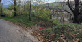
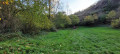
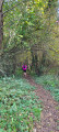
This walk offers a lovely stroll along the banks of the Furand and through the valleys around Saint-Antoine-l’Abbaye.
The path along the banks of the Furand was recently opened by the Association des Sentiers Antonins, which obtained the necessary permissions to cross this private land. Please respect the area.
Please note that in wet weather, the route may be slippery (or even flooded) in the Combe de la Charrette

Details

66382331
Creation:
Last update:
Last review:
  • Walking
    Activity: Walking
  • ↔
    Distance: 4.70 mi
  • ◔
    Average duration: 2h 45 
  • ▲
    Difficulty: Moderate

  • ⚐
    Back to start: Yes
  • ↗
    Ascent: + 692 ft
  • ↘
    Descent: - 689 ft

  • ▲
    Highest point: 1,522 ft
  • ▼
    Lowest point: 1,014 ft

Photos

Description of the walk

The starting point is at the car park of the village hall in Saint-Antoine-l’Abbaye.

(S/E) Head up towards the village and turn immediately right onto Avenue du 19 Mars 1962 until you reach the sewage treatment works.

(1) Turn right and follow the dirt track down to the banks of the Furand

(2) The entrance to the Furand riverside path is on the left. It begins by following the Furand along its left bank for about a hundred metres before reaching a wooden footbridge built by the association. Cross the bridge and continue along the path on the right bank until you reach a crossroads.

(3) Here, you’ll come across a path coming down from your right and heading towards a footbridge on the left. Ignore this path and carry on along the right bank, heading slightly uphill to the right until you reach the ruins of the Moulin Brûlé.

(4) The ruins are on your right. Stay firmly on the path along the right bank; do not cross the concrete footbridge. You’ll come to a junction.

(5) Turn right to enter the Combe de la Charrette. Follow this winding valley along the edge of the stream, which is usually dry(take care if it has been raining). You’ll come to a Fork in the road.

(6) Head up a short, fairly steep path on the left for about a hundred metres. This then leads onto a wider track, which you’ll also follow to the left. Cross a field and look out for a ruined house on your left. Then carry on straight on until you reach the top of the climb at a multi-way junction.

(7) Turn right just before the tarmac road. This path has recently been reopened by the association. Carry on straight ahead until you reach a road.

(8) Take the road straight ahead, then keep going straight instead of following the road which bends to the right. Next, follow a small road downhill. Turn left twice at the bottom of this road. Immediately after turning left, take the path down into the Combe de Fontfroide on the right.

(9) Follow this path. Cross a bridge and head back up the other side. Then, walk through the hamlet of Montmartel, staying on the road. Continue left along the road as you leave the hamlet until you reach a Fork in the road near a bench.

(10) Just before the bench on your right, there is a small path that descends along the cliff face. Take care on this section! You can avoid it by taking the road. You’ll come out near the stonemason’s workshop. Turn right twice to rejoin Rue des Terreaux. Follow it back to the starting point (S/E).

Waypoints

  1. S/E : mi 0 - alt. 1,152 ft - Village hall
  2. 1 : mi 0.34 - alt. 1,152 ft - Wastewater treatment plant
  3. 2 : mi 0.47 - alt. 1,142 ft - Entrance to the path along the banks of the - Furand (rivière) - Affluent de l'Isère
  4. 3 : mi 0.86 - alt. 1,099 ft - Crossroads, concrete footbridge - Furand (rivière) - Affluent de l'Isère
  5. 4 : mi 1.44 - alt. 1,014 ft - Moulin Brûlé - Furand (rivière) - Affluent de l'Isère
  6. 5 : mi 1.65 - alt. 1,043 ft - Fork in the road, entrance to Combe de la Charrette
  7. 6 : mi 1.99 - alt. 1,112 ft - Fork in the road and climb up the Combe de la Charrette
  8. 7 : mi 2.9 - alt. 1,486 ft - End of the climb, Route de Montagne
  9. 8 : mi 3.37 - alt. 1,509 ft - Road
  10. 9 : mi 3.76 - alt. 1,339 ft - Entrance to Combe de Fontfroide
  11. 10 : mi 4.38 - alt. 1,276 ft - Entrance to the stonemason’s path - Furand (rivière) - Affluent de l'Isère
  12. S/E : mi 4.7 - alt. 1,152 ft - Village hall

Reviews and comments

4.5 / 5
Based on 3 reviews

Reliability of the description
4.5 / 5
Ease of following the route
4.3 / 5
Route interest
4.7 / 5
piero427
piero427

Overall rating : 4.7 / 5

Date of your route : Jun 15, 2026
Reliability of the description : ★★★★★ Very good
Ease of following the route : ★★★★☆ Good
Route interest : ★★★★★ Very good
Very busy route : No

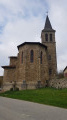
HELLO – a lovely, shaded walk; a wonderful way to discover Furand and its mysterious valleys. The route is varied, taking you through the valleys and across meadows, and offers a magnificent view of Saint Antoine Abbey at the end.

Machine-translated

andrebayle
andrebayle

Walk completed on 1 May 2026. The field at a place called "COSSIOZ" is under cultivation. You obviously have to go round it, but the route crosses through it, so signposting and clear directions would be welcome

Machine-translated

User 3930304
• Edited:

Insufficient information

Machine-translated

Protee26
Protee26

Overall rating : 4.5 / 5

Date of your route : Jul 20, 2025
Reliability of the description : Not used / Not applicable
Ease of following the route : ★★★★★ Very good
Route interest : ★★★★☆ Good
Very busy route : No

A short, varied and very easy hike, completed in two hours. I recommend this walk, but be aware that heavy rain will make the valley between points 5 and 6 more challenging.

Machine-translated

AALEX
AALEX

Overall rating : 4.3 / 5

Date of your route : Apr 20, 2025
Reliability of the description : ★★★★☆ Good
Ease of following the route : ★★★★☆ Good
Route interest : ★★★★★ Very good
Very busy route : No

A very interesting walk, in a setting that is at times wild, but it’s worth noting that it’s a bit of a challenge. Between points 5 and 6, the stream hadn’t dried up and flows through a small valley with vertical cliffs, making it difficult to keep your feet dry as you navigate from one bank to the other. So it’s best avoided in wet weather or after rain. Please note that the path at point 5 is difficult to find. After point 10, there is a very steep 50-metre stretch.
Enjoy the walk, everyone.

Machine-translated

Other walks in the area

For more walks, use our search engine .

The GPS track and description are the property of this route's author. Please do not copy them without permission.