The Bois de la Garde and the Bois de Pionsat

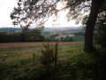
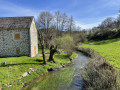
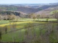
A route through the wooded hills south-east of Pionsat, following in the footsteps of the Resistance fighters of the Nestor Perret maquis and offering some stunning views of the Limousin and the Chaîne des Puys. The first and last sections of the route provide a glimpse of the typical buildings and bocage landscape of the Combrailles.

Details

3266732
Creation:
Last update:
Last review:
  • Walking
    Activity: Walking
  • ↔
    Distance: 9.83 mi
  • ◔
    Average duration: 5h 45 
  • ▲
    Difficulty: Moderate

  • ⚐
    Back to start: Yes
  • ↗
    Ascent: + 1,407 ft
  • ↘
    Descent: - 1,430 ft

  • ▲
    Highest point: 2,638 ft
  • ▼
    Lowest point: 1,880 ft

Photos

Description of the walk

Start in front of La Cellette church (parking available alongside the church).

(S/E) Walk up the main street (follow a sign for the viaduct). At Puy Séguy, pass under a bridge. On leaving the hamlet, turn right at the cross. Follow the track and cross the viaduct.

(1) Continue along the track for 600 m, passing under a power line.

(2) At the junction, turn left; then, about a hundred metres further on, level with a building, take the path on the left which climbs into the Bois de la Garde. Follow this path for just over 1 km.

(3) As you come out of the woods, take the track on the left. Cross a small road, leave a grassy path on your left and you’ll reach a track.

(4) Follow the track to the right. Cross the D227 with care. Just after the road, carry on straight ahead for about a hundred metres.

(5) At the fork in the road, turn right and continue for about 500 metres. At the next fork, keep left. Pass a path and a track on your right.

(6) At the fork, follow the path which continues along the track.

(7) About 400 m further down, take the path leading down to the left. Follow it for about 500 m, then turn right onto a grassy track.

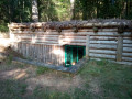
(8) Make a slight detour to the right to pass in front of the Nestor Perret Maquis camp. Continue for about 300 m, turn right, then take the path on the right and follow it for about 1 km.

(7) Turn left and join a track.

(9) Turn left onto this track and follow it for about 900 m, completing a circular route. Pass a path on your right and continue to the junction with a track.

(10) Turn left and follow it for just over 2 km to the hamlet of Les Grands Mas.

(11) Carry on straight ahead on the D525 (do not follow the sign for the hamlet of L’Étrade on the left). Pass through the hamlet of La Mazère.

(12) Leave the D525 towards the hamlet of Les Petits Mas, turn left and pass through Chez Tullat.

(13) As you leave the hamlet, take a track on the right and continue for just over 200 metres. At the next fork, turn right and, about thirty metres further on, take the small road on the left.

(14) Cross the D227 with care, follow it to the right for a few metres and turn left onto the track.

(15) Turn left and follow the track for just over 500 m until you rejoin the route you have already taken.

(2) Ignore the paths you have already taken, turn left and pass under a power line.

(16) At a place called Le Fraisse, continue along the track running parallel to the D227. At the cemetery, turn right and head towards the church at La Cellette (S/E).

Waypoints

  1. S/E : mi 0 - alt. 1,919 ft - Parking alongside the church at La Cellette
  2. 1 : mi 0.37 - alt. 1,955 ft - La Cellette Viaduct
  3. 2 : mi 0.82 - alt. 2,077 ft - Entrance to the Bois de la Garde
  4. 3 : mi 1.65 - alt. 2,270 ft - Exit from the Bois de la Garde
  5. 4 : mi 2.4 - alt. 2,438 ft - Track on the left
  6. 5 : mi 3 - alt. 2,428 ft - Turn right at the fork in the road
  7. 6 : mi 3.68 - alt. 2,608 ft - Path continuing from the track
  8. 7 : mi 3.93 - alt. 2,585 ft - Junction at the Nestor Perret circular Maquis loop
  9. 8 : mi 4.36 - alt. 2,520 ft - Nestor Perret Maquis camp
  10. 9 : mi 5.42 - alt. 2,543 ft - Track on the left, descent
  11. 10 : mi 6.43 - alt. 2,362 ft - Track on the left
  12. 11 : mi 7.65 - alt. 1,969 ft - Les Grands Mas
  13. 12 : mi 8.09 - alt. 1,883 ft - Road to Les Petits Mas
  14. 13 : mi 8.46 - alt. 1,939 ft - Leaving the hamlet of Chez Tullat
  15. 14 : mi 8.68 - alt. 2,031 ft - Crossing the D227
  16. 15 : mi 8.83 - alt. 2,116 ft - Track on the left at the junction
  17. 16 : mi 9.5 - alt. 1,946 ft - Le Fraisse
  18. S/E : mi 9.83 - alt. 1,919 ft - Parking alongside the church at La Cellette

Worth a visit

  • La Cellette Viaduct (1).
  • View of the Chaîne des Puys to the south-south-east after (4) and before the D227.
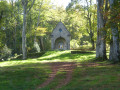
  • Nestor Perret Maquis after (7).
  • Views of the bocage and the Limousin plateau to the west between (1) and (2); (10) and (11); and between (15) and (16).

Reviews and comments

4.8 / 5
Based on 2 reviews

Reliability of the description
5 / 5
Ease of following the route
4.5 / 5
Route interest
5 / 5
Yves_Remord
Yves_Remord

Thank you for your feedback

Machine-translated

Helene102
Helene102

Overall rating : 4.7 / 5

Date of your route : Aug 08, 2022
Reliability of the description : ★★★★★ Very good
Ease of following the route : ★★★★☆ Good
Route interest : ★★★★★ Very good
Very busy route : No

A fairly long walk, but not difficult.
The climb is at the start, in the shade and on a gentle slope.
There are plenty of sections through the woods, which is lovely in hot weather.
We strayed from the path at times but found it again easily. This must be down to the GPS being a bit off.
To get to point 8, we recommend taking the circular path to the right, as in the other direction the grassy path is hard to see; we struggled to find the Nestor Perret maquis camp, a beautifully restored memorial site.
Many thanks to the author of this walk.

Machine-translated

JFS03
JFS03

Overall rating : 5 / 5

Date of your route : Mar 21, 2021
Reliability of the description : ★★★★★ Very good
Ease of following the route : ★★★★★ Very good
Route interest : ★★★★★ Very good
Very busy route : Yes

The walk takes us through the woods for a long stretch, and it’s truly lovely to walk in the tranquillity of the forest, accompanied by birdsong.
And let’s not forget to spare a thought for our beloved Resistance fighters as we pause to reflect at the site

Machine-translated

Other walks in the area

For more walks, use our search engine .

The GPS track and description are the property of this route's author. Please do not copy them without permission.