Voie du Piémont. Béziers – Capestang

The first section of a magnificent route, from Béziers to Carcassonne, which follows the Chemin du Piémont towards Santiago de Compostela: 100 km through the vineyards, pine forests and hills of the Minervois.
Fully signposted, alternating between red and white for sections shared with the GR® 78, and yellow and blue for certain sections that allow you to make the most of unpaved tracks and paths, closer to the historic route: the Camin Romieu.
Suggested route in five stages: Capestang, Pouzols Minervois, Rieux Minervois, Malves.

Details

n°53508829
Creation:
Last update:
Last review:
  • Walking
    Activity: Walking
  • ↔
    Distance: 11.97 mi
  • ◔
    Average duration: 5h 35 
  • ▲
    Difficulty: Moderate

  • ⚐
    Back to start: No
  • ↗
    Ascent: + 131 ft
  • ↘
    Descent: - 59 ft

  • ▲
    Highest point: 164 ft
  • ▼
    Lowest point: 26 ft
  • ⚐ Country: France
  • ⚐ City: Béziers (34500)
  • ⚑
    Start: N 43.335094° / E 3.213404°
  • ⚑
    End: N 43.33149° / E 3.0443°
  • ❏
    IGN map(s): Ref. 2545ET, 2545OT
  • Hour-by-hour weather

Description of the walk

Several car parks near the canal bridge in Béziers.

(S) From the canal bridge, follow the River Orb upstream and turn left to cross the river. At the roundabout, take the second exit onto the departmental road and continue to the canal.

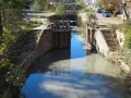
(1) Walk along the left-hand side of the canal towards the Fonseranes Locks (visitor centre).

(2) Cross over and turn left onto the towpath, following the Canal du Midi towards Colombiers. Pass under the D609 and the D64 to reach a third bridge.

(3) Stay alongside the Canal du Midi and follow it to Colombiers and its bridge.

(4) Carry on straight ahead and do the same at the road to pass through the Malpas Tunnel.

(5) At the junction above the tunnel, turn left then right and stay along the canal to reach the path leading to Régimont le Haut.

(6) Head straight ahead to rejoin the road: follow it straight on, staying on the bank of the Canal du Midi until you reach Poilhes Town Hall.

(7) Keep heading along the fitness trail beside the canal. Pass under the high-voltage power lines to reach Le Guéry. Follow the road to the Pont de Trésille.

(8) Go under the bridge and follow the canal to Capestang and its river stop (E).

Waypoints

  1. S : mi 0 - alt. 33 ft - Béziers - Orb (fleuve)
  2. 1 : mi 0.39 - alt. 39 ft - Canal
  3. 2 : mi 0.8 - alt. 59 ft - Ecluses de Fonséranes
  4. 3 : mi 2.22 - alt. 105 ft - Bridge - Canal du Midi
  5. 4 : mi 4.67 - alt. 112 ft - Colombiers
  6. 5 : mi 5.68 - alt. 164 ft - Malps Tunnel
  7. 6 : mi 7.14 - alt. 108 ft - Path leading to Régimon-le-Haut
  8. 7 : mi 8.57 - alt. 115 ft - Poilhes
  9. 8 : mi 10.05 - alt. 105 ft - Trésille Bridge - Canal du Midi
  10. E : mi 11.97 - alt. 105 ft - Capestang

Worth a visit

- Canal du Midi
- Visit Béziers and Capestang

Always be cautious and plan ahead when you're outdoors. Visorando and the author of this route cannot be held responsible for any accidents occurring on this route.

The GR® and PR® markings are the intellectual property of the Fédération Française de Randonnée Pédestre.

Reviews and comments

4 / 5
Based on 2 reviews

Reliability of the description
3.5 / 5
Ease of following the route
4.5 / 5
Route interest
4 / 5
Sylvie2109
Sylvie2109

Overall rating : 4.3 / 5

Date of your route : Apr 24, 2025
Reliability of the description : ★★★★☆ Good
Ease of following the route : ★★★★★ Very good
Route interest : ★★★★☆ Good
Very busy route : No

A very easy route to follow, as we’re walking alongside the Canal du Midi.
The harbour at Colombiers makes for a very pleasant stop, with all its shops and stone steps where you can rest whilst enjoying the view of the boats.
There are plenty of houseboats on the canal, as well as pleasure craft, during this holiday period.
The Malpas Tunnel is truly spectacular and easily accessible; you walk through it on a towpath, the only one that has been preserved (it’s a tunnel for boats).

Machine-translated

Hérault Tourisme
Hérault Tourisme

Overall rating : 3.7 / 5

Date of your route : Jul 02, 2024
Reliability of the description : ★★★☆☆ Average
Ease of following the route : ★★★★☆ Good
Route interest : ★★★★☆ Good
Very busy route : No

Please note: at present, the GR®78 is not yet signposted between Béziers and Capestang.
The route is fairly straightforward between the Pont Vieux and Capestang, but you will need to follow the track and the route description.
A note regarding the arrival in Capestang: the route, approved by the local authorities and Voies Navigables de France, follows the ‘north’ bank of the canal, taking you past the harbour master’s office and the Tourist Office.

Machine-translated

Other walks in the area

For more walks, use our search engine .

The GPS track and description are the property of this route's author. Please do not copy them without permission.