Country:

 City:
City:


Park behind the school bus shelter on the departmental road, just before you reach the town hall.
(S/E) Head to the right, towards Buis-les-Baronnies on the D523, and at the cross, turn left.
(1) Head uphill, staying on the PR®-marked path.
(2) At the three-way junction, head left up the forest track, still following the PR®.
(3) At the fork, leave thePR® and head due east along the wide path on the right.
(4) Join a forest track again and head towards theGR®9, climbing up to the Col de Milmandre.
(5) Then turn left and stay on theGR®9until you reach the Col du Linceuil.
(6) A few dozen metres further on, after this pass, turn left, heading due west, onto the wide path, until you reach the Col de la Posterle at an elevation of 897.
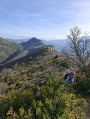
(7) At this pass, leave theGR® and continue straight on, north-west, along the ridge. You’ll find light green markings, which are very helpful during the crossing. Continue towards the summit at an elevation of 964. Take in the view, then begin the descent, heading due north.
(8) At an altitude of around 880 m, turn left to rejoin a pleasant little path that takes you to the Col des Moulins, still following the green markings.
(9) At this pass, cross the dry stream and, about ten metres further on, take the forest track on the right and continue until you rejoin the PR®.
(10) Take the hairpin bend to the right and continue along the wide forest track. Keep to the left, ignoring the paths on your right.
(11) After the sharp bend to the left, leave the forest track and take the grassy path on the right. Enter the woodland and cross the dry stream bed. You will see green or fluorescent pink markings. Follow these markings for a while. Do not go down to the stream.
(12) Leave the marked path and continue straight on along the main track until you reach the 549-metre mark, where you’ll come to a wide stony track; follow this to the left. After just over a hundred metres, look out for the small path on the left.
(13) Follow it until you rejoin the forest track, which you’ll take to the left.
(14) Leave the track again by turning right, then, at the three-way junction ahead, take the forest track on the left. Continue until you reach the junction of the forest tracks, turn left and you’ll soon spot a path on the left.
(15) Follow this path, which leads to the Col de la Croix at an elevation of 781.
(16) At this pass, take the hairpin bend to the right towards Les Granges, and descend to the hamlet of Les Granges. Turn left onto the road (D523) and you’ll reach the car park (S/E).


 Visorando Member