Émosson Dams and Col de la Terrasse from Vallorcine

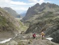
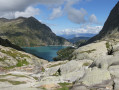
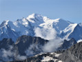
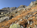
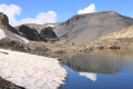
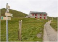
A hike offering varied landscapes and trails. We took the train to cross into Switzerland and walked back to France. You’ll discover the two Émosson dams, a magnificent landscape and dinosaur footprints, and the reward is the breathtaking view of Mont Blanc and its glaciers from the Col de la Terrasse, before returning via the Loriaz mountain huts.

Details

n°26496054
Creation:
Last update:
Last review:
  • Walking
    Activity: Walking
  • ↔
    Distance: 12.25 mi
  • ◔
    Average duration: 10h 40 
  • ▲
    Difficulty: Difficult

  • ⚐
    Back to start: Yes
  • ↗
    Ascent: + 5,778 ft
  • ↘
    Descent: - 5,784 ft

  • ▲
    Highest point: 8,642 ft
  • ▼
    Lowest point: 3,658 ft
  • ⚐ Country: France
  • ⚐
    Area: Alps
  • ⚐ City: Vallorcine (74660)
  • ⚑
    Start/End: N 46.032395° / E 6.932996°
  • ❏
    IGN map(s): Ref. 3530ET, 3530ETR, 3630OT, 3630OTR
  • Hour-by-hour weather

Photos

Description of the walk

(DA) At Vallorcine station, take the TMR train towards Martigny. Get off at Le Chatelard Frontière (8 mins – one stop).

(1) Let’s go! As you leave the station, head up to the right along the road towards the border and take the path signposted ‘Barberine’ leading up into the forest.

(2) Before you reach the wooden bridge, take a quick detour to see the waterfall, then come back and carry on along the path.

(3) In the village, head up the road to the right. The hiking signs do not provide any directions. The climb starts to get quite steep.

(4) At the Col du Passet, turn right to join the road leading to the Émosson dam. Follow it to the left until you come to a small sign for walkers.

(5) Climb up to the left, along the side of the Gorge du Vieux, until you reach the Lac du Vieux Émosson dam.

(6) Cross the dam and follow the path round the lake to its far end. A steep climb lies ahead! You’ll come to a signpost.

(7) Carry on to the right to see the dinosaur footprint site.

(8) Retrace your steps back to the previous junction.

(7) Carry on to the right towards the Col de la Terrasse. Follow the red markers and the cairns.

(9) Take in the view of the glaciers and Mont Blanc.
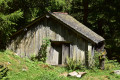
Set off again, following the large yellow markings on the rocks. The first few metres of the descent are very steep. Be careful and keep your hands free to hold on to the rocks. Make your way to the Chalets de la Loriaz.

(10) Continue straight ahead to reach the Croix de la Loriaz.

(11) Turn left and follow the signs for Vallorcine Chef-Lieu.

(12) Pass the first fork in the path (elevation 1759) and arrive at a crossroads.

:13:: Signs for Le Crot are on your right. So turn right and head towards the houses.

(14) Continue downhill, cross the D1506 with care, then take the wooden bridge to return to Vallorcine station (S/E).

Waypoints

  1. S/E : mi 0 - alt. 4,137 ft - Gare de Vallorcine
  2. 1 : mi 1.93 - alt. 3,658 ft - Le Châtelard Gietroz railway station (Switzerland) - Gare de Le Châtelard Gietroz (Suisse)
  3. 2 : mi 2.39 - alt. 3,770 ft - Barberine Waterfall
  4. 3 : mi 2.47 - alt. 3,786 ft - The village of Barberine
  5. 4 : mi 4.25 - alt. 6,407 ft - Émosson Dam - Barrage d'Émosson
  6. 5 : mi 5.32 - alt. 6,378 ft - On the left – Pain de Sucre (Emosson) - Pain de Sucre (Emosson)
  7. 6 : mi 6.18 - alt. 7,251 ft - Vieux Émosson Lake Dam - Lac du Vieux Émosson
  8. 7 : mi 7.66 - alt. 7,897 ft - Junction. Return trip to the site – Émosson Dinosaur Site - Empreintes de dinosaure d'Émosson
  9. 8 : mi 7.79 - alt. 7,923 ft - Émosson Dinosaur Site - Empreintes de dinosaure d'Émosson
  10. 9 : mi 8.53 - alt. 8,642 ft - Col de la Terrasse – Pointe de la Terrasse - Pointe de la Terrasse
  11. 10 : mi 9.92 - alt. 6,627 ft - Loriaz chalets - Chalets de la Loriaz
  12. 11 : mi 10.05 - alt. 6,512 ft - Loriaz Cross
  13. 12 : mi 10.73 - alt. 5,787 ft - Junction (altitude 1759)
  14. 13 : mi 11.53 - alt. 4,593 ft - Crossroads, towards Crot
  15. 14 : mi 11.91 - alt. 4,167 ft - The village of Le Crot
  16. S/E : mi 12.25 - alt. 4,131 ft - Gare de Vallorcine

Notes

The length of the walk includes a 3 km train journey.

Places to eat:
- Lac du Vieux Émosson mountain refuge (6)
- Loriaz mountain hut (10)

Worth a visit

Don’t forget to take a moment to look back and admire the views – they’re simply magnificent.

Reviews and comments

4.7 / 5
Based on 1 review

Reliability of the description
5 / 5
Ease of following the route
4 / 5
Route interest
5 / 5
Bernard La
Bernard La

Overall rating : 4.7 / 5

Date of your route : Oct 02, 2023
Reliability of the description : ★★★★★ Very good
Ease of following the route : ★★★★☆ Good
Route interest : ★★★★★ Very good
Very busy route : No

We were unable to set off from Vallorcine because access to the forest is prohibited by a local council order due to the risk of falling trees.
So we drove to the first dam.
The view and the general atmosphere are exceptional.
At this time of year, there are few walkers.

Machine-translated

Other walks in the area

For more walks, use our search engine .

The GPS track and description are the property of this route's author. Please do not copy them without permission.