Balcons de Meuse 4 Gernelle/Rumel

Starting from the village of Gernelle, follow the stream known as l’Infernal and cross the clearings towards Issancourt. From there, head towards the Vrigne and make your way up via Rumel towards the Calvaire de Gernelle and one of the most beautiful valleys in the canton.

Details

14423
Creation:
Last update:
Last review:
  • Walking
    Activity: Walking
  • ↔
    Distance: 4.74 mi
  • ◔
    Average duration: 2h 30 
  • ▲
    Difficulty: Moderate

  • ⚐
    Back to start: Yes
  • ↗
    Ascent: + 407 ft
  • ↘
    Descent: - 390 ft

  • ▲
    Highest point: 892 ft
  • ▼
    Lowest point: 587 ft

Photos

Description of the walk

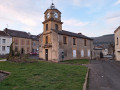
In Gernelle, there is plenty of parking available near the town hall/school and the church.

(S/E) To the left of the school, take Rue des Wèbes, which passes in front of the village hall, and continue through the housing estate. The path continues alongside the Infernal, a culverted stream that runs through Gernelle and becomes visible again after the housing estate.

(1) When you reach the first junction of paths, turn left. The path climbs slightly through the schist, making a wide circular loop. Follow it as it descends into the birch plantations.

(2) Reach the edge of the woodland and follow the path to the first turn-off on the left into the woodland, which you follow. On leaving the woodland, continue along the path to the right and join a small road

(3) which you take by turning right. After a series of pastures, the road passes through a small wood again. Pass the first path on the right and arrive at a timber landing area serving as a car park. A footpath branches off to the left into the wood.
At the first junction, head left and follow the uphill path straight on.
Cross a footpath; the track becomes muddy in places, so head into the woods to avoid the ruts.

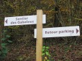
(4) At the very bottom of the path, at the crossroads, follow the signpost by turning right towards Rumel, but not before stopping to see the Vrigne (stream), which can be seen just below.
Walk past the stadium and head back to Rumel.

(5) Set off again to the right towards Gernelle.

(6) At the cemetery, turn left and then immediately right. You’ll arrive at the village square and find your car.


Waypoints

  1. S/E : mi 0 - alt. 764 ft - To the left of the school
  2. 1 : mi 0.71 - alt. 712 ft - Head off to the left
  3. 2 : mi 1.5 - alt. 673 ft - Edge of the woods
  4. 3 : mi 1.85 - alt. 643 ft - Turn right onto the road
  5. 4 : mi 2.34 - alt. 610 ft - Turn right towards Rumel
  6. 5 : mi 3.89 - alt. 594 ft - Turn right towards Gernelle
  7. 6 : mi 4.39 - alt. 820 ft - At the cemetery, turn left
  8. S/E : mi 4.74 - alt. 764 ft - To the left of the school

Notes

In wet weather, make sure you wear good waterproof shoes because of the mud and ruts.
A map of the walk or an IGN map.

Worth a visit

The Gallo-Roman vicus and the arboretum at Ville-sur-Lumes.
In Saint-Laurent, the agricultural college and the Maison des Produits Ardennais.
Not far away, the Maison de la chasse et de la nature, 2 km away.
Charleville-Mézières is about 10 km away.
Sedan is about 15 km away.

Reviews and comments

3.9 / 5
Based on 4 reviews

Reliability of the description
3.8 / 5
Ease of following the route
4.3 / 5
Route interest
3.8 / 5
Yvonne M
Yvonne M

Overall rating : 4.3 / 5

Date of your route : Aug 21, 2021
Reliability of the description : ★★★☆☆ Average
Ease of following the route : ★★★★★ Very good
Route interest : ★★★★★ Very good
Very busy route : No

The whole section through the forest is pleasant, but the final stretch along the road is far less so.
We didn’t understand the instructions for point 2 and had to find our way using a GPS.

Machine-translated

pavois51
pavois51

Overall rating : 4.3 / 5

Date of your route : Aug 01, 2019
Reliability of the description : ★★★★★ Very good
Ease of following the route : ★★★★★ Very good
Route interest : ★★★☆☆ Average

A lovely walk up to point 4, but after that it’s dead boring – made even worse by the Rumel–Gernelle stretch, which is a dangerous road with no pavement where vehicles only spot you at the very last moment!
Based on the IGN map, between points 3 and 4, I suggest turning right at the spot marked ‘216’ and following the ridge paths to Gernelle, as the village of Rumel is of no interest (the new houses are far too flashy!).
See you soon!

Machine-translated

montceenn
montceenn

Overall rating : 4 / 5

Date of your route : Jan 24, 2019
Reliability of the description : ★★★★☆ Good
Ease of following the route : ★★★★☆ Good
Route interest : ★★★★☆ Good

Enjoy your walk.
Most of the route is through the woods, followed by a stretch along the road to finish (a timber-hauling site that used to serve as a car park, now replaced by a mound of earth)
Well worth a visit...

Machine-translated

gazok54
gazok54 ★

Thank you, pdanguy.
Just before the fourth kilometre, the author writes:

At the very bottom of the path, at the crossroads, follow the sign and turn right towards Rumel

Is that where you went wrong?
If you have any ideas on how to improve the route description, please do let us know.

Machine-translated

pdanguy
pdanguy

Overall rating : 3 / 5

Date of your route : Jul 10, 2017
Reliability of the description : ★★★☆☆ Average
Ease of following the route : ★★★☆☆ Average
Route interest : ★★★☆☆ Average

I got lost at the 4th kilometre; I couldn’t find my way

Machine-translated

Other walks in the area

For more walks, use our search engine .

The GPS track and description are the property of this route's author. Please do not copy them without permission.