Country Walk from Nancras to Balanzac

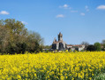
Amidst woods, fields and small hamlets, the countryside around the villages of Nancras and Balanzac unfolds. A typical example of Romanesque Saintonge heritage, the13th- and16th-century churches and the16th-century castle evoke a heritage rich in history.

Details

67206023
Creation:
Last update:
Last review:
  • Walking
    Activity: Walking
  • ↔
    Distance: 8.67 mi
  • ◔
    Average duration: 4h 05 
  • ▲
    Difficulty: Moderate

  • ⚐
    Back to start: Yes
  • ↗
    Ascent: + 66 ft
  • ↘
    Descent: - 66 ft

  • ▲
    Highest point: 131 ft
  • ▼
    Lowest point: 85 ft
  • ⚐ Country: France
  • ⚐ City: Nancras (17600)
  • ⚑
    Start/End: N 45.74472° / W 0.88269°
  • ❏
    IGN map(s): Ref. 1430SB, 1432SB
  • Hour-by-hour weather

Description of the walk

The entire route is marked with a yellow line. Parking: Place de la Fontaine in Nancras; GPS 45°44'41.5"N 0°52'58.2"W

(S/E) At the far end of Place de la Fontaine, find a passage between the houses on the left (Impasse du Mérard) and cross the stream of the same name, which leads back onto Rue de la Berthinière. Follow this road to the right until you reach the village boundary.

(1) Then turn left onto the D 243 E1. Cross a small road and head towards Triboulet. At the next junction, turn left towards the hamlet.

(2) Follow the grassy Pons track to the right. Turn left onto a road and cross the D 142 with care.

(3) Carry on straight ahead until you reach the edge of the Bois des Joux. Follow it to the right, then turn left and then right to rejoin the road.

(4) Follow it to the left until you reach Balanzac church, surrounded by its cemetery. At the junction, keep left.

(5) Continue to the D 728. Cross it carefully at the pedestrian crossing. Walk past the village hall and the town hall.

(6) You can start the walk here. Otherwise, carry on along the street, then take the second right to reach a Fork in the road.

(7) Continue north-west, to the left, towards Maine Grolier. At the first Fork in the road, take the left-hand branch and go straight on to the end. Then turn right towards Maine Grolier until you reach the third Fork in the road.

(8) Pass the turn-off on the left and carry on straight ahead. Then turn left onto the road towards the Piphanes farm.

(9) The road becomes a dirt track. Cut across another dirt track to reach a Fork in the road at Fief du Chagnon.

(10) Turn right and head for the old Croix Marchand mill. Cross the D 117 with care and continue straight ahead onto another track leading into a wooded area.

(11) Turn left onto a track at the edge of the small Bois des Mottes. Turn right onto the road and pass through the hamlet of Feuilloux.

(12) Between the houses, find a path and, at the junction, turn left onto another path that leads into a wooded area until you reach a crossroads.

(13) Turn left at the edge of the Bois de la Casse. Head due east, cross the D 117 with care and then turn right, heading due south, towards Nancras.

(14) Back in the village centre, turn right onto Rue de Saintonge (D728) and pass the church on your left. Continue; at the junction with the D117, head straight on towards Oléron and pass the wash house below on your left to return to the starting point (S/E).

Waypoints

  1. S/E : mi 0 - alt. 92 ft - Place de la Fontaine - MLérard (cours d'eau) - Affluent de la Course de Sablonceaux
  2. 1 : mi 0.27 - alt. 92 ft - Leaving the village
  3. 2 : mi 1.14 - alt. 131 ft - Triboulet
  4. 3 : mi 2.24 - alt. 112 ft - D142
  5. 4 : mi 2.7 - alt. 112 ft - Road junction
  6. 5 : mi 3.09 - alt. 105 ft - Cemetery
  7. 6 : mi 3.23 - alt. 102 ft - Balanzac Town Hall
  8. 7 : mi 3.47 - alt. 89 ft - Crossroads
  9. 8 : mi 4.59 - alt. 115 ft - Maine Grolier
  10. 9 : mi 5.15 - alt. 118 ft - Piphanes Farm
  11. 10 : mi 5.81 - alt. 125 ft - Fief du Chagnon
  12. 11 : mi 6.44 - alt. 105 ft - Bois des Mottes
  13. 12 : mi 6.91 - alt. 112 ft - Feuilloux
  14. 13 : mi 7.7 - alt. 112 ft - Road junction
  15. 14 : mi 8.54 - alt. 108 ft - Church of the Nativity of the Blessed Virgin
  16. S/E : mi 8.67 - alt. 92 ft - Place de la Fontaine

Notes

Possible starting point at (6) Balanzac Town Hall; GPS 45°44'29.0"N 0°50'11.2"W

Worth a visit

Balanzac Castle, a private property, was built in the16thcentury. You can explore an imposing polygonal tower and a domed well.

The Church of Sainte-Madeleine is the castle’s former chapel; it still features a Romanesque window with diamond-point decoration. The present bell tower was erected after 1840.

The Church of the Nativity of the Blessed Virgin is a Gothic building. With a very simple rectangular plan and rather austere architecture, it was built around the middle of the13th century.

Reviews and comments

4.5 / 5
Based on 2 reviews

Reliability of the description
5 / 5
Ease of following the route
4.5 / 5
Route interest
4 / 5
Jean-Jacques Mongeaud

Overall rating : 4 / 5

Date of your route : Jun 08, 2026
Reliability of the description : ★★★★★ Very good
Ease of following the route : ★★★★☆ Good
Route interest : ★★★☆☆ Average
Very busy route : No

A pleasant walk, best done when it’s not too hot, as there’s very little shade.

Machine-translated

chipie33290
chipie33290

Overall rating : 5 / 5

Date of your route : Dec 20, 2025
Reliability of the description : Not used / Not applicable
Ease of following the route : ★★★★★ Very good
Route interest : ★★★★★ Very good
Very busy route : No

A very well-marked route, which is flat and easy to follow, allowing you to explore two villages while enjoying the peace and quiet of the countryside.
An added bonus: a great bakery in Balanzac.
Thank you to the tourism professional for taking the time to suggest the walks on Visorando.

Machine-translated

Other walks in the area

For more walks, use our search engine .

The GPS track and description are the property of this route's author. Please do not copy them without permission.