A romantic walk in the Verdon region

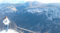
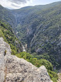
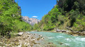
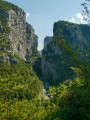
A very easy, shaded walk starting from La Palud, offering lovely views of the Verdon region.

Details

n°794780
Creation:
Last update:
Last review:
  • Walking
    Activity: Walking
  • ↔
    Distance: 4.50 mi
  • ◔
    Average duration: 2h 35 
  • ▲
    Difficulty: Easy

  • ⚐
    Back to start: Yes
  • ↗
    Ascent: + 548 ft
  • ↘
    Descent: - 538 ft

  • ▲
    Highest point: 3,428 ft
  • ▼
    Lowest point: 2,969 ft

Description of the walk

Start: central crossroads in La Palud-sur-Verdon.

(S/E) Head towards La Maline via the D23, then turn left at the first junction, follow the edge of the park, and turn left a second time to head back up towards the village at the church.

(1) Turn right onto the D952 and carry on to the next junction.

(2) Take the path on the left and follow it straight on. The path leads into the woodland, climbing up the Brusquet ravine, heading roughly north, then veering east.

(3) Leave the signposted path on your left and continue along the main track (unmarked). The route runs along the edge of the woodland. On reaching Courchon, ignore the ‘dead end’ signs intended for vehicles.

(4) Leave the private track on your right and continue along the path on the left. It emerges from the woods, runs alongside a truffle field and veers sharply to the right. Climb through the forest to point 1042. From there, the path descends gently and joins a road.

(5) Turn left. The road climbs slightly then turns left, offering lovely views as it reaches the Col de la Croix de Châteauneuf.

(6) Continue straight on and descend gently towards La Palud via the D123 road (which has little traffic).

(7) Turn right, then left at the Oratoire Saint-Jean to return to the starting point (S/E).

Waypoints

  1. S/E : mi 0 - alt. 3,054 ft - La Palud central crossroads
  2. 1 : mi 0.34 - alt. 3,028 ft - Church
  3. 2 : mi 0.5 - alt. 2,972 ft - Junction for the Brusquet Ravine path, on the left
  4. 3 : mi 1.19 - alt. 3,159 ft - Junction of the signposted path, straight ahead
  5. 4 : mi 1.83 - alt. 3,261 ft - Junction with a private road; take the path on the left
  6. 5 : mi 2.54 - alt. 3,327 ft - Route de Châteauneuf, on the left
  7. 6 : mi 3.12 - alt. 3,415 ft - Col de la Croix de Châteauneuf
  8. 7 : mi 4.1 - alt. 3,136 ft - Junction with two roads leading to the village; turn right
  9. S/E : mi 4.5 - alt. 3,054 ft - Central crossroads at La Palud

Notes

Car parks: in the village, below the town hall (buses and campervans) – on the outskirts of the village towards Rougon (opposite the church).
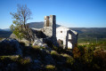
Rest area with picnic tables in the park below the castle.

Alternatives:
- From (5), you can take a return trip up to the ruined village (+4 km +100 m).
- From (6), you can return to the start via the Brusquet ravine, following the same route as on the way out (avoiding the road) without changing the distance.

Worth a visit

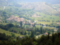
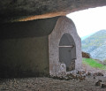
(5) Views of the ruined village.

Reviews and comments

3.5 / 5
Based on 2 reviews

Reliability of the description
4.5 / 5
Ease of following the route
4 / 5
Route interest
2 / 5
gerard.gounon@gmail.com

Hike route downloaded for a reconnaissance trip to be planned for March/April
Kind regards
Gérard GOUNON

Machine-translated

cgabs
cgabs

Overall rating : 3 / 5

Date of your route : Sep 10, 2019
Reliability of the description : ★★★★☆ Good
Ease of following the route : ★★★☆☆ Average
Route interest : ★★☆☆☆ Disappointing

Hello

This walk doesn’t offer any lovely views; you have to climb quite a bit to reach a plateau that doesn’t offer any lovely scenery (once you leave the circular path).
However, it is a crossroads of trails, so there are surely other walks to choose from at this point to explore further.
We weren’t able to change our route as I was walking with my mum (aged 76) and my dog (beware of herding dogs...)
We did a return walk, cutting the route short (we left the circular route as it was too tough for my mum) and didn’t go back down via the road.
To sum up, the difficulty is more moderate than easy, and the walk isn’t particularly scenic despite the setting.
We weren’t particularly impressed, but that didn’t put us off – we went on other walks!
Perhaps this walk is best done at a different time of year?

Machine-translated

Patberpilat
Patberpilat

Don’t worry, you haven’t upset me – I just wanted to explain my choice. Enjoy your walks!

Machine-translated

chery.gerard
chery.gerard

I didn’t mean to upset you, and thank you for the walk

Machine-translated

Patberpilat
Patberpilat

As I’ve mentioned, one option is to return via the Brusquet ravine. This means retracing a short section of the outward route, but it avoids the tarmac. I’d recommend the road, as it offers some lovely views that you wouldn’t get on the footpath – and which can also be rather romantic… with a little imagination…

Machine-translated

chery.gerard
chery.gerard

Overall rating : 4 / 5

Date of your route : Oct 19, 2017
Reliability of the description : ★★★★★ Very good
Ease of following the route : ★★★★★ Very good
Route interest : ★★☆☆☆ Disappointing

The first part is beautiful and very shady, but the last 3.5 kilometres are along a tarmac country road, which, whilst certainly not very busy, is also rather unromantic.

Machine-translated

Other walks in the area

For more walks, use our search engine .

The GPS track and description are the property of this route's author. Please do not copy them without permission.