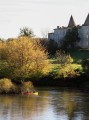
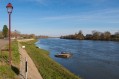
Gourmet route from Pessac-sur-Dordogne to Castillon-la-Bataille

By bike from the Pessac-sur-Dordogne canoe club, you can reach Castillon-la-Bataille by following the Dordogne as closely as possible, on roads with very little traffic!
The return journey can be made via the left bank, with a short climb for the more energetic cyclists over the last kilometre to reach Pessac-sur-Dordogne

Details

n°83278
Creation:
Last update:
Last review:
  • Touring/Gravel
    Activity: Touring/Gravel
  • ↔
    Distance: 16.78 mi
  • ◔
    Duration according to the author: 2 hrs 
  • ▲
    Difficulty: Moderate

  • ⚐
    Back to start: No
  • ↗
    Ascent: + 302 ft
  • ↘
    Descent: - 299 ft

  • ▲
    Highest point: 315 ft
  • ▼
    Lowest point: 13 ft
  • ⚐ Country: France
  • ⚐
    Area: Périgord
  • ⚐ City: Pessac-sur-Dordogne (33890)
  • ⚑
    Start: N 44.820838° / E 0.078909°
  • ⚑
    End: N 44.819738° / E 0.077067°
  • ❏
    IGN map(s): Ref. 1636E, 1637SB, 1736O

  • ◶
    Type of surface:
  •  
     
     
    ■ 33% Road ■ 34% Byway ■ 33% Path
  • Hour-by-hour weather

Photos

Description of the route

Start from the car park near the bridge at Pessac-sur-Dordogne.

(S/E) Take the D11 north-west towards Saint-Seurin-de-Prats. 300 metres further on, at the restaurant, turn left (watch out for fast-approaching cars).

(1) Ignore the road leading to Les Sommières and carry on straight on towards Prats.

(2) Pass the Château Destinée (formerly Pitray) and carry on straight towards the walnut and apple trees. After Le Castin, turn right.

(3) Follow the main road to the left.

(4) At the junction, turn left.

(5) At the crossroads, turn right.

(6) After the lake and the Lamothe-Montravel nursery school, turn left (Rue du Lavoir) to reach the quays. Join the D 936 on leaving the village by following the main road.

(7) At the ‘Stop’ sign on the D936, turn left with care, as there is heavy traffic. Continue for approximately 300 metres.

(8) Leave the D 936 by turning left towards the Talbot Monument and follow the main road to the Dordogne.

(9) Pass the Talbot Monument on your right and arrive at the quayside in Castillon.

(10) Bridge over the Lidoire.

(11) At Castillon-la-Bataille, ignore the bridge and carry on straight ahead to the next bridge.

(12) Cross the Dordogne via the iron bridge.

(13) At the crossroads, turn left and follow the river to Flaujagues (6 km).

(14) Continue along the Dordogne and head for Flaujagues.

(15) Head towards Pessac-sur-Dordogne (D 130).

(16) Ignore the turn-off for Rivière de Prats and carry on along the D130.

(17) At the viewpoint, enjoy the panoramic view, then carry on along the D130.

(18) At the junction, turn left and head for the quays of Pessac-sur-Dordogne via Rue du Port on the left (S/E).

Waypoints

  1. S : mi 0 - alt. 52 ft - Pessac-sur-Dordogne - Dordogne (fleuve)
  2. 1 : mi 0.54 - alt. 36 ft - Straight on towards Prats
  3. 2 : mi 1.21 - alt. 36 ft - Château Destinée (Pitray). Straight on
  4. 3 : mi 1.99 - alt. 33 ft - To the left, the main road
  5. 4 : mi 2.38 - alt. 33 ft - Crossroads, turn left
  6. 5 : mi 2.7 - alt. 36 ft - At the T-junction, turn right
  7. 6 : mi 3.66 - alt. 30 ft - Children’s garden and skatepark
  8. 7 : mi 4.33 - alt. 59 ft - Stop. D 936, turn left
  9. 8 : mi 4.52 - alt. 43 ft - Leave the D936, turning left
  10. 9 : mi 6.25 - alt. 23 ft - Talbot Monument
  11. 10 : mi 7.12 - alt. 13 ft - Bridge over the - Lidoire (ruisseau) - Affluent de la Dordogne
  12. 11 : mi 7.63 - alt. 30 ft - Stone bridge, town centre
  13. 12 : mi 8.09 - alt. 49 ft - Iron bridge
  14. 13 : mi 8.32 - alt. 26 ft - Beach café
  15. 14 : mi 10.8 - alt. 26 ft - Along the Dordogne
  16. 15 : mi 13.53 - alt. 39 ft - Flaujagues (Campsite)
  17. 16 : mi 14.64 - alt. 92 ft - Prats River
  18. 17 : mi 15.84 - alt. 236 ft - Taverne du Belvédère
  19. 18 : mi 16.55 - alt. 52 ft - Pessac-sur-Dordogne
  20. E : mi 16.78 - alt. 33 ft - Pessac-sur-Dordogne

Notes

Restaurants with outdoor seating all along the route and much more besides!

(14) Option to turn right towards Lac de la Cadie.

(16) Option to head down to the Rivière de Prats, where there are campsites and lodges.

Worth a visit

(S) In Pessac: Canoeing, kayaking and cycling
4 restaurants nearby: Le Palma Nova (in summer) and Le PessacàQuai (under renovation, opening soon)
+ L’Ardoise (opposite on the other bank) and the Restaurant Café de la Paix in Gensac
Wine cellars in Pessac/d: Les Chais Bio – Château Carbonneau – Domaine Fontana (wine shop in Gensac)

(3) Bar-pub at __Château Destinée__

(6) Skate park – Fishing lake and Restaurant 108 on the D 936 in Lamothe-Montravel.

(9) Talbot Chapel, then at the eastern entrance to Castillon, the Camping des Batailleurs.

(11) Castillon-la-Bataille – Wine cellar: Le Chai au Quai; Orge et Houblon beer bar.

(13) Guinguette La Plage restaurant (in summer, on the left bank at the foot of the iron bridge) and the pop-up guinguette Chez Yvonne (on the right-bank quays).

(14) Two restaurants near Mouliets. Turn off the route to the right, towards Lac de la Cadie (entertainment) with Restaurant La Guinguette de La Cadie, or continue straight on for 600 metres to the riverside restaurant Au Four de la Rive (in the hamlet of Cancadoual)

(15) Le p’tit Flaujaguais restaurant in Flaujagues.

(16) La Rivière de Prats rural campsite.

(17) Juillac restaurant/bar: La Taverne du Belvédère.

Follow signs for the Castillon Tourist Office.

Reviews and comments

4.7 / 5
Based on 1 review

Reliability of the description
5 / 5
Ease of following the route
5 / 5
Route interest
4 / 5
Marie-Renée VALLET
Marie-Renée VALLET

Overall rating : 4.7 / 5

Date of your route : Sep 29, 2025
Reliability of the description : ★★★★★ Very good
Ease of following the route : ★★★★★ Very good
Route interest : ★★★★☆ Good
Very busy route : No

Route as described, option to start and finish in Castillon la Bataille, plenty of parking available.
Very pleasant country roads, beautiful views of the Dordogne at Flaujague, as well as at Pessac sur Dordogne and, of course, at Castillon!
Pass through the typical village of Lamothe Montravel.

Machine-translated

For more walks, use our search engine .

The GPS track and description are the property of this route's author. Please do not copy them without permission.