Mireille the Goat’s Walk in Namur

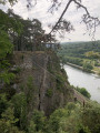
A walk through woods and fields. Discover a small neighbourhood in Beez (Namur).

Details

14266405
Creation:
Last update:
Last review:
  • Walking
    Activity: Walking
  • ↔
    Distance: 5.31 mi
  • ◔
    Average duration: 3h 00 
  • ▲
    Difficulty: Moderate

  • ⚐
    Back to start: Yes
  • ↗
    Ascent: + 646 ft
  • ↘
    Descent: - 659 ft

  • ▲
    Highest point: 650 ft
  • ▼
    Lowest point: 295 ft

Photos

Description of the walk

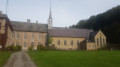
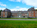
Park in the car park at Abbaye du Vivier.

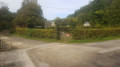
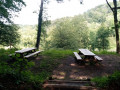
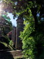
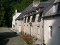
(S/E) From the abbey car park, head towards Le Vivier and then towards the “La Porterie” lodge on your right. Go through the wooden gate under the porch, turn right and start the climb. You’ll pass another of the abbey’s lodges and then two picnic tables with a view of the enclosures. At the Y-junction, carry straight on and do not take the path on the right.

(1) When you reach the crossroads, take the path on the left to reach another crossroads. Turn right and walk for about fifty metres.

(2) You’ll see a wooden sign and a crossroads with six paths. Take thesecond path on the right. On a tree you’ll find the Santiago de Compostela logo.

(3) At the next crossroads, take the path on the left (still the Way of St James). At thefirst fork, leave the Way of St James by turning right. You will then walk along the edge of the woodland on your left and a clearing on your right.

(4) At the Y-junction, take the path furthest to the left (white mark on a tree and a white stone on the ground) and continue through the woods. At the next junction, turn right and, at the next Y-junction, turn left onto the path that leads downhill, following the Saint-Jacques signposts once more. You will pass a wooden shelter where a bench bears the inscription ‘Bois de Gournées’. As you emerge from the woods, you’ll come out in a neighbourhood of Beez on Rue du Mont. Head down to the left.

(5) After the last house on the right and just before the railway bridge, you’ll find a narrow forest track on the right that climbs into the woods. Take this track. When you reach a small clearing with a small wooden bench, take thefirst path on the right. Then walk past a shed and, once past it, continue to the junction.

(6) Turn left and take the stony path. At the top of the small hill, follow the path to the right and walk alongside the woodland. You’ll then pass by the quarries before coming out into our beautiful countryside.

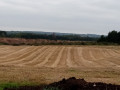
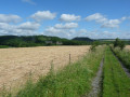
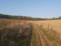
(7) At the crossroads, turn right. After crossing some fields, walk alongside a woodland and meadows once more. Keep going straight on until you reach the edge of the woodland.

(8) Turn right.

(3) When you reach the wooden sign again, take the same path as at the start.
Alternative route: At this wooden signpost, take the path on the left and then the first path on the right. At the end of this path, you’ll reach the six-way junction (PdP 2).

(2) With your back to the wooden sign, head straight on along the widest path, which leads back down towards Abbaye du Vivier. Almost at the bottom of the descent, go round a metal gate. Then, on your right, you’ll see a chapel.

(9) At the small cluster of houses, take the narrow path on the left. Passing between the two gates, follow the narrow track back to the starting point (S/E).

Waypoints

  1. S/E : mi 0 - alt. 344 ft - Abbaye du Vivier Car Park
  2. 1 : mi 0.45 - alt. 643 ft - In the woods, take the first path on the left
  3. 2 : mi 0.77 - alt. 587 ft - Common junction (out and back)
  4. 3 : mi 1.09 - alt. 636 ft - Wooden signpost + Way of St James
  5. 4 : mi 1.47 - alt. 528 ft - Y-junction, marked in white
  6. 5 : mi 2.34 - alt. 295 ft - Beez, the last house on the right. Near the - Meuse (fleuve)
  7. 6 : mi 2.66 - alt. 410 ft - Hangar on the left
  8. 7 : mi 3.38 - alt. 525 ft - Crossroads in the countryside
  9. 8 : mi 4.21 - alt. 633 ft - Entrance to the woods
  10. 9 : mi 5.22 - alt. 312 ft - A small cluster of houses, on the left
  11. S/E : mi 5.31 - alt. 344 ft - Vivier Abbey

Notes

Wear walking shoes as some paths may be muddy

__Alternative route__ If you do not wish to walk the same section twice, at the wooden signpost, take the path on the left and then the first path on the right. At the end of the path, you will return to the six-way junction.

Reviews and comments

4 / 5
Based on 4 reviews

Reliability of the description
4.3 / 5
Ease of following the route
4 / 5
Route interest
3.8 / 5
Mirbou
Mirbou

Thank you for your feedback. I'm glad you had a good time.

Machine-translated

User 27540908

Overall rating : 4 / 5

Date of your route : Feb 01, 2026
Reliability of the description : ★★★★☆ Good
Ease of following the route : ★★★★☆ Good
Route interest : ★★★★☆ Good
Very busy route : No

A very beautiful walk, easy to follow with the app. A bit muddy because it rained during the night. Not many people, so we were able to enjoy the silence.
Thank you.

Machine-translated

Mirbou
Mirbou

Thank you for your comment.

Machine-translated

User 26987078

Overall rating : 4.3 / 5

Date of your route : Sep 30, 2025
Reliability of the description : ★★★★★ Very good
Ease of following the route : ★★★★☆ Good
Route interest : ★★★★☆ Good
Very busy route : No

A walk in the woods, not much tarmac, it goes up and down, really beautiful.

Machine-translated

kimouche
kimouche

Overall rating : 2.7 / 5

Date of your route : Oct 16, 2022
Reliability of the description : ★★★☆☆ Average
Ease of following the route : ★★★☆☆ Average
Route interest : ★★☆☆☆ Disappointing
Very busy route : No

The start is quite steep; otherwise, it’s just a normal walk through the woods

Machine-translated

Mirbou
Mirbou

A huge thank you for your comment.

Machine-translated

Scaplune
Scaplune
• Edited:

Overall rating : 5 / 5

Date of your route : Nov 14, 2021
Reliability of the description : ★★★★★ Very good
Ease of following the route : ★★★★★ Very good
Route interest : ★★★★★ Very good
Very busy route : No

A brilliant walk for all ages, through the woods and along paths, starting and ending at the Bethlehem Chapel – a really lovely restaurant!

Machine-translated

Other walks in the area

For more walks, use our search engine .

The GPS track and description are the property of this route's author. Please do not copy them without permission.