Country:
 City:
City:


Start at Sclaigneaux station (car park at the rear, Rue de la Limite).
(S/E) With your back to the station, follow the road to the left towards Seilles. Walk alongside the Meuse on your right-hand side.
(1) Go round a roundabout on the left and take the second exit, a small road which soon turns left to cross the railway line.
(2) At the Fork in the road, turn left and head up into the Bois de Foresse.
(3) At the next fork in the road, turn right and head uphill (quite a steep slope). Shortly afterwards, opposite a sort of small fort, take a dirt track on the right. You’ll enter the nature reserve about 2 km after setting off.
(4) At the end of the dirt track, turn left. After about 200 m, at a junction, carry straight on. Descend gently and ignore all turn-offs to the left.
(5) Take the hairpin bend to the left and follow the road towards Sclaigneaux.
(6) After about 400 m, turn right towards Colignon Farm.
(7) At the next junction, take the dirt track on the left which runs between two ponds. Head uphill through the woods, keep heading west and ignore all the side paths.
(8) Roughly at the top of the hill, on the edge of the woods, turn left onto a dirt track heading towards Sclermont Farm.
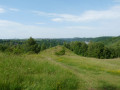
(9) At the farm (with a clear view over the Meuse valley), turn right onto the path which joins a small road.
(10) At the T-junction, near a chapel, take the first left. Pass under a high-voltage power line and then follow the path alongside a quarry on your left.
(11) You’ll come out onto a wide road; follow it to the left.
(12) At a fork in the road, turn left onto Rue de la Limite. Follow this road to the car park at Sclaigneaux station (S/E).

 Tourist office
 Easy
Easy 
 Visorando Member