Biodiversity walk: Carpe Diem circular loop

A blend of nature and Périgord architecture.
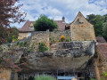
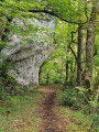
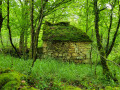
The walk passes through woodland and crosses small hamlets with beautiful houses in the Périgord architectural style. The route climbs out of small valleys lined with cliffs reminiscent of the Castel-Merle valley (a famous site in the Vézère Valley) or that of the nearby ‘Abri du Poisson’.

Details

42089193
Creation:
Last update:
Last review:
  • Walking
    Activity: Walking
  • ↔
    Distance: 3.90 mi
  • ◔
    Average duration: 2h 05 
  • ▲
    Difficulty: Easy

  • ⚐
    Back to start: Yes
  • ↗
    Ascent: + 381 ft
  • ↘
    Descent: - 390 ft

  • ▲
    Highest point: 663 ft
  • ▼
    Lowest point: 256 ft

Description of the walk

In Les Eyzies, from the tourist office, drive towards Périgueux. After 4.7 km, once you’ve entered the village of Manaurie, turn left and cross the railway line. Follow the road branching off to the right and, 600 metres further on to the left, park in the car park on the RD31.

(S/E) Follow the RD31 down to the Carpe Diem site.

(1) Turn left onto Route de Pataye to reach the junction of the circular route.

(2) Carry on straight ahead for 50 metres. Once you reach the bottom of the valley, the road follows the railway line (above on the right). Leave the road, which turns right under the bridge, and take the path opposite which continues to run alongside the railway line. As you emerge from the woods, carry on straight ahead across the meadow until you reach the road leading to Les Placials.

(3) Follow the road to the right, leaving the houses of the hamlet ‘Les Placials’ on your left. Continue to the junction with the Chemin des Ourtaloux.

(4) Turn right for a few metres, then take the path on the left alongside the pond. Walk up the valley. You can just make out the rocks lining it on either side. Stay on the path furthest to the left, skirting the four ponds of the Placial valley on the right until you reach the bottom of the valley.

(5) Turn left. Head up onto the plateau and reach a crossroads.

(6) Turn right to reach the highest point of the walk. Cut across a road to reach the direction indicator mast.

(7) Head down to the left, towards Manaurie. On the descent, at the Fork in the road, take the middle path to continue towards the hamlet known as La Gane. Pass through it and continue along the road until, at its end, you reach the crossroads from the outward journey.

(2) Turn right and return to the starting point (S/E).

Waypoints

  1. S/E : mi 0 - alt. 328 ft - Car park on the RD 31
  2. 1 : mi 0.05 - alt. 312 ft - Carpe-Diem
  3. 2 : mi 0.19 - alt. 272 ft - Junction of the circular loop
  4. 3 : mi 0.96 - alt. 351 ft - Les Placials
  5. 4 : mi 1.13 - alt. 331 ft - Chemin des Ourtaloux
  6. 5 : mi 1.88 - alt. 390 ft - At the bottom of the valley, take the path on the left
  7. 6 : mi 2.12 - alt. 476 ft - Plateau
  8. 7 : mi 2.84 - alt. 659 ft - Signpost
  9. S/E : mi 3.9 - alt. 325 ft - Car park on the RD 31

Worth a visit

Reviews and comments

4.8 / 5
Based on 2 reviews

Reliability of the description
5 / 5
Ease of following the route
5 / 5
Route interest
4.5 / 5
Settgt
Settgt

Overall rating : 4.7 / 5

Date of your route : Aug 25, 2026
Reliability of the description : ★★★★★ Very good
Ease of following the route : ★★★★★ Very good
Route interest : ★★★★☆ Good
Very busy route : Yes

We had no trouble following this route as described on Visorando. There were six of us, including a 10-month-old baby.
A lovely walk with beautiful and varied scenery, hamlets, ponds, woodland and the entrance to a cave (which we stumbled upon by chance whilst following a small path...).
A superb, well-signposted trail.

Machine-translated

dnrphil
dnrphil

Overall rating : 5 / 5

Date of your route : Apr 21, 2024
Reliability of the description : ★★★★★ Very good
Ease of following the route : ★★★★★ Very good
Route interest : ★★★★★ Very good
Very busy route : No

A very pleasant route to follow.
You’ll often need to check your sat-nav to make sure you don’t go the wrong way.

Machine-translated

Other walks in the area

For more walks, use our search engine .

The GPS track and description are the property of this route's author. Please do not copy them without permission.