A walk through the countryside around Davezieux

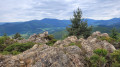
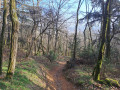
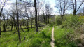
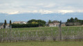
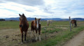
This walk is 60 per cent on tarmac roads. It is possible to cycle the route. Apart from a short climb at the end, the route is practically flat. You’ll walk past orchards and meadows with cows or horses. There’s a lovely view of the Vercors halfway along the route.

Details

n°45183438
Creation:
Last update:
Last review:
  • Walking
    Activity: Walking
  • ↔
    Distance: 6.52 mi
  • ◔
    Average duration: 3h 15 
  • ▲
    Difficulty: Moderate

  • ⚐
    Back to start: Yes
  • ↗
    Ascent: + 272 ft
  • ↘
    Descent: - 279 ft

  • ▲
    Highest point: 1,434 ft
  • ▼
    Lowest point: 1,237 ft

Photos

Description of the walk

Use a car park near the Church of Sainte-Marguerite in Davézieux, either on Place Ferme Richard or in front of the church.

(S/E) Cross Rue de la République at the pedestrian crossing and follow Rue de Vernosc to the roundabout.

(1) Turn right into Rue Félicien Vergier and head towards the cemetery.

(2) Turn left into Rue des Assomptionnistes and, at the roundabout, carry on straight ahead until you reach the junction with Rue des Patureaux.

(3) Turn left, then immediately right onto Rue du Poulet. Follow this street, which curves in an S-shape as it passes through the hamlet. Continue until you reach a star-shaped junction where several streets meet. 

(4) Take the left-hand street leading uphill, Rue des Grailles, and follow it until you cross the bridge over the departmental road. The path then becomes a dirt track. Continue along the main path, ignoring any side tracks, until you come to a departmental signpost.

(5) Keep left and follow the flat, narrow path that leads to a house.

(6) Turn left before the house, then right to go round it and rejoin the tarmac road. Go straight on, cross a road to reach an unpaved track opposite. Continue to the junction in a bend.

(7) Turn left and follow this road, which curves in an S-shape before reaching a junction with a tarmac road.

(8) Turn right. At the next junction, take the unpaved track opposite:the view opens up widely onto the Alps. Continue to the departmental signpost.

(9) Turn left onto the unpaved track and continue to the first junction of paths nearby.

(10) Turn left again towards the orchards. Once past them, cross the Ruisseau de l’Eterpas and follow the path, which becomes tarmacked again. 

(11) At the junction, turn left, then left again a few dozen metres further on to join the dirt track. Keep going in the same direction, cross a tarmac road and continue straight on, ignoring any side paths.

(12) Pass under the main road, carry on straight ahead and walk past some housing estates until you come to a dirt track on the right marked in yellow and white.

(13) Turn onto this track and, after a few dozen metres, you’ll come to the one and only uphill section. (Cyclists will need to dismount here.) The climb is very short; you’ll soon be back on a good, flat track and then onto the tarmac of Rue René Clair. At the junction, turn left until you reach Rue Sarah Bernhardt.

(14) Turn right onto it and follow it until you reach Rue des Rameaux, where you turn left to return to the roundabout you passed on the way out.

(1) Turn right and, following the reverse route of the outward journey, return to the car park (S/E). 

Waypoints

  1. S/E : mi 0 - alt. 1,434 ft - Church car park
  2. 1 : mi 0.16 - alt. 1,401 ft - Roundabout
  3. 2 : mi 0.23 - alt. 1,404 ft - Cemetery
  4. 3 : mi 0.68 - alt. 1,345 ft - Rue des Patureaux
  5. 4 : mi 1.38 - alt. 1,280 ft - Rue des Grailles
  6. 5 : mi 2.14 - alt. 1,335 ft - Signpost
  7. 6 : mi 2.31 - alt. 1,329 ft - Accommodation
  8. 7 : mi 2.91 - alt. 1,319 ft - Turn left
  9. 8 : mi 3.26 - alt. 1,270 ft - Signol junction
  10. 9 : mi 3.76 - alt. 1,280 ft - Signpost
  11. 10 : mi 3.91 - alt. 1,270 ft - Junction of paths
  12. 11 : mi 4.66 - alt. 1,286 ft - Street junctions
  13. 12 : mi 5.49 - alt. 1,302 ft - Passing under the county road
  14. 13 : mi 5.86 - alt. 1,352 ft - Short dirt track
  15. 14 : mi 6.2 - alt. 1,424 ft - Street junctions
  16. S/E : mi 6.52 - alt. 1,434 ft - Church car park

Reviews and comments

3.7 / 5
Based on 2 reviews

Reliability of the description
4 / 5
Ease of following the route
3.5 / 5
Route interest
3.5 / 5
Randominikm
Randominikm

Hello,
For routes shorter than 15 km, I now only rely on GPS tracking.
I no longer do reconnaissance because it takes too much time.
I have never lost my group of 20 people.
So I'm pleased to have discovered this very easy route.
I have nearly 50 routes in northern Ardèche, but Viso Rando won't publish them because I don't provide any comments, just the GPS track, which confirms that the route is passable without any problems.
Best regards

Machine-translated

michelemounier
michelemounier

Overall rating : 4.7 / 5

Date of your route : Oct 16, 2025
Reliability of the description : ★★★★★ Very good
Ease of following the route : ★★★★★ Very good
Route interest : ★★★★☆ Good
Very busy route : Yes

very pleasant (i.e. there is no shade)

Machine-translated

dougere
dougere

The description couldn’t be any clearer; all the street and path names are listed. As for how easy it is to follow the route, I’d like to remind you that the Visiorando app is free and guides you along the way with no trouble at all. What’s more, yellow markings are placed along the route.

Machine-translated

Marie ,Hélène
Marie ,Hélène

Overall rating : 2.7 / 5

Date of your route : Apr 25, 2025
Reliability of the description : ★★★☆☆ Average
Ease of following the route : ★★☆☆☆ Disappointing
Route interest : ★★★☆☆ Average
Very busy route : No

The instructions are unclear. There are several junctions along the route.

Machine-translated

Other walks in the area

For more walks, use our search engine .

The GPS track and description are the property of this route's author. Please do not copy them without permission.