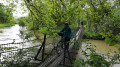
Walk to the 7 Locks

A superb walk taking in riverbanks, fields and wooded areas.

Details

n°36124236
Creation:
Last update:
Last review:
  • Mountain biking
    Activity: Mountain biking
  • ↔
    Distance: 5.68 mi
  • ◔
    Duration according to the author: 30 mins 
  • ▲
    Difficulty: Easy

  • ⚐
    Back to start: Yes
  • ↗
    Ascent: + 13 ft
  • ↘
    Descent: - 13 ft

  • ▲
    Highest point: 492 ft
  • ▼
    Lowest point: 479 ft
  • ⚐ Country: France
  • ⚐ City: Plobsheim (67115)
  • ⚑
    Start/End: N 48.449728° / E 7.743552°
  • ❏
    IGN map(s): Ref. 3816OT

  • ◶
    Type of surface:
  •  
     
     
    ■ 10% Road ■ 75% Byway ■ 15% Path
  • ⇧
    Bike carrying: No
  • ▲
    Difficulty: Easy
  • Hour-by-hour weather

Description of the route

The starting point is at the ‘7 Locks’ car park.

(S/E) Walk past the refreshment kiosk and the pétanque courts, cross the bridge over the canal and you’ll immediately come to a fork in the path

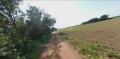
(1) Head straight ahead, walk past the pumping station and continue along the track until you reach a junction with a stream running along your right-hand side.

(2) Turn left, walk for about 200 metres and you’ll come to the start of a grassy path on the right.

(3) Leave the main track and veer to the right. Head towards a row of trees and follow the stream on your right, which forms a large circular curve to the left. After passing under a high-voltage power line for asecond time, you’ll reach a fork in the path.

(4) Carry on straight ahead and, at the four-way junction, turn right. Follow the track, go straight on and reach a path on the right through the woodland.

(5) Turn right, cross a bridge, ignore the religious centre on your left and arrive at a four-way junction at the end of Rue Fin de Banlieue.

(6) Turn left with caution onto this busy road, then turn left a few metres further on, just before the bridge over the Canal d’Alimentation de l’Ill, and follow the canal on your right.

(7) At the fork, carry on straight ahead, keeping the waterway on your right, until you reach a multi-way junction with a car park, just after crossing a footbridge.

(8) Cross the bridge, then turn left immediately and continue along the track that runs alongside the watercourse on your right until you rejoin the route you took earlier.

(1) Turn right and, following the path in the opposite direction to the outward journey, head back to the ‘7 Locks’ car park (S/E).

Waypoints

  1. S/E : mi 0 - alt. 492 ft - 7 Locks car park - Rhin (fleuve)
  2. 1 : mi 0.12 - alt. 482 ft - A/R junction - Rhin Tortu (cours d'eau) - Affluent de l'Ill
  3. 2 : mi 0.94 - alt. 482 ft - Crossing with a stream on the right-hand side
  4. 3 : mi 1.07 - alt. 482 ft - Grassy path on the right
  5. 4 : mi 1.78 - alt. 482 ft - Junction
  6. 5 : mi 2.74 - alt. 486 ft - Junction
  7. 6 : mi 3.68 - alt. 489 ft - End of the Street, End of the Suburb - Canal du Rhône au Rhin
  8. 7 : mi 4.32 - alt. 482 ft - Junction
  9. 8 : mi 4.96 - alt. 492 ft - Multiple junctions
  10. S/E : mi 5.68 - alt. 492 ft - The 7 Locks

Notes

(S/E) A lovely spot to relax and have a picnic, with a children’s play area and pétanque courts. There’s also a small refreshment bar to quench your thirst!

Reviews and comments

4 / 5
Based on 2 reviews

Reliability of the description
4.5 / 5
Ease of following the route
4.5 / 5
Route interest
3 / 5
Sabouralf
Sabouralf

Overall rating : 4 / 5

Date of your route : Oct 12, 2026
Reliability of the description : ★★★★☆ Good
Ease of following the route : ★★★★☆ Good
Route interest : ★★★★☆ Good
Very busy route : No

a route (unmarked) undertaken by a group of senior citizens
a very quiet area
Slightly modified: extended to the canal, crossed for a lunch break (tables and benches under the trees)
return to the county road along the Ill feed canal
fishermen’s path a few bramble patches halfway along the route

Machine-translated

gg67370
gg67370

Overall rating : 4 / 5

Date of your route : Mar 08, 2026
Reliability of the description : ★★★★★ Very good
Ease of following the route : ★★★★★ Very good
Route interest : ★★☆☆☆ Disappointing
Very busy route : No

Monotonic route, mainly in fields

Machine-translated

Other walks in the area

For more walks, use our search engine .

The GPS track and description are the property of this route's author. Please do not copy them without permission.