Around Miellin

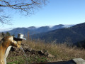
A mountain hike across the peaks surrounding the small village of Miellin, featuring wild and bucolic landscapes. This route is reserved for experienced walkers or even keen trekkers.

Details

7312958
Creation:
Last update:
Last review:
  • Walking
    Activity: Walking
  • ↔
    Distance: 10.12 mi
  • ◔
    Average duration: 6h 25 
  • ▲
    Difficulty: Difficult

  • ⚐
    Back to start: Yes
  • ↗
    Ascent: + 2,067 ft
  • ↘
    Descent: - 2,057 ft

  • ▲
    Highest point: 2,966 ft
  • ▼
    Lowest point: 1,867 ft

Photos

Description of the walk

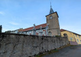
Head to Miellin via the RD 133 from Servance (junction near the Saut de l’Ognon). Park near the church (altitude 578). If there are no spaces available, drive back down to the town hall.

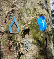
(S/E) Walk back to the large crossroads and take the road that slopes gently down to the left, known as Rue de Saint-Blaise. Cross the river La Doue de l’Eau via the Pont Charreau. At the junction near a cross, note a small, landscaped area on the left, set amongst the rocks and featuring a statue of the Virgin Mary. Leave the road leading up to Les Landres and Belfahy on your left and carry straight on to reach the hamlet of Les Frechins.

(1) After crossing the bridge over the little Landres stream, take the lane on the left opposite the sawmill. The path climbs steeply along the left bank of the stream. After passing through a clear-cut area of fir trees, turn right and continue climbing beneath the firs. The climb becomes steep.

(2) The path takes a hairpin bend to the left, and the slope becomes less steep. Pass a path coming from the right and emerge onto a forest track. Follow it to the left and continue climbing on a gentler slope until you reach the gate.

(3) Two options:
(3.1) Head down the Yellow Ring-marked road and, 300 metres further down, join a forest track on the right.
(3.2) As shown on the map, leave the ‘Yellow Ring’ route and turn right onto the tarmac road which continues to climb. At the first right-hand bend, take the forest track branching off to the left, the entrance to which is marked by a gate (marked ‘Yellow Disc’). Personally, I prefer this option, as the area is wilder and more pleasant.

(4) After 100 m, take care and follow the goat track branching off to the left (C.B.L. signpost: ‘Chapelle Saint-Blaise – 25 mins’). The narrow path follows the contour line at around 870 m. Cross the first stream; the path then ends at a small torrent.
This is a tricky section. Cross the stream, climb the embankment opposite for 5 m and keep a close eye out for a track leading off to the left. With a bit of luck, you’ll spot a Yellow Disc marker tucked away on a beech tree. If in doubt, head north-north-west on a gentle descent to come out onto a good path (junction with option 3.1).

(5) Turn right and follow the Yellow Ring markings you left behind earlier, now accompanied by the Yellow Disc, to soon reach a crossroads at the end of a tarmac road.

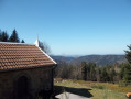
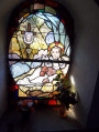
(6) Take a path leading uphill to the right and you’ll soon reach the Chapel of Saint Blaise. Admire the idyllic landscape and the charm of the chapel. Note the spring: the water of Saint Blaise soothes all ailments.

(7) Retrace your steps.

(6) Turn right and continue downhill. About 100 metres further on, turn right again, following the signposts. Cross the Ruisseau de la Goutte Radère. Leave the lovely road on your right and head down to the bottom of the valley. After a hairpin bend to the left, leave the ‘Yellow Ring’ signposting, which goes straight on, and turn right to cross the Doue de l’Eau bridge.

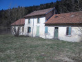
(8) As you come off the bridge, follow a lovely road to the left. Pass the former Verrerie forest house, which, as its name suggests, stands on the site of a former glassworks established in 1695.

(9) About 150 m further on, leave the road and turn right onto the path leading uphill, marked with a Blue Ring (signpost ‘Cote 820 – 5 km140’). The climb is gentle at first but becomes steeper after crossing the stream. The path curves sharply to the right and climbs more steeply. On the left, a large pile of stones catches your eye: about a hundred metres further on, look out for the start of a path on the left.

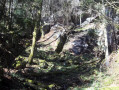
(10) Take this path on the left, which leads to the pile of stones you saw earlier (these are the remains of a granite quarry that was opened in the early 20th century). Retrace your steps back to the main path.

(10) Take the signposted path to the left again and, after a steep climb, emerge at the Plain des Bornes.

(11) Follow the ridge path to the left, which runs along the boundary between the communes of Miellin and Haut-du-Them. Initially pleasant, lined with fir trees and a carpet of moss, the path now features a few slightly muddy sections. Numerous short climbs alternate with descents between altitudes of 806 and 880 metres.

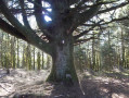
(12) Note a large fir tree on the left with an unusual canopy. Continue west, then south-west, along the Blue Ring trail. Reach the 820-metre mark and its memorial to the soldiers of the1st Shock Battalion who died in action on 4 October 1944.

(13) Continue south-south-west and you will soon come to a crossroads in a small clearing.

(14) Take thefirst path on the left, still signposted ‘Blue Ring’. Descend gently through woodland, with some difficult sections over pebbles requiring great care. You’ll come to a tarmac road, pass through the hamlet of Les Perriguey and arrive at the church in Miellin (S/E).

Waypoints

  1. S/E : mi 0 - alt. 1,900 ft - Église Saint-Blaise (Miellin)
  2. 1 : mi 0.56 - alt. 1,867 ft - Les Frechins (Sawmill)
  3. 2 : mi 1.16 - alt. 2,411 ft - Trail marker
  4. 3 : mi 2.1 - alt. 2,802 ft - Barrier (tarmac road)
  5. 4 : mi 2.28 - alt. 2,884 ft - Descent via the CBL path
  6. 5 : mi 2.74 - alt. 2,894 ft - Junction of alternative routes
  7. 6 : mi 3.44 - alt. 2,795 ft - Access to the chapel
  8. 7 : mi 3.61 - alt. 2,966 ft - Chapelle Saint-Blaise (Belfahy)
  9. 8 : mi 4.98 - alt. 2,280 ft - Bridge - Doue de l'eau (ruisseau)
  10. 9 : mi 5.11 - alt. 2,241 ft - La Verrerie crossroads
  11. 10 : mi 5.67 - alt. 2,602 ft - Access to the old granite quarry
  12. 11 : mi 6.02 - alt. 2,825 ft - Plain des Bornes
  13. 12 : mi 7.26 - alt. 2,838 ft - Remarkable fir tree
  14. 13 : mi 8.39 - alt. 2,661 ft - Monuments to the Shock Battalion
  15. 14 : mi 8.51 - alt. 2,562 ft - Crossroads – Picnic shelter
  16. S/E : mi 10.12 - alt. 1,896 ft - Église Saint-Blaise (Miellin)

Notes

This walk is suitable only for experienced walkers or even trekkers (steep ascents and difficult descents)
Tables and benches at the Saint-Blaise Chapel and at the 820-metre mark.
Covered picnic area 150 m past the 820-metre mark
Apart from the Saint-Blaise Fountain, there is nowhere to top up your water supplies

Worth a visit

Servance: The Ognon Waterfall
Haut-du-Them/Château-Lambert: The Mountain Museum and the Environment Centre

Reviews and comments

3.9 / 5
Based on 3 reviews

Reliability of the description
4 / 5
Ease of following the route
4.3 / 5
Route interest
3.3 / 5
loir25
loir25

Overall rating : 4.7 / 5

Date of your route : Sep 03, 2023
Reliability of the description : ★★★★★ Very good
Ease of following the route : ★★★★★ Very good
Route interest : ★★★★☆ Good
Very busy route : No

An overall pleasant and ‘challenging’ route.
Two fairly steep climbs: the first after the Miellin sawmill between points 1 and 2, and the second after La Verrerie to reach the 820-metre mark between points 9 and 11.
And to finish, a very steep descent along a rutted path strewn with large stones, after point 14.
These three sections are clearly marked in the route description, which is why this walk is classified as “difficult” – a classification that is fully justified. Simply read the description before setting off to avoid any surprises.
As for the scenery, most of the route takes place in the forest, which is very pleasant in hot weather, but does limit the view of the surrounding peaks.

Machine-translated

Pierrot DAVID
Pierrot DAVID

Two reviews for this walk.
Whilst you both agree on the condition of the paths – and that’s certainly true – opinions on the route’s appeal range from very good to very disappointing. It just goes to show that everyone’s interests are very different.

Machine-translated

Vinceny
Vinceny

Overall rating : 2.7 / 5

Date of your route : Jun 12, 2022
Reliability of the description : ★★★☆☆ Average
Ease of following the route : ★★★★☆ Good
Route interest : ★☆☆☆☆ Very disappointing
Very busy route : No

Walk taken this Sunday, 12 June.
A rather unremarkable route, apart from the chapel and its adjoining spring.
A good third of the paths we took have been destroyed by forestry machinery. What’s more, the view is constantly obstructed, which makes the climb to the peaks of Miellin rather uninspiring.
The final descent, labelled ‘dangerous’, is in fact ‘very dangerous’, and there is a real risk of serious injury.

I do not recommend it.

Machine-translated

kaola123
kaola123

Overall rating : 4.3 / 5

Date of your route : May 31, 2021
Reliability of the description : ★★★★☆ Good
Ease of following the route : ★★★★☆ Good
Route interest : ★★★★★ Very good
Very busy route : No

In glorious sunshine, we set off on this hike despite the slightly chilly air
No time to warm up – it’s a tough climb for quite a while. We keep cutting down more and more diseased fir trees – how sad – and, above all, the carnage caused by their machinery: no one cares about preserving nature any more, with ruts everywhere and even trenches. In short, what a disaster in our beautiful forests!!! A quick stop at the chapel; we have a bite to eat and off we go again, only to find paths in a sorry state due to the felling – yes, again and again. We pass by the old granite quarry and finally reach the plateau. Once again, it’s a desolate sight amidst this tangle of cut branches, followed by a rather difficult descent over pebbles and through trickling water, and before we know it, we’re back in Miellin.
A lovely walk, but through a landscape that’s been completely ravaged,

Machine-translated

Other walks in the area

For more walks, use our search engine .

The GPS track and description are the property of this route's author. Please do not copy them without permission.