Country:
 City:
City:


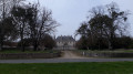
If arriving via the N147, park at Place des Tilleuls by the traffic lights.
(S/E) Cross the N147 and take the Route de Verrières, then turn immediately left onto Rue de la Boussagère; after the left-hand bend, continue along the dirt track until you reach a small road
(1) Turn right onto this, then take the second track on your left. Follow this track to the small road, then carry on straight ahead to reach the hamlet of La Rocherie and a left-hand bend.
(2) At this bend, take the track on the right, which turns into a small road and joins a crossroads with another track before the village of Verrières.
(3) Take the path on the right, under the trees, which climbs gently. You’ll come to open ground and, before the path starts to descend again, take the grassy path on your left. After a bend to the right, this leads to the hamlet of Torsac.
(4) At the entrance to Torsac, follow the road to the left for a few metres, then immediately turn right. As you leave the hamlet, the road turns left; pass the hamlet of La Maison Neuve and continue to the Verrières road (D8).
(5) Cross the small bridge on the left and follow the road alongside the Étang de la Forge on your left. You will reach the entrance to the Château de la Forge de Verrières.
(6) Continue along the edge of the lake, pass the large crossroads and, 50 metres further on, leave the D8 and turn right onto the road leading up towards Le Teil. After the hamlet, continue south-west along the grassy track through the Champs du Teil until you reach a four-way crossroads.
(7) Turn 90° to the right, then, a little further on, to the left. Pass through the hamlet of Chez Bernard and reach the hamlet of Rabardeau.
(8) At the hamlet of Le Rabardeau, turn right and, at the first bend, carry straight on along the grassy track. It bends to the left and, immediately at the three-way junction, turn right. Please note that the track is difficult to see and is not shown on the map; keep heading south-west.
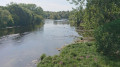
(9) Just before the road, turn right, heading north-west, onto a narrow path through brambles and gorse. After a gentle descent along a barely visible track, cross the small wooden bridge. The track disappears, but rejoin the road on your left by following the bank of the Rin for about ten metres: duck under some branches, step over a tree trunk, then climb up the embankment and follow the road to the right, which goes uphill. See Practical Information.
(10) On the climb, turn right towards Le Grand Peu. After a series of bends, at Le Grand Peu turn left and join the D8B. See Practical Information.
(11) At the crossroads, turn left again for a few dozen metres, then follow the road as it bends to the right. Carry on straight ahead, leaving the D8B as it bends to the left; pass the hamlet of Le Pont on your right and you’ll reach the houses of a recently built housing estate.
(12) Turn right, then right again along the RN147. After the bends, cross the bridge over the Drive and, at the traffic lights, you’ll reach the Place des Tilleuls (S/E).


 Visorando Member

 Easy
Easy 
 Difficult