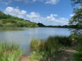
Around the Butte de Miremont

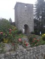
A short walk starting from the water tower on the Butte de Miremont which, as its name suggests, offers views of the surrounding mountains, with four orientation tables accessed via an external spiral staircase.
This route is published by the Basque Country Tourist Office under the name Urgorri. It is reproduced here for use with Visorando.

Details

11437126
Creation:
Last update:
Last review:
  • Walking
    Activity: Walking
  • ↔
    Distance: 2.17 mi
  • ◔
    Average duration: 1h 20 
  • ▲
    Difficulty: Easy

  • ⚐
    Back to start: Yes
  • ↗
    Ascent: + 400 ft
  • ↘
    Descent: - 417 ft

  • ▲
    Highest point: 607 ft
  • ▼
    Lowest point: 220 ft

Description of the walk

The starting point is at the Butte de Miremont car park; don’t leave without visiting the information boards on the water tower.

(S/E) Take the road to the water tower (Chemin de Remiremont) westwards for about 200 m. At the junction with the Chemin de Perü, head down to the right onto a stony track and walk alongside the first fenced-off meadow (feeding trough).

(1) Make sure you take a detour first turning left then right to continue along a grassy path at the edge of the field (yellow markings). The path runs alongside a motorbike trial track and then descends towards the bottom of the valley (steep section).

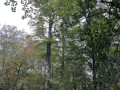
(2) At the bottom of the steep descent, immediately turn right onto the wooden footbridge over a stream. Head up the left-hand side of the stream through a deciduous woodland, then switch to the right-hand side 100 metres further up. The track suddenly climbs to the right, returning towards a second motorbike trial area.

Turn left, passing between the boulders, descend 30 m along the edge of a hedge, then turn right onto the path at the lower end of a clearing. Just before the rocks of a third motorbike trial section, turn left this time onto a pleasant path under the oak trees which rejoins the stream, below on the right.

(3) Cross the stream via a metal footbridge and climb the steep slope on the opposite bank. Halfway up the slope, turn right onto a level path, which continues as a track. At the next junction, turn sharply left to continue the climb through the forest. After passing through a gate and its pedestrian crossing, you’ll emerge onto a wide stony track (farm shed).

(4) Follow the track uphill to the right, passing under the high-voltage power line. At the top, walk alongside the D253 road to the right (take care), keeping to the right-hand verge in the grass. At the junction, head up the Route de Miremont to the right to return to the car park (S/E).

Waypoints

  1. S/E : mi 0 - alt. 594 ft - Car park at the - Butte de Miremont
  2. 1 : mi 0.46 - alt. 387 ft - Entrance to the forest
  3. 2 : mi 0.65 - alt. 220 ft - Footbridge over the stream
  4. 3 : mi 1.02 - alt. 299 ft - Metal footbridge
  5. 4 : mi 1.35 - alt. 397 ft - Wide track
  6. S/E : mi 2.17 - alt. 594 ft - Car park at the - Butte de Miremont

Reviews and comments

3.5 / 5
Based on 5 reviews

Reliability of the description
3.6 / 5
Ease of following the route
3.6 / 5
Route interest
3.4 / 5
User 18444552

Overall rating : 5 / 5

Date of your route : Jun 08, 2026
Reliability of the description : ★★★★★ Very good
Ease of following the route : ★★★★★ Very good
Route interest : ★★★★★ Very good
Very busy route : Yes

There’s a pretty steep climb and a brilliant descent. So it’s not for those looking for a gentle stroll.
I loved being surrounded by nature for much of the route

Machine-translated

gidoina
gidoina

Overall rating : 3.7 / 5

Date of your route : Jun 17, 2024
Reliability of the description : ★★★★☆ Good
Ease of following the route : ★★★★☆ Good
Route interest : ★★★☆☆ Average
Very busy route : No

Hello,
You’ll need good footwear to walk down and back up on either side of the stream. The motocross route (full of intersecting tracks) makes it difficult to find your way around based on descriptions (e.g. there’s no track halfway up the slope, but a path that starts at the metal footbridge and joins a road). There’s a shooting range in the area (I thought it might be a hunt or a clay pigeon shooting range), so what should you do? Fortunately, we’d done a recce of the motocross route (the lads assured me it was safe). P.S. The map showing the route is misleading. According to the map on the signpost, south is at the top (instead of north), with the start on our left. This orientation??? Misleads anyone without a compass. You have to turn your back on the map.

Machine-translated

Didmd
Didmd

Overall rating : 3.7 / 5

Date of your route : May 26, 2024
Reliability of the description : ★★★★☆ Good
Ease of following the route : ★★★★☆ Good
Route interest : ★★★☆☆ Average
Very busy route : No

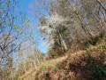
A route that winds its way mainly through woodland. There aren’t really any panoramic views of the Pyrenees, except for the first few metres of the route. There are also a few very steep sections that should be avoided in wet weather...

Machine-translated

y sabourin
y sabourin

Hello,
thank you for your reply.
Actually, my comment wasn’t directed at Visorando at all, but at the signposting on the ground at the start of the walk.
The walk looked so easy that I didn’t take either your PDF or your GPX file with me (I won’t make that mistake again)

Sorry for not being clear enough in my comment.

Kind regards
YS

Machine-translated

Hervé Bignon
Hervé Bignon

Hello,

Visorando isn’t just a map; it also includes instructions on how to use it.

What’s more, there’s also a GPS app for smartphones.

What more could you ask for?

Signposting is never shown on Visorando as it may be in poor condition and isn’t necessarily required to follow a route.

The main thing is that you’ve found the place interesting, despite the negative comment already left on the site.

Machine-translated

y sabourin
y sabourin

Overall rating : 2.3 / 5

Date of your route : Dec 02, 2023
Reliability of the description : ★☆☆☆☆ Very disappointing
Ease of following the route : ★☆☆☆☆ Very disappointing
Route interest : ★★★★★ Very good
Very busy route : No

The direction of the walk isn’t marked! So I ended up walking the wrong way round: all the yellow markings were behind me

Machine-translated

randonneuse pays basque
• Edited:

Overall rating : 3 / 5

Date of your route : Sep 14, 2022
Reliability of the description : ★★★★☆ Good
Ease of following the route : ★★★★☆ Good
Route interest : ★☆☆☆☆ Very disappointing
Very busy route : Yes

For those who love trial motorbikes, clay pigeon shooting and hunters, this ride is for you. What a disappointment to come face to face with a group of 20 motorcyclists authorised to tear up 70 per cent of the forest – with permission from the local council, they told me – who are even laying out the trail with large stones, holes and obstacles! There isn’t a single fern left; everything’s been ploughed up! This forest doesn’t deserve this!

Engines and pollution – that sums up my dismal walk. I’d been hoping for peace and quiet, the scents of autumn and perhaps a deer in the distance… I was disappointed and even angry with Visorando, which has turned into Visomoto…

A little further on, a clay pigeon shooting range, then the hunters’ lodge…

This walk has no place on this app.

Machine-translated

Other walks in the area

For more walks, use our search engine .

The GPS track and description are the property of this route's author. Please do not copy them without permission.