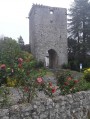
Around Biarrotte

Please note: part of this route is closed by municipal order (October 2023)
Published by the Landes Departmental Tourism Committee under the name “Entre bois et lac à Biarrotte”, this route allows you to explore Lake Bédorède and the Maison de La Mayou.

Details

4431868
Creation:
Last update:
Last review:
  • Walking
    Activity: Walking
  • ↔
    Distance: 3.04 mi
  • ◔
    Average duration: 1h 30 
  • ▲
    Difficulty: Easy

  • ⚐
    Back to start: Yes
  • ↗
    Ascent: + 115 ft
  • ↘
    Descent: - 108 ft

  • ▲
    Highest point: 141 ft
  • ▼
    Lowest point: 56 ft
  • ⚐ Country: France
  • ⚐ City: Biarrotte (40390)
  • ⚑
    Start/End: N 43.559636° / W 1.27419°
  • ❏
    IGN map(s): Ref. 1344OT
  • Hour-by-hour weather

Photos

Description of the walk

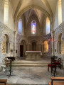
Park in front of Biarrotte Church.

(S/E) Take the D12 southwards towards Saint-Laurent-de-Gosse for about 300 m.

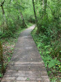
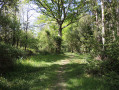
(1) Turn left towards the sewage treatment works for about 200 m. The path follows a circular route through the forest and approaches the D12. Then follow the D12 through a further stretch of woodland.

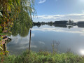
(2) Enter the grounds of Lac de Bédorède. Walk along the left-hand side of the lake for 400 m.

(3) Turn left towards the north onto a path that winds its way through woodland and cultivated fields until it joins a tarmac road.

(4) Take the tarmac road to the right, then follow it northwards until you reach a T-junction with a cross.

(5) Turn left onto the Route du Bousquet. At the first right-hand bend, continue straight on along a grassy track which joins the D817, passing in front of the Mayou house. Walk along the left-hand side of the D817 for 50 m to return to the car park (S/E).


Waypoints

  1. S/E : mi 0 - alt. 128 ft - Car park - Église Saint-Etienne (Biarrotte)
  2. 1 : mi 0.2 - alt. 128 ft - Turn left towards the Station
  3. 2 : mi 1.19 - alt. 92 ft - Lac de Bédorède
  4. 3 : mi 1.49 - alt. 56 ft - Path on the left
  5. 4 : mi 2.18 - alt. 138 ft - Tarmac road on the right
  6. 5 : mi 2.48 - alt. 125 ft - Route du Bousquet on the left
  7. S/E : mi 3.04 - alt. 128 ft - Car park - Église Saint-Etienne (Biarrotte)

Reviews and comments

3.9 / 5
Based on 4 reviews

Reliability of the description
3.8 / 5
Ease of following the route
3.8 / 5
Route interest
4.3 / 5
JadeMqt
JadeMqt

Overall rating : 3.3 / 5

Date of your route : Oct 08, 2023
Reliability of the description : ★★★☆☆ Average
Ease of following the route : ★★★☆☆ Average
Route interest : ★★★★☆ Good
Very busy route : No

PLEASE READ:
The Biarrotte local council has closed the footpath between points 2 and 3. At point 2, you will find the following notice: “Due to the current situation and the risks and dangers present both day and night, the footpath is closed to pedestrians until further notice” (January 2023) due to a subsidence of the embankment.

Otherwise, the start of the route through the woods is very pleasant. Be careful not to take the main road, but instead take the small path through the woods towards the Chemin du Heriche (between points 1 and 2). The circular route is therefore no longer possible, but it’s a lovely route for a one-hour stroll (there and back) when the weather is warm.

Machine-translated

Nikobcn
Nikobcn

Overall rating : 4.7 / 5

Date of your route : May 13, 2022
Reliability of the description : ★★★★★ Very good
Ease of following the route : ★★★★★ Very good
Route interest : ★★★★☆ Good
Very busy route : No

A rather pleasant walk, all on my own! The first section through the forest is lovely; I’d recommend turning back once you reach the lake (there’s a lovely viewpoint a little further on, on the other side of the lake), as the second part of the walk isn’t very interesting – you just walk alongside a field and a road.

Machine-translated

Thiech
Thiech

Overall rating : 5 / 5

Date of your route : Apr 18, 2022
Reliability of the description : ★★★★★ Very good
Ease of following the route : ★★★★★ Very good
Route interest : ★★★★★ Very good
Very busy route : No

A lovely walk through varied countryside (woodland, lake, fields). Please note: the green signposting provided by the local council follows the route in the opposite direction; there are three steep gullies which may prove challenging for those who aren’t particularly fit; and finally, some sections can be very wet (particularly the second part after the lake). Nevertheless, I recommend this pleasant little walk!

Machine-translated

Hervé Bignon
Hervé Bignon

I’m sorry for Pépita, who’s clearly disappointed, but having walked this route again today, I can confirm that the route is perfectly accurate and that the path branching off to the left after the last houses in the village is indeed the route as marked on this itinerary, and I find it hard to imagine that anyone could walk past it without noticing it.

So, naturally, if you take a different route, you’re bound to be disappointed.

I’d advise setting off with more than just a route description; you’ll need a map or, even better, use the Visorando app, which will let you know if you’re going the wrong way.

The green signposting is indeed a bit patchy in places, but apart from the start, it’s hard to go wrong.
It’s worth noting that I have no control over the signposting, which I didn’t put up myself, and I never recommend relying on signposting – that’s exactly why Visorando exists.

We’ll have to give this route another go some other time.

Kind regards,

Hervé

Machine-translated

Pépita
Pépita

Overall rating : 2.7 / 5

Date of your route : Apr 28, 2021
Reliability of the description : ★★☆☆☆ Disappointing
Ease of following the route : ★★☆☆☆ Disappointing
Route interest : ★★★★☆ Good
Very busy route : No

The green signposting is often unreliable. For example, we couldn’t find the turn-off to the sewage treatment plant => so we followed the D12 all the way to the lake. It was dangerous and very unpleasant with all the traffic.

Machine-translated

Other walks in the area

For more walks, use our search engine .

The GPS track and description are the property of this route's author. Please do not copy them without permission.