Around Cormeilles-en-Vexin

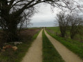
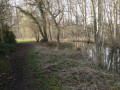
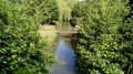
In the footsteps of Caesar’s legions, Merovingian huts huddled around their chapel and ponds.

Details

n°1211703
Creation:
Last update:
–
Last review:
  • Walking
    Activity: Walking
  • ↔
    Distance: 6.39 mi
  • ◔
    Average duration: 3h 10 
  • ▲
    Difficulty: Average

  • ⚐
    Back to start: Yes
  • ↗
    Ascent: + 276 ft
  • ↘
    Descent: - 276 ft

  • ▲
    Highest point: 538 ft
  • ▼
    Lowest point: 331 ft

Description of the walk

From Pontoise, take the D915 and drive to Cormeilles-en-Vexin. Park by the church.

(S/E) With your back to the church, head across to Rue Pasteur and follow it to the end, then turn left onto Rue de Grisy. At number 23 bis, take the grassy path on the right until you reach the road diversion.

(1) Turn left. Turn right onto a track, pass under the bypass and continue for 300 metres. Take the track on the left, keep left and continue along the track which leads you onto the D190. Leave the track on the right and continue along the road for about 130 metres until you reach the first track at a place called Le Pot à Beurre.

(2) Take the track on the left and very quickly turn right, heading due west, until you reach the T-junction.

(3) Turn left and continue straight on uphill towards the Frémécourt water tower. At the roundabout, follow the D915 on the right and cross it carefully at the pedestrian crossing (heavy traffic)

(4) Opposite, follow the path that continues from the pedestrian crossing. Cross Chemin Eric Teyssot to reach Chemin de la Butte Sanson. Pass by the hamlet of Artimont and continue left along Rue des Vieilles Vignes before turning right onto the stony path at the next bend. Follow this path to the next crossroad.

(5) Take the path that starts almost directly opposite. Carry on straight ahead to reach the Croix de Bazancourt.

(6) Carry on straight ahead until you reach the next road.

(7) Carry on straight ahead again. After just over a kilometre, you’ll come to a junction of paths.

(8) Turn left, then turn left again at the industrial estate and follow the road alongside it (Allée des Terres Rouges). After about 300 metres, before the warehouse, go up the dirt track on the right (between the industrial estate and the park) to reach Rue Curie.

(9) Turn left and follow this street to return to the starting point (S/E).

Waypoints

  1. S/E : mi 0 - alt. 482 ft - Car park - Église Saint-Martin (Cormeilles-en-Vexin)
  2. 1 : mi 0.68 - alt. 371 ft - Road diversion
  3. 2 : mi 1.76 - alt. 367 ft - Le Pot à Beurre
  4. 3 : mi 2.27 - alt. 420 ft - T-junction
  5. 4 : mi 3.02 - alt. 531 ft - Water tower
  6. 5 : mi 3.61 - alt. 400 ft - Mare Épicière
  7. 6 : mi 4.49 - alt. 364 ft - Bazancourt Cross
  8. 7 : mi 4.91 - alt. 371 ft - La Grande Mare
  9. 8 : mi 5.48 - alt. 331 ft - Turn left towards the industrial estate
  10. 9 : mi 6.24 - alt. 466 ft - Rue Curie
  11. S/E : mi 6.39 - alt. 482 ft - Car park - Église Saint-Martin (Cormeilles-en-Vexin)

Notes

Route along local tracks.

In the event of heavy rain prior to the walk to La Grande Mare (7), turn left towards Cormeilles church, as the path consists of a series of potholes 50 to 80 cm deep and may be dangerous as the vegetation conceals the holes

Worth a visit

Saint-Martin Church, Rue Guynemer (listed as a historic monument in 1913) (S/E).
Ecce Homo monument, in the cemetery, D 190 (listed as a historic monument in 1947): from the (S/E), turn left into Rue du Général Leclerc. Follow this street until you reach Rue de Breançon on the right. The monument is on the left.
Mare des Joncs, shortly after the (1).
Mare Épicière (6).
La Grande Mare (7).

Reviews and comments

4.3 / 5
Based on 2 reviews

Reliability of the description
5 / 5
Ease of following the route
5 / 5
Route interest
3 / 5
ZEN 95
ZEN 95

Overall rating : 4.3 / 5

Date of your route : Mar 04, 2025
Reliability of the description : ★★★★★ Very good
Ease of following the route : ★★★★★ Very good
Route interest : ★★★☆☆ Average
Very busy route : No

Hello

An easy and enjoyable walk to do in sunny weather at this time of year

Machine-translated

jayjay
jayjay

Overall rating : 4.3 / 5

Date of your route : Aug 28, 2023
Reliability of the description : ★★★★★ Very good
Ease of following the route : ★★★★★ Very good
Route interest : ★★★☆☆ Average
Very busy route : No

A disappointing walk.
Not many sections through the woods. The paths run between fields of beetroot and maize.

Machine-translated

Other walks in the area

For more walks, use our search engine .

The GPS track and description are the property of this route's author. Please do not copy them without permission.