Country:

 City:
City:


On the D17, park in the large Aurigon car park, situated about 2 km east of Le Tholonet.
(S/E) Set off along the DFCI SV106 track, heading north-east. You’ll come to a Y-junction.
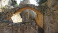
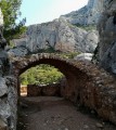
(1) Turn left onto the track marked with green and yellow-red dots onthe GR®2013. You’ll soon reach the old marble quarry, where there are still many remains. You’ll come to a Y-junction.
(2) Turn right, following the green markings, towards the Bimont Dam. The track turns left at the 331-metre mark.
(3) Keep to the right at the 362-metre mark. Follow the paths running along the right-hand side of the track to get the best view of the landscape.
(4) Turn left at elevation 373. You’ll come to a T-junction.
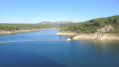
(5) Keep to the left and arrive at the dam. Take a look around; the setting is magnificent.
(6) Viewpoint. Retrace your steps.
(5) Turn left at the signpost, then, about 50 metres further on, keep to the left. Follow the path through the woodland, marked with green dots, which leads out onto a large meadow. At the far end, you’ll come to a junction of two tracks.
(7) Carry on straight ahead, taking the track that slopes down slightly. You’ll come to a path on the left.
(8) Leave the track to take this sandy path, which rejoins the same track further down. Head down this concrete track until you reach an X-shaped junction with ‘Military Ground’ signs on the left and, on the right, a ruin and a private road. Opposite, a sign indicates the diversion path.
(9) Follow the direction indicated by this sign. You’ll come across the green dot markings again. The path follows a stream, crosses it via a footbridge, then comes close to a track and a wooden bridge.
(10) Pass to the left of the bridge (elevation 264), then turn eastwards onto the long, straight track ofthe GR®653A, until it curves.
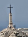
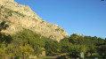
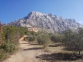
(11) Continue straight on along a shortcut which joins the track further up. Pass the underground cistern no. 338. In view: Montagne Sainte-Victoire and a magnificent landscape. You can see the Croix de Provence at its summit and, on the right, perched on a rock, the cross of the Chapelle du Trou. You’ll reach a T-junction.
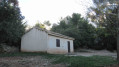
(12) Turn left, heading north, and walk for about 50 m. Take a sharp right-hand bend to pass by a well, then the Refuge Cézanne. Walk past the refuge, continuing straight on towards a path, then up metal steps leading to the ruins of the Chapelle du Trou. Explore the site and head back down the other side.
(13) Turn right onto the brown-marked path, then, about 250 m further on, turn right at a Y-junction. Follow the path downwards, which includes a few steps (made of logs). At the bottom of the steps, you’ll come to a track near the 357-metre mark.
(14) Turn right and follow this track, which runs alongside a large olive grove. At the end, you’ll reach a Y-junction.
(15) Turn left onto a path through the woodland, then, about 200 m further on, keep right at a Y-junction. You’ll come to a track; follow it to the left. You’ll reach a Y-junction.
(16) Turn right onto the straight path and follow it for about 100 m. Look out for a track on the left that leads downhill. Follow this track and, further down, you’ll see some picnic tables, a small bridge and the track you took at the start of the walk. Once there, turn left to return to the car park (S/E).


 Visorando Member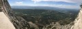
 Difficult
 Easy
Easy 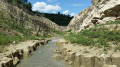

 Extremely difficult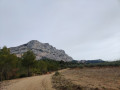
 Association / Club / Walk leader