Ascent and circuit of Pic Iguzki

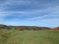
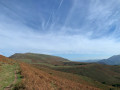
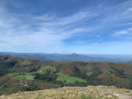
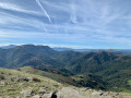
A lovely circular route to reach the summit of Iguzki after circling it.

Details

3117877
Creation:
Last update:
Last review:
  • Walking
    Activity: Walking
  • ↔
    Distance: 3.33 mi
  • ◔
    Average duration: 2h 20 
  • ▲
    Difficulty: Moderate

  • ⚐
    Back to start: Yes
  • ↗
    Ascent: + 965 ft
  • ↘
    Descent: - 951 ft

  • ▲
    Highest point: 2,769 ft
  • ▼
    Lowest point: 1,804 ft

Photos

Description of the walk

To reach the start, head to Itxassou via the D918. Follow signs for “Pas de Roland” via the D249 then the D349.
Once at Pas de Roland, take the road that goes straight on and follows the course of the Laxia. At the three-way junction, take the left-hand road towards the Saint-Pierre restaurant. Continue along the road and turn left at the three-way junction leading up to the Col de Mehatse (or Col de Mehatze or Col de Méhatché, depending on the map you’re using).

(S/E) Head back down the road until you reach the first right-hand bend.

(1) Take the path opposite that leads downhill. After passing through the wooded area, follow the meadow on your left.

(2) Turn left onto the path that runs along the hillside and joins the ridge.

(3) Take the path on the left which climbs northwards along the ridge.

(4) Follow the path to the right along the hillside until you reach the north-eastern shoulder overlooking the Col de Mehatze.

(5) Turn left to climb to the summit of Pic d’Iguzki.

(6) Descend via the same route.

(5) Continue straight ahead to return to the Col de Mehatze (S/E).

Waypoints

  1. S/E : mi 0 - alt. 2,346 ft - Car park - Col de Mehatze ou col Méhatché (716m)
  2. 1 : mi 0.54 - alt. 2,103 ft - Start of the trail - Col d'Iguzkaiko (639m)
  3. 2 : mi 0.98 - alt. 1,804 ft - T-junction
  4. 3 : mi 1.83 - alt. 2,182 ft - Junction
  5. 4 : mi 2.11 - alt. 2,303 ft - Junction
  6. 5 : mi 2.77 - alt. 2,474 ft - Access to the summit
  7. 6 : mi 2.98 - alt. 2,769 ft - Iguzki
  8. S/E : mi 3.33 - alt. 2,346 ft - Col de Mehatze car park

Notes

No water along the route.

(4) An alternative route continues straight ahead, climbing directly towards the summit.

Worth a visit

The passes on this border road are the starting points for many beautiful hikes.

There is a restaurant on the road leading up to the pass (book in advance for lunch).

Reviews and comments

4.6 / 5
Based on 3 reviews

Reliability of the description
4.7 / 5
Ease of following the route
4.7 / 5
Route interest
4.3 / 5
User 12512496

Overall rating : 4 / 5

Date of your route : Oct 05, 2025
Reliability of the description : ★★★★☆ Good
Ease of following the route : ★★★★☆ Good
Route interest : ★★★★☆ Good
Very busy route : No

Very beautiful views
Hike much shorter than advertised (1 hour 15 minutes)
Starting point quite far from access point (long narrow road, difficult junction)

Machine-translated

Gîte Auclairdusoleil
• Edited:

Actually, we didn’t climb Iguzki but Artzamendi from the pass… The guide led us to it, and the route itself was quite an experience!!!
The view is magnificent, and the animals roaming freely (Pottok, pigs, vultures) add to the wild feel of the place.

Machine-translated

jujucourbis
jujucourbis

Overall rating : 4.7 / 5

Date of your route : Jul 26, 2021
Reliability of the description : ★★★★★ Very good
Ease of following the route : ★★★★★ Very good
Route interest : ★★★★☆ Good
Very busy route : No

Hike completed today.
The difficulty was listed as ‘moderate’, but in fact it was easy.
The view from the top of the peak is magnificent. We took the shortcut from point 4 and that worked very well too, even though the climb was tough...
We saw plenty of vultures, horses and sheep along the way.
The trickiest bit, in the end, is getting to the start point (car park) by car, as the road is so narrow in places that you end up having to reverse when you meet another vehicle.

Machine-translated

Martine et Patrick
Martine et Patrick

Overall rating : 5 / 5

Date of your route : Apr 03, 2021
Reliability of the description : ★★★★★ Very good
Ease of following the route : ★★★★★ Very good
Route interest : ★★★★★ Very good
Very busy route : No

Very easy and quick, with some lovely views to boot. And the historical interest of the cromlechs. Those people certainly had good taste...

Machine-translated

Other walks in the area

For more walks, use our search engine .

The GPS track and description are the property of this route's author. Please do not copy them without permission.