


Refine your search for walks in Allée couverte de la Pierre Turquaise
Allée couverte de la Pierre Turquaise walks


 The Carnelle Forest from Viarmes
 Visorando Member

 9.25 mi
 +1,047 ft
 -1,024 ft
 5h 10
 Moderate
 Departure from Viarmes (Val-d'Oise)
The Carnelle National Forest is a forest located on a hill 25 km north of Paris. Its summit (altitude 210 m) is one of the highest points in the Val d'Oise. The variety of its landscapes makes it one of the most pleasant sites in the region.
This hike follows part of the northern flank of the forest, allowing you to discover some interesting features of the forest and its surroundings.
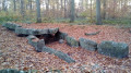
Three covered walkways around Presles
 8.13 mi
+509 ft
-535 ft
4h 10
Moderate
Departure from Presles (Val-d'Oise) (Val-d'Oise)
As the title suggests, this hike takes in three covered walkways, two of which are among the most remarkable in the Ile-de-France region. The first part takes place in the Carnelle Forest, with beautiful beech woods and two pleasant lakes. The second part takes place mainly across fields.
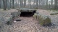
De Presles à Luzarches par la Forêt de Carnelle et la Pierre Turquaise
 12.46 mi
+751 ft
-702 ft
6h 25
 Difficult
Departure from Presles (Val-d'Oise) (Val-d'Oise)
La randonnée se déroule d'abord à travers la Forêt de Carnelle, avec un passage à la superbe Allée couverte de la Pierre Turquaise, la plus imposante d'Ile-de-France. On continue en forêt puis à travers champs, pas loin de l'Oise, pour une visite à l'ancienne Abbaye de Royaumont. On termine entre bois, prés, champs et zones résidentielles.
The Carnelle Forest
7.60 mi
+787 ft
-787 ft
4h 10
Moderate
Departure from Saint-Martin-du-Tertre (Val-d'Oise) (Val-d'Oise)
This forest is steeped in history, as Saint Louis and Blanche of Castile used to walk here. It takes its name from the Celtic root "Carn", meaning stone, as some of its covered paths contain the remains of Neolithic tribes who came from the north.
The exploitation of gypsum and marl gave rise to two ponds: the Petit Étang and the Lac Bleu.
Circular route between Viarmes and Presles
 13.58 mi
+1,598 ft
-1,611 ft
7h 40
Difficult
Departure from Viarmes (Val-d'Oise)
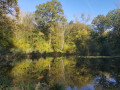
A circular walk that follows the GR®1 from Viarmes station to Presles on the outward leg. After passing through Noisy-sur-Oise, a village overlooking the Oise Valley, the GR®1 enters the Carnelle Forest, runs alongside Lac Bleu and passes near the covered walkway at La Pierre Turquaise. On the return leg, the route runs alongside the three lakes of the Carnelle Forest. Before arriving at the station, the route offers a chance to discover one of Viarmes’ many wash houses.
Grand Tour of Paris: from station to station
 343.64 mi
+13,451 ft
-13,451 ft
26 days
Difficult
Departure from Cergy (Val-d'Oise)
This route, comprising 26 walks from station to station – generally long (averaging 21 km) – allows you to gradually circumnavigate the Île-de-France region and discover its full diversity. The route passes through several large forests, winds its way through cultivated fields and runs alongside numerous rivers. Apart from certain stages that are predominantly through woodland, there is a wealth of heritage to be discovered along the way.
GR®1: Tour of Île-de-France
 363.31 mi
+17,464 ft
-17,103 ft
21 days
 Very difficult
Departure from Paris
Over 500 km long and with more than 4,000 m of elevation gain, this hike is accessible to everyone if broken down into several stages. Beautiful, rural and fairly close to Paris, it is suitable for anyone who wants to try their hand at hiking. There are many points of interest along this route. History and heritage enthusiasts, as well as nature lovers, will find something to enjoy.