Country:

 City:
City:


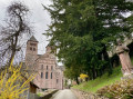
From Buhl, take the D40.2 towards Rimlishof, continuing to Saint-Barnabé, where there is a large car park offering plenty of parking spaces.
(S/E) Start the walk by taking the access road (D40.2) towards Rimlishof.
Yellow Disc signposting
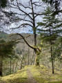
(1) Turn right onto Rue du Rimlishof and walk between the holiday centre on your left and the detached houses on your right. Once past the houses, enter the forest where the tarmac gives way to a dirt track. You’ll come to a Fork in the road.
(2) Stay on the forest track and do not take the path on the right signposted‘Saint-Barnabé’. Further on, a path on the right will be signposted ‘Saint-Barnabé’; do not take this either, but continue along the same track until you reach a crossroads.
(3) Turn right where the track descends to a Fork in the road.
Red Disc markings
(4) Continue to the right, following the descent, until you reach a junction.
Red Triangle markings
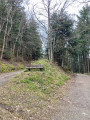
(5) Turn left, well before the houses at Saint-Barnabé. Climb the final short slope of the walk and continue until you reach a bench directly in front of you, situated between two paths.
(6) Take the path to the right of the bench; you’ll very quickly reach a junction (note: you might miss it; there’s a sign on a tree, but it’s intended for walkers coming from the other direction).
Blue Disc markings
(7) Take the small path leading down to the right. This path is the steepest part of the walk and can be slippery in wet weather. If the trees have no leaves, try to spot the abbey. Enter the village via a small bridge. Then, take the street on the left and then the one on the right to head towards the abbey.
(8) You can extend the walk by continuing on to the Chapel of Notre-Dame de Lorette, from where there is a superb view of the abbey.
When you arrive at the abbey from the rear, be sure to admire it, particularly the traces of the nave which no longer exists – this gives you an idea of just how grand this abbey must once have been. Take the opportunity to go inside the abbey.
Set off again, passing under the great gate of Murbach. Just beyond the gate, on the right, walk through the medieval garden, alongside which the River Murbach flows. As you leave the medieval garden, spend a few minutes at the telephone box… Have a look at the logbook where calls are recorded – perhaps the phone will ring. A unique curiosity in France.
(9) After this final break, take the road opposite to the car park; this section is a quick walk (S/E).

 Visorando Member

 Association / Club / Walk leader
 Easy
Easy 
 Difficult
  Tourist office