Country:
 City:


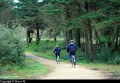
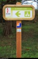
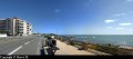
(S) In Brétignolles-sur-mer, the route starts at the Parée roundabout.
(1). Head towards Marais Girard beach by following the coastal road.
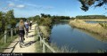
(2) At the Marais Girard roundabout, carry on straight ahead along the cycle path that runs along the top of the beach. Behind Normandelière Beach, turn left to pass between the dune and the lake.
(3) After skirting the lake, turn right towards Dunes Beach. The cycle path runs through the dunes. At the first houses, turn right to reach a road after a hill. Follow it to the right. At the junction, carry on straight ahead on the cycle path between the dunes on the right and the campsite on the left (the entrance is protected by a barrier that can only be crossed by pedestrians and cyclists). At the end of the straight stretch, turn left.
At the roundabout, go straight ahead. At the next junction, turn right to pass in front of the entrance to a campsite.
(4). Follow the road to La Gachère. At the junction with the RD54, turn right.
(5) Cross the bridge over the Havre de la Gachère channel. Take the first road on the right towards the hamlet of Les Granges. Continue along the cycle path. After a long straight stretch, leave the road at the start of a bend to join the cycle path which leads into the forest
(6) Go through the tunnel that passes under the D80 and, at the exit, turn right onto the tarmac road.
Just before rejoining the D80, turn left onto the cycle path. At the next junction, continue to the left. At the junction where three roads meet, turn right to rejoin the D80. Cross it (take care) and follow the path opposite. At the next junction, turn right to head into the forest. In the centre of the hamlet, at a bend, turn right onto the cycle path, the entrance to which is protected by a barrier that can only be crossed by pedestrians and cyclists. You’ll come to a road. Carry on straight ahead. Pass the entrance to a campsite, then turn right onto a cycle path. You’ll reach the road leading to Sauveterre beach. Turn right onto the tarmac cycle path. 100 metres further on, just before the junction, use the pedestrian crossing to cross the road. Follow the narrow tarmac cycle path until you reach a road. Turn right onto it. At the next junction, turn right. Then turn right again. Cross the bridge, then turn right immediately afterwards. You’ll reach a road. Turn right onto it. At the next junction, turn right. Cross the bridge to reach the D87.
Cross the D87 and take the cycle path opposite, which leads into the forest. You’ll pass close to a cemetery.
(7) You’ll reach the entrance to a campsite.
(8) Turn left onto the cycle path, which climbs steeply before descending towards the sea. Follow the seafront. Lovely views of the sea and the beach. The cycle path veers away from the seafront after the Paracou beach car park, passing to the left of the road. Take the first street on the right to reach Rue des Cormorans. Carry on straight ahead to reach Rue des Ajoncs. Follow it to the right. Carry on straight ahead. After the block of flats, turn right to follow Rue de l’Aiguillon. Carry on straight ahead.
(9) At the roundabout, turn left. Head towards the Armandèche Lighthouse.
(10) Carry on straight ahead until you see the channel leading to the ports of Les Sables d’Olonne.
(11) Then follow the quay.
(12). At the roundabout, take the road opposite that runs alongside the hypermarket (heading north). Take care (keep well to the right). At the next roundabout, carry on straight ahead towards La Bernadière. At the junction, turn right. Cross the bridge, then turn left. Then follow the same route as on the way there.

 Visorando Member

 Easy