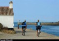
Route des Moulins

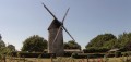
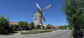
Around Challans, this route takes you to explore two mills that are still in operation.
The first section, in the Sallertaine marshes, offers the chance to spot numerous wetland birds.
In the second part, around Châteauneuf, you may spot wildlife in the early morning (roe deer, hares, pheasants, etc.) and, in spring, observe the storks nesting near the abbey on Île Chauvet.

Details

95886
Creation:
Last update:
Last review:
  • Mountain biking
    Activity: Mountain biking
  • ↔
    Distance: 25.50 mi
  • ◔
    Duration according to the author: 4 hrs 
  • ▲
    Difficulty: Moderate

  • ⚐
    Back to start: Yes
  • ↗
    Ascent: + 135 ft
  • ↘
    Descent: - 144 ft

  • ▲
    Highest point: 102 ft
  • ▼
    Lowest point: 3 ft
  • ⚐ Country: France
  • ⚐ City: Challans (85300)
  • ⚑
    Start/End: N 46.854044° / W 1.895545°
  • ❏
    IGN map(s): Ref. 1125OT

  • ◶
    Type of surface:
  •  
     
     
     33% Road  34% Byway  33% Path
  • ⇧
    Bike carrying: Not specified
  • ▲
    Difficulty: Easy
  • Hour-by-hour weather

Photos

Description of the route

Start at the Leclerc shopping centre

(S/E) Take the cycle path that goes under the flyover, then turn left onto the path towards Saint-Jean and Salertaine.

(1) Turn right onto the cycle path towards Les Cétrées and continue towards Le Petit Lieu. Turn right north-east towards Le Payement and continue to a junction.

(2) Turn left onto the road towards Sallertaine. In the village, at the church, turn left onto the D71.

::3 Carry on to La Pointe.

(4) After this hamlet, leave the D71 and carry on straight ahead until the next junction.

(5) Turn right towards La Charraud Basse, La Galvigne and the Moulin de Rairé.

(6) Set off again from the mill along the small road at the back towards Les Éves

(7) Turn left onto the dirt track and follow the path. Cross the D103 and take the small road opposite.

(8) At the poultry farm, turn right, cross the Creuset and join the D948.

(9) Cross it, continue north-east and head for L’Enclose.

(10) Leave the road, turn left onto the cycle path towards Sallertaine and follow the ‘La Vendée à vélo’ signs to Le Petit Moulin.

(11) Return to the cycle path until you reach the village of Châteauneuf.

(12) At the cemetery, take the small path on the left and head towards a road.

(13) Turn left towards the Abbey of Île Chauvet (open to visitors in summer) and head for the stork’s nest viewing point.

(14) Turn back.

(13) Carry on straight ahead along the Route de la Maison Neuve until you reach the D28.

(15) Turn right and arrive at the cemetery you passed earlier.

(12) Turn left towards La Garnache. Follow the D71 to La Belle Aisance.

(16) Turn right and follow the track to Sainte Marie.

(17) Turn left towards Pas du Bois.

(18) Turn right and carry on to Le Cargnon.

(19) Turn right until you reach the next track on the left.

(20) Turn onto this track and carry on to the D58.

(21) Cross it and, in Payré, turn left and follow the track to the second junction.

(22) Turn left and go round Les Emonnières.

(23) At the next junction, turn left to join the D58.

(24) Enter Challans via the four-lane road, then, at the roundabout, turn right onto the cycle path until you reach the starting point (S/E).

Waypoints

  1. S/E : mi 0 - alt. 20 ft - Shopping centre car park
  2. 1 : mi 1.9 - alt. 7 ft - Junction
  3. 2 : mi 4.06 - alt. 3 ft - Crossroads
  4. 3 : mi 5.78 - alt. 23 ft - D71
  5. 4 : mi 6.64 - alt. 10 ft - La Pointe
  6. 5 : mi 7.14 - alt. 7 ft - Crossroads
  7. 6 : mi 8.23 - alt. 7 ft - Rairé Mill - Moulin de Rairé
  8. 7 : mi 8.52 - alt. 7 ft - Les Éves junction
  9. 8 : mi 9.11 - alt. 10 ft - Les Bouchauds
  10. 9 : mi 10.29 - alt. 46 ft - D948
  11. 10 : mi 10.57 - alt. 39 ft - L’Enclose
  12. 11 : mi 14.36 - alt. 66 ft - The Petit Moulin
  13. 12 : mi 15.41 - alt. 39 ft - Châteauneuf Cemetery
  14. 13 : mi 15.92 - alt. 16 ft - Road junction
  15. 14 : mi 16.23 - alt. 10 ft - Observatory
  16. 15 : mi 16.79 - alt. 30 ft - D28
  17. 16 : mi 19.48 - alt. 62 ft - La Belle Aisance
  18. 17 : mi 19.98 - alt. 62 ft - Sainte-Marie
  19. 18 : mi 20.32 - alt. 72 ft - Le Pas du Bois
  20. 19 : mi 20.74 - alt. 79 ft - Le Cargnon
  21. 20 : mi 21.16 - alt. 62 ft - Junction
  22. 21 : mi 22.63 - alt. 46 ft - Crossing the D58
  23. 22 : mi 23.67 - alt. 43 ft - Crossroads
  24. 23 : mi 24.01 - alt. 26 ft - Junction
  25. 24 : mi 24.42 - alt. 30 ft - D58
  26. S/E : mi 25.5 - alt. 16 ft - Shopping centre car park

Worth a visit

Visit to the Rairé Mill
Visit to the Petit Moulin de Chateauneuf.
Stork observatory on Chauvet Island.

Reviews and comments

4 / 5
Based on 3 reviews

Reliability of the description
3.3 / 5
Ease of following the route
4.3 / 5
Route interest
4.3 / 5
assez85
assez85

Overall rating : 3.7 / 5

Date of your route : May 13, 2019
Reliability of the description : ★★☆☆☆ Disappointing
Ease of following the route : ★★★★★ Very good
Route interest : ★★★★☆ Good

A brilliant bike ride
I’d recommend it
There are a few picnic tables near the Rairé mill.
Please note, the text description contains several errors
- In Sallertaine, contrary to the text description, you turn left, not right.
- There are several errors in the waypoint numbers.

Machine-translated

Reisset98
Reisset98

Overall rating : 4.7 / 5

Date of your route : Mar 27, 2017
Reliability of the description : ★★★★☆ Good
Ease of following the route : ★★★★★ Very good
Route interest : ★★★★★ Very good

A very pleasant cycle ride, enjoyed in glorious sunshine, following the suggested route. We saw lots of storks both near Sallertaine and Châteauneuf. After the ‘vieilles ventes’, we decided to follow the signposts for ‘Les Lucs, sur Boulogne, La Garnache’ rather than continue along the D71. We left the Vendée cycle route at “La Vallée des Landes” to rejoin the route at point 19. After “Le Cargnon”, don’t miss the track at point 23: don’t be misled by the “Le Pavillon” sign, which is located in front of a building materials yard, just before “Les Brandes”.

Machine-translated

MALRIF
MALRIF

Overall rating : 3.7 / 5

Date of your route : Jul 23, 2016
Reliability of the description : ★★★★☆ Good
Ease of following the route : ★★★☆☆ Average
Route interest : ★★★★☆ Good

To do this cycle ride, we used a GPS device mounted on the handlebars of a bike. It’s much more convenient than reading route descriptions whilst cycling. So I have no comments to make on the route description. As for the route itself, I’d previously downloaded the itinerary onto my computer so I could fine-tune it before uploading it to my GPS. The main inaccuracy is particularly noticeable after point 13, where the route heads due north through the Tartifune neighbourhood to join the D28 (but there’s no path there and the route runs through the middle of a residential area). We therefore took Rue du Moulin northwards to link up with the D28.
We preferred to start the route from the centre of Sallertaine, rather than from the car park at the Leclerc shopping centre, so that we could have a drink on a terrace at the end of the walk and visit the Vaulieu Garden and Rue des Artisans.
The first part of the route, between Challans and Châteauneuf, is more pleasant. In particular, we spotted some storks in a meadow between points 6 and 7 on the route.
We also stopped at the Rairé mill for a guided tour led by the miller. I’d highly recommend it.
There was just one hiccup: one of us got a puncture on their mountain bike. A word of advice: do bring a puncture repair spray with you, just in case. This allowed us to cover the last few kilometres of the route and get back to the starting point where our cars were parked.

Machine-translated

For more walks, use our search engine .

The GPS track and description are the property of this route's author. Please do not copy them without permission.