Route de découverte à vélo de Saint-Gilles-Croix-de-Vie

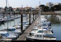
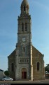
This route offers a pleasant way to explore the seaside resort of Saint-Gilles-Croix-de-Vie. The Jaunay lock, the church of Saint-Gilles, the left bank of the Vie, the old quarters of Saint-Gilles and Croix-de-Vie, the church of Sainte-Croix, the Soudinière lake, the fishing harbour and the marina, the dune and the Garenne jetty are all sights to discover along this 11 km cycle ride.

Details

n°37082
Creation:
Last update:
Last review:
  • Mountain biking
    Activity: Mountain biking
  • ↔
    Distance: 6.96 mi
  • ◔
    Duration according to the author: 1 hr 
  • ▲
    Difficulty: Easy

  • ⚐
    Back to start: Yes
  • ↗
    Ascent: + 16 ft
  • ↘
    Descent: - 16 ft

  • ▲
    Highest point: 30 ft
  • ▼
    Lowest point: 0 ft
  • ⚐ Country: France
  • ⚐ City: Saint-Gilles-Croix-de-Vie (85800)
  • ⚑
    Start/End: N 46.691755° / W 1.933219°

  • ◶
    Type of surface:
  •  
     
     
    ■ 33% Road ■ 34% Byway ■ 33% Path
  • ⇧
    Bike carrying: Not specified
  • ▲
    Difficulty: Not specified
  • Hour-by-hour weather

Photos

Description of the route

(S/E) From the roundabout, follow Avenue du Jaunay.

(1) At the junction, turn left (towards the town centre and the harbour). After the Edmond Bocquier Primary School, turn right onto Rue Henri Collinet and continue straight on.

(2) You will reach Rue Gautte. Turn left and take the second street on the right.

(3) At the end of the street, opposite the cemetery wall, turn left onto the cycle path (signposted). Turn right onto it and ride past the casino entrance. Staying on the cycle path, follow Promenade Garcie Ferrande (do not go through the tunnel) to follow the left bank of the Vie.
Head up onto the Garcie Ferrande wooden quay.

(4) At the roundabout, cross the river via the André Bénéteau cycle and pedestrian footbridge, which runs alongside the Pont de la Concorde. At the end of this, take the third exit off the roundabout. Just before a shop, take the first street on the right (Rue Anatole France), then take the first street on the left (Rue de la Roussière). At the ‘No Entry’ sign, turn right and follow Rue du Maroc to the end. At the bar, turn left and then turn right onto Boulevard de l’Égalité.

(5) At the foot of the church, turn left, then head right to pass in front of the École rivée Sainte-Croix.

(6) After the school, turn right onto Rue du Gabio. Continue until you reach Boulevard Georges Pompidou. Turn left onto it, then turn right at the first junction to take Impasse des Salines. When you see the lake, go round it on the right.

(7) At the end of Rue de la Rabalette, turn left. At the roundabout, go straight on. Continue in the same direction along Rue de la Soudinière. Turn left, then right, to reach Quai de la République. Turn left.

(8) When you reach the Café de Rochebonne, cross the railway tracks. Ride past the shops. At the roundabout, continue onto the car park. In front of the MMA branch, use the small path to ride alongside the marina. At the end of the car park, rejoin Boulevard de l’Égalité.

(9) Cross the Pont de la Concorde. At the roundabout, take the first exit to rejoin the cycle path that runs alongside the Quai du Port Fidèle.

(10) Cross the River Jaunay to join the Promenade Marie Beaucaire, which runs alongside the mouth of the River Vie. At the end of this promenade, continue to the tip of the Grande Jetée, which runs alongside the channel.

(1) Return to the starting point near the Jaunay lock (S/E).

Waypoints

  1. S/E : mi 0 - alt. 16 ft - Roundabout, Avenue du Jaunay
  2. 1 : mi 0.14 - alt. 13 ft - Crossroads towards the town centre
  3. 2 : mi 0.46 - alt. 30 ft - Rue Gautte
  4. 3 : mi 0.7 - alt. 16 ft - Cemetery
  5. 4 : mi 1.3 - alt. 0 ft - The André Benetteau footbridge over the - Vie (fleuve)
  6. 5 : mi 1.73 - alt. 16 ft - Church
  7. 6 : mi 1.91 - alt. 23 ft - Rue Gabio
  8. 7 : mi 2.77 - alt. 10 ft - Rue Rabalette
  9. 8 : mi 3.28 - alt. 16 ft - Rochebonne railway lines
  10. 9 : mi 3.99 - alt. 0 ft - Pont de la Concorde
  11. 10 : mi 4.35 - alt. 3 ft - Jaunay (rivière)
  12. 11 : mi 5.65 - alt. 13 ft - End of the Grande Jetée
  13. S/E : mi 6.96 - alt. 16 ft - Roundabout, Avenue du Jaunay

Notes

This route can be completed on a hybrid bike.

Worth a visit

- The Vendée Miniature Museum in Brétignolles-sur-Mer (1 April to 30 September): http://www.vendee-miniature.fr/.

- Excursions for walks or sea fishing: http://www.amidupecheur.fr/FR/ or http://www.mephisto4.com/accueil.html.

- A trip to Île d’Yeu (about an hour by boat) from Saint-Gilles-Croix-de-Vie: http://www.compagnie-vendeenne.com/.

- The 1920s Fisherman’s Cottage, with its period furniture, utensils and clothing: http://lehope.free.fr/.

- A tour of the Vie salt marshes (from June to September).

Reviews and comments

4.5 / 5
Based on 2 reviews

Reliability of the description
4 / 5
Ease of following the route
4.5 / 5
Route interest
5 / 5
User 3192973

Overall rating : 4.7 / 5

Date of your route : Sep 01, 2026
Reliability of the description : ★★★★☆ Good
Ease of following the route : ★★★★★ Very good
Route interest : ★★★★★ Very good
Very busy route : No

Well signposted, lovely weather

Machine-translated

miradi5
miradi5

Overall rating : 4.3 / 5

Date of your route : Aug 07, 2016
Reliability of the description : ★★★★☆ Good
Ease of following the route : ★★★★☆ Good
Route interest : ★★★★★ Very good

A very enjoyable outing for exploring, despite the crowds in some areas.

Machine-translated

lolo36
lolo36
• Edited:

Thanks to Malrif for your route. Whilst on holiday in Saint-Jean-de-Monts – in Orouet, to be precise – I followed the Vendée Vélo cycle path, which runs along the coast and the Vendée coastal road as far as the port of Saint-Gilles, and then followed your route to explore the town. It was a lovely experience, despite the crowds in some sections. I particularly enjoyed the little streets I explored!
Hope to see you soon on Visorando, and thanks again!

Machine-translated

MALRIF
MALRIF
• Edited:

Not an 11 km walk in 1 hour. It was stated as ‘mountain biking’ on the route description and now in the title.

Machine-translated

leonchevrier
leonchevrier

An 11km walk??? You’ll have to pick up the pace!!!

Machine-translated

Other walks in the area

For more walks, use our search engine .

The GPS track and description are the property of this route's author. Please do not copy them without permission.