Discovering the European mink

The town of Saint-Aigulin offers a pleasant walk of a few kilometres through the village. As you stroll along the banks of the Dronne, set off to discover one of its most iconic and endangered inhabitants: the European mink. Informative signs accompany you throughout your walk, helping you to learn more about Saint-Aigulin’s natural and historical heritage.

Details

198017
Creation:
Last update:
Last review:
  • Walking
    Activity: Walking
  • ↔
    Distance: 2.74 mi
  • ◔
    Average duration: 1h 20 
  • ▲
    Difficulty: Easy

  • ⚐
    Back to start: Yes
  • ↗
    Ascent: + 36 ft
  • ↘
    Descent: - 36 ft

  • ▲
    Highest point: 105 ft
  • ▼
    Lowest point: 56 ft

Photos

Description of the walk

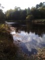
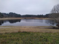
The trail ends at the banks of the River Dronne. A car park is available, as well as a covered area for shelter. There is also a boules court nearby.
A sign marking the start of the “Discovering the European Mink” nature trail awaits you.

(S/E) To start the trail, follow the river westwards (passing to the right of the large covered area).
After 100 metres, you’ll come to the first information board. Turn right after the poplar grove to head up a country lane, then left onto Rue Hector Martin to reach the church.

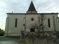
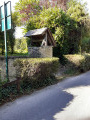
(1) In front of Saint-Fort Church: read the second information board and take the opportunity to visit the church and a permaculture garden on your left. Continue straight on along Rue Henri IV, then turn left onto Avenue Georges Clémenceau for about 250 metres. Turn right onto Rue Pierre Bourdan and continue straight on until you reach the river. A lovely private pond and a few pools line this street.

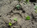
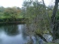
(2) Back to the banks of the Dronne. A third information panel awaits you. A footpath allows you to walk along the river to the right (east). During your walk, keep an eye out for animal tracks along the banks!

(3) About 700 metres further on, this is where the path leaves the river. A fourth information board gives you a chance to stop and read. Turn right onto the path that leads through the wet meadows. This is a good spot for a play break and a picnic. On this path, the fifth information board awaits you. At the top of the hill, you’ll see the “Lodges de la Dronne” in front of you. Turn right onto Rue Jean Bouin and follow it for 200 metres.

(4) At the end of these 200 metres, on your left, a sixth information board marks the entrance to the arboretum. Turn left; the rest of the path invites you to explore it.
Halfway along the grounds, you’ll find an entrance to the local football pitch on your left. Take this, walk alongside the pitch on your right, then turn right again through the open sports complex to reach Rue Pasteur. To help you find your way, the tennis court will be on your left.
Turn right onto Rue Pasteur, then left onto Rue Gambetta, and finally right onto Rue du 14 Juillet.

(5) At the end of this street, you’ll find Place de la Victoire, its war memorial and the final information panel.
To complete the circular route, turn left onto Rue Victor Hugo for 50 metres, then right to cross the open-air theatre and reach the boules court and the banks of the Dronne.
You are now back at your starting point (S/E).

Waypoints

  1. S/E : mi 0 - alt. 69 ft - Banks of the Dronne (river)
  2. 1 : mi 0.23 - alt. 89 ft - Saint-Fort Church
  3. 2 : mi 0.93 - alt. 59 ft - Dronne (rivière)
  4. 3 : mi 1.49 - alt. 59 ft - Path leading to the meadow
  5. 4 : mi 1.88 - alt. 95 ft - Turn left towards the arboretum
  6. 5 : mi 2.57 - alt. 92 ft - Place de la Victoire – War Memorial
  7. S/E : mi 2.74 - alt. 69 ft - The banks of the Dronne

Notes

A flat trail, accessible to cyclists, pushchairs and wheelchairs.
No special equipment is required.
For nature lovers, a camera and binoculars will come in handy.

Worth a visit

The path along the river is ideal for spotting animal tracks and aquatic wildlife.
The nature trail and its seven information boards draw your attention to points of interest relating to the area’s natural and historical heritage.

Good to know: The town of Saint-Aigulin offers two other longer walking trails through the Forest of La Double, starting from Avenue Jean Moulin, near the secondary school and the coach park.

Reviews and comments

4.1 / 5
Based on 4 reviews

Reliability of the description
4.3 / 5
Ease of following the route
4.3 / 5
Route interest
3.8 / 5
Tipelle
Tipelle

Overall rating : 3.3 / 5

Date of your route : Aug 19, 2024
Reliability of the description : ★★★★☆ Good
Ease of following the route : ★★★★☆ Good
Route interest : ★★☆☆☆ Disappointing
Very busy route : Yes

Most of the walk takes you through unremarkable housing estates from the 1950s and 1960s.
Otherwise, it’s a lovely riverside walk

Machine-translated

randofr
randofr

Overall rating : 4 / 5

Date of your route : Oct 29, 2018
Reliability of the description : ★★★★☆ Good
Ease of following the route : ★★★★☆ Good
Route interest : ★★★★☆ Good

A lovely, easy route for the whole family. A pleasant route along the riverbank.

Machine-translated

cannelle02
cannelle02

Overall rating : 5 / 5

Date of your route : Jul 03, 2017
Reliability of the description : ★★★★★ Very good
Ease of following the route : ★★★★★ Very good
Route interest : ★★★★★ Very good

A well-maintained footpath along the banks of the Dronne. Very pleasant and shaded during the heat of summer

Machine-translated

lionel17
lionel17

Overall rating : 4 / 5

Date of your route : Apr 17, 2017
Reliability of the description : ★★★★☆ Good
Ease of following the route : ★★★★☆ Good
Route interest : ★★★★☆ Good

A lovely, pleasant walk along the banks of the Dronne…
A word of advice for walkers who aren’t familiar with Saint-Aigulin: make sure you read the instructions carefully in the bottom left-hand corner of the information boards.

Machine-translated

Other walks in the area

For more walks, use our search engine .

The GPS track and description are the property of this route's author. Please do not copy them without permission.