Country:
 City:


Car park at the Touffreville-la-Corbeline Community Centre.
(S/E) Turn left onto Rue des Écoles, then at the end turn right onto Route du Val au Cesne. Follow the road to the next junction.
(1) Turn left onto the Route du Val au Cesne (D104), passing under the power lines. At the next junction at a place called Marplay, turn right to continue along the Route du Val au Cesne. Ignore the Route du Maroc, which branches off to the left. Continue along the road until you reach the bend.
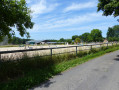
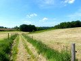
(2) Take the path, theGR® 211A, which continues straight ahead. Ignore theGR® 211A branching off to the left and the road branching off to the right. Follow the path (the grass is a bit long). When you reach the small road, turn right to follow theGR® 211A. At the next junction, cross the Route du Val au Cesne and carry on straight ahead on theGR® 211A via the Route du Berfolet. At the end of the street, you’ll come to an equestrian centre.
(3) Turn left onto Rue du Bois de Caux, leaving theGR® 211A, which branches off to the right. Carry on, passing through a small hamlet to reach a path that continues from the street, then head down into the woods and arrive at Rue du Val au Cesne.
(4) Cross the D89 and follow the road opposite, which climbs up to the next junction.
(5) Turn right (power pylon on the right) and follow the street. At the next junction, go straight on, pass through the hamlet of Le Val Rioly, continue along the small road which bends left within the hamlet and follow the street. You will reach a junction.
(6) Turn right into the dead-end road (Impasse de Limare). At the bend, carry on along the path which continues straight ahead (the grass is a bit long), leaving the road that turns right. Carry on along the path until you reach a small road that joins it. At the crossroads, cross over, carry on along the road opposite and follow it to the next crossroads. Cross the D289 and take the grassy path opposite towards the high-voltage power line to pass underneath it. Carry on along the grassy path until you reach the road.
(7) Turn left at the hairpin bend onto the road, pass under the high-voltage power line again, reach the hamlet of Beau Soleil and continue to the Stop sign.
(8) Take the road on the right to cross the hamlet, passing under the high-voltage power line again as you leave the hamlet. Continue along the road to the next junction, where there is a farm on the right.
(9) At the farm, turn left onto the Route d’Étaintot and follow it, keeping the high-voltage power line on your right. Ignore the Impasse du Gaillardin, which branches off to the right. Carry on to the end to reach a crossroads.
(10) Turn left onto the road, leaving the Impasse de la Ferme de la Mare on your right. Continue along the road, passing a farm on your left. The road bends to the right, then to the left and right again, leading to the Bois Saint-Jacques.
(11) Leave the road, go through the gate on the right, enter the woods, follow the path and walk alongside the field on your right. Stay on the path, keeping the field on your right; first pass under a power line and, a little further on, under the high-voltage line. There is a farm on the right. Continue along the path as it moves away from the field, heading downhill and rounding a bend to reach a signpost on the right. Leave the path, which continues straight ahead, and turn right.
(12) The path descends slightly; pass the first fence (an electric wire with a handle). Descend a little further. Pass the second electric wire (a handle). Descend a little further.
Pass two more electric wires (two handles), then head down across the field towards the road. Take the few steps down to reach the road and a signpost.
(13) Follow the road to the left (watch out for traffic). At the bend, turn right onto Rue à L’eau and continue along this street.
(14) Don’t miss the chance to look, from the little bridge, at the small stream flowing here, the pond, the spring and the house on the right.
(15) A little further down the street, admire the lovely little thatched cottage with green shutters on the right. Continue along this street.
(16) At the Stop sign, turn right onto the road and follow it. Pass a horse farm (Haras de l’If) on your right. Carry on along the road. At the Fork in the road, turn right onto the D37 and carry on along the road.
(17) TheGR® 211A joins from the small path on the left; it continues along the road you are following. Follow the D37 and theGR® 211A. Ignore the D89, which branches off to the right.
(18) At the junction, turn right onto the Route du Val de la Haie and theGR® 211A. Carry on to the end.
(19) At the junction, turn left onto the road, leaving theGR® 211A which branches off to the right. On your left, you’ll see three ponds; continue along the road, pass the few houses and arrive at the junction.
(1) Carry straight on along the Route du Val au Cesne and turn left onto Rue des Écoles. You’ll arrive back at the starting point, the Touffreville-la-Corbeline community hall (S/E).

 Visorando Member

 Moderate


 Easy