West of Naujan and Postiac

A slightly undulating route through woods, vineyards, scenic viewpoints and the Lapébie cycle path.

Details

394507
Creation:
Last update:
Last review:
  • Walking
    Activity: Walking
  • ↔
    Distance: 5.10 mi
  • ◔
    Average duration: 2h 30 
  • ▲
    Difficulty: Easy

  • ⚐
    Back to start: Yes
  • ↗
    Ascent: + 187 ft
  • ↘
    Descent: - 187 ft

  • ▲
    Highest point: 276 ft
  • ▼
    Lowest point: 108 ft

Photos

Description of the walk

(S/E) Car park: Village hall, town hall, schools if there are a lot of you, otherwise in front of the church.
If parking at the town hall, cross the D128 carefully, turn right for a few metres, then take the path leading down to the left towards the hamlet of Girolatte.

(1) When you reach the road, turn right, then immediately left after the first house; continue straight on until you reach the copse in front of Conques Castle. Once at the copse, at the foot of the castle, turn left, cross the D19 and continue straight on until you reach another road.

(2) To reach this new road, you’ll need to go round the vineyard slightly to the right, then turn left onto the road; keep right at the first fork. When you reach a T-junction, turn left towards the woods,

(3) About 100 metres past the woods, take the path on the left until you reach the road. Cross the D128, then walk alongside the copse and enter the woods.

(4) As you come out of the woods, turn left and head straight on towards the woods, which you will walk alongside.

(5) When you reach the cycle path, turn left and carry on to Arpaillan Castle. Please be aware that cyclists have right of way and are often silent...

(6) Before the château, leave the cycle path and take the small road to the left, then right, and left again heading north-east.

(7) Turn slightly right at the fork until you reach the D19.

(8) Cross this road and take the path opposite; follow the copses northwards, then rejoin the road.

(9) Turn right, then left before the houses to reach the car park (S/E).

Waypoints

  1. S/E : mi 0 - alt. 194 ft - Town Hall and Schools Car Park
  2. 1 : mi 0.45 - alt. 200 ft - The hamlet of Girolatte
  3. 2 : mi 1.23 - alt. 246 ft - Turn right, then left
  4. 3 : mi 1.78 - alt. 256 ft - Y-junction on the path
  5. 4 : mi 2.57 - alt. 272 ft - Exit the woods to the left, heading south
  6. 5 : mi 2.93 - alt. 226 ft - Cycle path on the left
  7. 6 : mi 3.6 - alt. 174 ft - Arpaillan Castle on the left
  8. 7 : mi 3.81 - alt. 210 ft - Turn right towards the D19
  9. 8 : mi 4.2 - alt. 256 ft - Junction X D19
  10. 9 : mi 4.56 - alt. 259 ft - Turn right towards the village
  11. S/E : mi 5.1 - alt. 194 ft - Town Hall and Schools Car Park

Notes

Important:
On the cycle path, remember that cyclists have right of way and that some may not be very audible, so please be vigilant.
This route takes you off the beaten track; all the landmarks mentioned in the description (local place names, castle names, as well as high-voltage power lines, bridges, etc.) are shown on the corresponding IGN 1:25,000 map, but are not always included on the scaled-down map.
It is strongly recommended that you either obtain this map or use the app on a smartphone, which will also allow you to be geolocated at all times, enabling you to track your progress accurately.
You will very often be crossing private property; please be discreet and respectful – this is the only way we can continue to offer routes like this.
The route may cross or follow other signposted routes. It is tempting to follow the signposts! Unless otherwise stated, do not stray from this route…
Using walking poles can be very useful and reassuring; as well as providing stability, they help distribute the strain more evenly.

Reviews and comments

4.1 / 5
Based on 4 reviews

Reliability of the description
4 / 5
Ease of following the route
4 / 5
Route interest
4.3 / 5
bx86
bx86

Overall rating : 3 / 5

Date of your route : Jun 22, 2025
Reliability of the description : ★★★☆☆ Average
Ease of following the route : ★★★☆☆ Average
Route interest : ★★★☆☆ Average
Very busy route : No

Hello, so I went for a walk this Sunday, 22 June.
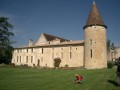
An easy, fairly varied route, ideal for a walk as there isn’t much to see apart from the beautiful castle (private property) in Arpaillan. Vineyards, a few hamlets, farmland, sheep, and even a roe deer. The route is quite shaded on the first half, less so on the second.
As we’ve been doing these routes using a GPS, a 1:25,000 map and a printed guide, we’d like to add a few details that might be useful
A few details
Between points 1 and 2 after Girolatte, keep the vineyard on your left and the hedge on your right. Ignore a path on the right.
When you’re almost at the end, take the grassy track that climbs to the right (access for the winegrower) and pass in front of the Métairie de Conques (as marked on the 1:25,000 map) (the word ‘château’, used in the region to refer to a wine-producing building, can be misleading!). There is no château at this location, just a house!
You reach point 2 by taking a grassy path on the right for 20 metres, running alongside the vineyard, which blocks further progress. The road is visible (telegraph poles).
Between points 4 and 5, at the edge of the woodland (as the vines were previously grubbed up), you can either continue straight on as indicated by the GPS track, between the woodland on the left and the field, to join the cycle path, or follow the departmental signposts (yellow for horses, cyclists and walkers) which lead to the path a little further east.
Finally, in Arpaillan, do not take the first small road on the right as you leave the hamlet (towards Les Planches d’Arpaillan), but take the second road!
Thank you for this route.

Machine-translated

delangeb
delangeb

Overall rating : 5 / 5

Date of your route : Mar 07, 2022
Reliability of the description : ★★★★★ Very good
Ease of following the route : ★★★★★ Very good
Route interest : ★★★★★ Very good
Very busy route : No

Very nice. Perhaps a little more detail would be helpful

Machine-translated

Lilas33
Lilas33

Overall rating : 4 / 5

Date of your route : Sep 21, 2020
Reliability of the description : ★★★★☆ Good
Ease of following the route : ★★★☆☆ Average
Route interest : ★★★★★ Very good
Very busy route : No

Thank you to whoever posted this route. It’s a very interesting route. Please do feel free to be a bit more specific. It’s a lovely walk.

Machine-translated

jiced
jiced

Overall rating : 4.3 / 5

Date of your route : Mar 18, 2018
Reliability of the description : ★★★★☆ Good
Ease of following the route : ★★★★★ Very good
Route interest : ★★★★☆ Good

Beautiful scenery and wildlife … otherwise, nothing to report.

Machine-translated

Other walks in the area

For more walks, use our search engine .

The GPS track and description are the property of this route's author. Please do not copy them without permission.