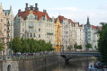
Circular route around Karlstejn, the castle and the old quarries

This walk is accessible by train. It takes you through the very touristy village of Karlstejn, past the castle, and through some beautiful surrounding forests, mainly beech woods. The paths are very well signposted throughout, with red or yellow markings between two white stripes.

Details

n°63415383
Creation:
Last update:
Last review:
  • Walking
    Activity: Walking
  • ↔
    Distance: 8.64 mi
  • ◔
    Average duration: 4h 55 
  • ▲
    Difficulty: Moderate

  • ⚐
    Back to start: Yes
  • ↗
    Ascent: + 1,070 ft
  • ↘
    Descent: - 1,076 ft

  • ▲
    Highest point: 1,339 ft
  • ▼
    Lowest point: 686 ft

Photos

Description of the walk

Arrive by train at Karlstejn station. If travelling by car, you can park in the adjacent car park.

(S/E) On leaving the station, take the small road on the right that runs past it. Turn left, cross the bridge over the river and continue to the right towards Karlstejn.

(1) Turn left to walk through the village.

(2) Carry on straight ahead, then turn right, following the white-red-white markings. Enter the forest and, once at the edge, continue to the right until you come out onto a road.

(3) Turn left and head towards Morina. Walk as far as the church.

(4) Turn left, following the white-yellow-white markings. Walk through the village until you reach a triangular junction.

(5) Turn slightly to the right once, then again a few dozen metres further on. At the next junction, turn right onto the street, which later becomes a track and leads to a railway line: picnic table.

(6) Cross the tracks carefully and continue straight ahead to reach Velká Amerika, a very large former quarry.

(7) Turn left to walk alongside it.

(8) Turn left to reach the viewpoint, then turn back.

(8) Resume the route by turning left, passing by the former Mexiko site and joining a tarmac road.

(9) Cross carefully, then turn left. Walk past a small dirt car park and then the former Kanada site. Continue to Malá Amerika.

(10) Turn left. Go straight ahead at the first junction, turn right at the second and
reach the third, a four-way junction.

(11) Turn left and carry on straight ahead.

(12) At the picnic table, turn right. You’ll come to a small road; follow it straight on for about 200 m.

(13) After passing the restaurant, leave the road and take the path on the left leading to Karlstejn Castle.

(14) Turn right and carry on to the end.

(15) Turn back.

(14) Turn right again; this will take you onto a road which you should follow straight on until you reach the junction where the circular route begins.

(2) Continue along the outward route in the opposite direction, passing through the village again.

(1) Follow the road for about a hundred metres, then turn left to cross the bridge. Then turn right to return to the station (S/E).

Waypoints

  1. S/E : mi 0 - alt. 705 ft - Karlstejn station
  2. 1 : mi 0.41 - alt. 732 ft - Karlstejn
  3. 2 : mi 0.94 - alt. 846 ft - Junction of the circular loop
  4. 3 : mi 2 - alt. 1,247 ft - Road junction
  5. 4 : mi 2.89 - alt. 1,181 ft - Church, fork to the left
  6. 5 : mi 3.35 - alt. 1,112 ft - Junction on the right
  7. 6 : mi 3.78 - alt. 1,243 ft - Railway line, picnic table
  8. 7 : mi 4.02 - alt. 1,322 ft - Velká America
  9. 8 : mi 4.68 - alt. 1,306 ft - Junction
  10. 9 : mi 5.15 - alt. 1,270 ft - Tarmac road
  11. 10 : mi 5.81 - alt. 1,299 ft - Malá America
  12. 11 : mi 6.18 - alt. 1,198 ft - Junction
  13. 12 : mi 6.64 - alt. 968 ft - Turning point to the right, picnic table
  14. 13 : mi 7.03 - alt. 896 ft - Castle Trail
  15. 14 : mi 7.26 - alt. 955 ft - Junction
  16. 15 : mi 7.35 - alt. 928 ft - Castle
  17. S/E : mi 8.64 - alt. 709 ft - Karlstejn station

Notes

This walk includes 1.5 km of road to extend the circular route and minimise the section of the route that is walked in both directions.

Reviews and comments

4.7 / 5
Based on 1 review

Reliability of the description
5 / 5
Ease of following the route
5 / 5
Route interest
4 / 5
Fredo83
Fredo83

Overall rating : 4.7 / 5

Date of your route : Oct 11, 2024
Reliability of the description : ★★★★★ Very good
Ease of following the route : ★★★★★ Very good
Route interest : ★★★★☆ Good
Very busy route : Yes

A pleasant walk with some lovely stretches and good signposting. That said, I was disappointed that too much of it was on tarmac.
A big plus for French tourists: accessible by train.
Thank you for this route

Machine-translated

Other walks in the area

For more walks, use our search engine .

The GPS track and description are the property of this route's author. Please do not copy them without permission.