Country:


Start at the Hřibitov Vraž cemetery.
(S/E) Follow the road that climbs to the left of the cemetery. At the left-hand bend, take the path that goes straight on, running alongside the wall. Continue through the woodland (yellow markings) until you reach a fork.
(1) Cross the valley and continue straight ahead along a forest track that descends through the woods. When you reach the road, turn right and stay on it until you reach the village of Svaty jan pod Skalou, where you’ll arrive at the car park in front of the church.
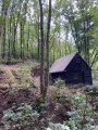
(2) Head left to the far end of the car park and take the path that climbs into the woods. The path passes a small chapel. Continue climbing until you reach a fork in the path.
(3) Turn right onto the path which climbs steeply up a flight of steps and leads to the ridge.
(4) Carry on to the right, following a loop to the viewpoint, then return to the junction.
(4) On your return, carry on straight ahead and you’ll reach a fork in the path a little over a hundred metres further on.
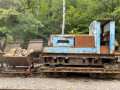
(5) Take the path on the right which leads uphill. Cross over a small railway line, then follow the path running alongside the railway line until you reach the junction at a large open space surrounded by trees.
(6) Turn left for a round trip and head for the Mining Museum.
(6) On your return, carry on straight ahead along a track that descends into the forest to a small clearing on the right
(7) Take a small, barely visible path on the left that leads into the undergrowth and head down to some small wooden structures. Follow the path on the left as it climbs, marked by a green cross, to a junction with a stone cross. Continue along this track for a few metres alongside a field on your right, then turn left (yellow cross on a tree).
(8) Leave the main track and follow a grassy path on the right which runs along the ridge. Almost at the edge of the woodland, take a path on the left (blue markings).
(9) As you emerge from the woods, walk along the edge of the clearing on the left. From this point onwards, there are no further coloured markings.
The path descends into the woods and generally follows the bottom of the valley, which looks like a motorway for wild boars.
(10) When the slope levels out, take care as the main path continues straight on, but you must take a barely visible path on the left.
Continue along this grassy, barely marked path until you reach a river. Cross the bridge, join the road and turn left until you reach a village. Just before the bridge crossing the river, take a dead-end road on the right and follow it to the end. Continue along a small path that climbs steeply and rejoins the original path.
(1) Carry on straight ahead, climbing until you reach the road. Turn right and, before the cemetery, follow a path on the left which leads back down to the car park (S/E).

 Visorando Member
 Easy