


No description
Paillon National Forest (La forêt domaniale du Paillon), Berre-Les-Alpes
Details
Creation:
Last update:
-
 Activity: Walking
-
 Distance: 8.23 mi
-
 Average duration: 5h 40
-
 Difficulty: Moderate
-
-
 Back to start: No
-
 Ascent: + 2,169 ft
-
 Descent: - 2,192 ft
-
-
 Highest point: 2,523 ft
-
 Lowest point: 1,168 ft
-
 Country:
France
-
 Areas: Alps, Préalpes de Nice
-
 City:
L'Escarène (06440)
-
 Start: N 43.834667° / E 7.354011°
-
 End: N 43.835495° / E 7.353228°
-
 IGN map(s): Ref. 3741ET, 3742OT
-


 Hour-by-hour weather
Description of the walk
Waypoints
- S : mi 0 - alt. 1,191 ft
- E : mi 8.23 - alt. 1,175 ft
Other walks in the area
Circular route from L'Escarène to Berre-les-Alpes via the Paillon National Forest.
 Visorando Member
 7.99 mi
+1,601 ft
-1,611 ft
5h 05
Moderate
Departure from L'Escarène (Alpes-Maritimes)
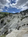
Stroll through the narrow streets and old bridges of L'Escarène. Cross the magnificent Paillon National Forest and stop at Berre-les-Alpes to admire the panoramic views and old buildings. The return journey takes you through the forest and its marlstone "canyons". The final path leads to the heart of L'Escarène.
The Crête de Scaletta from L'Escarène
 6.97 mi
+2,454 ft
-2,438 ft
5h 20
Moderate
Departure from L'Escarène (Alpes-Maritimes)
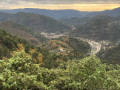
This route crosses two villages in the hinterland, L'Escarène and Touët-de-l'Escarène, via rarely used paths. A fewancient ruins, the remains of forgotten terraces, a 360° view from the top of the Crête de la Scaletta and abundant wildlife.
This hike is for experienced hikers. The Crête de la Scaletta is off-trail and the terraces between (11) and (12) form low walls that must be crossed. Sometimes you have to use your hands on the rock.
The Mont Panard circuit
 8.11 mi
+2,211 ft
-2,228 ft
5h 40
Moderate
Departure from L'Escarène (Alpes-Maritimes)
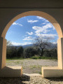
Although the start of this walk is rather uninspiring, as it begins on a track suitable for vehicles, the rest is a magnificent series of wooded paths, offering views of the Rocher Saint-Sauveur, then of the Baudon, Monts Ours and Mont Agel massifs, as well as distant views of the Mediterranean coastline.
Due to trail closures, the Visorando GPS app may prove useful.
La Cime du Castel
 7.28 mi
+2,323 ft
-2,316 ft
5h 20
Moderate
Departure from L'Escarène (Alpes-Maritimes)
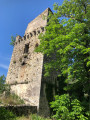
On the eastern side, the fairly steep climb up to the Cime du Castel, the panoramic view from its summit, and the two forgotten paths between the 17th-century Sainte-Brigitte tower and the River Paillon lend a unique character to these little-known spots near Nice.
The Paillon National Forest
 7.72 mi
+1,906 ft
-1,900 ft
5h 15
Moderate
Departure from L'Escarène (Alpes-Maritimes)
A bucolic and informative stroll in the back country of Nice.
The short tour of Mont Panard from Touët de l'Escarène station
 6.71 mi
+2,008 ft
-2,008 ft
4h 50
Moderate
Departure from Touët-de-l'Escarène (Alpes-Maritimes)
A beautiful walk starting from the station in the charming village of Touët de l'Escarène around Mont Panard, mostly through undergrowth. After crossing the tracks of the Train des Merveilles, the route climbs up the left bank of the Ravin d'Estiou and winds clockwise around Mont Panard. Beautiful views of the Mercantour peaks, the rocks of Saint Sauveur and Mont Brec.
From Touët-de-l'Escarène to La Baisse du Pape
8.12 mi
+2,159 ft
-2,175 ft
5h 35
Moderate
Departure from Touët-de-l'Escarène (Alpes-Maritimes)
A pleasant walk starting from Touët-de-l'Escarène. After an initial slightly uphill section, the route is then very easy going, mostly following DFCI tracks. The scenery is varied.
La Scaletta de Touët-de-l'Escarène
 4.43 mi
+1,903 ft
-1,893 ft
3h 40
Moderate
Departure from Touët-de-l'Escarène (Alpes-Maritimes)
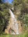
This pleasant route takes you along rarely used paths, past ancient ruins, the remains of forgotten terraces, refreshing streams, a 360° view from the top of the Scaletta ridge and abundant wildlife. This hike is for experienced hikers. The tour of the Scaletta ridge is off-trail and the terraces between points (6) and (7) form low walls that must be climbed over. You may need to use your hands on the rock.
For more walks, use our search engine .
The GPS track and description are the property of this route's author. Please do not copy them without permission.

