


No description
Tour des 10 plus hauts sommets de Chartreuse - J5

Jour 5 du Tour des 10 plus hauts sommets de Chartreuse.
Cirque de St-Même, Lance Sud de Malissard, Dôme de Bellefond, Piton de Bellefond, Dent de Crolles, col du Coq.
This walk is part of a multi-day hike: Tour des 10 plus hauts sommets de Chartreuse
Details
Creation:
Last update:
–
–
-
 Activity: Walking
 -
 Distance: 12.72 mi
 -
 Average duration: 10h 45
 -
 Difficulty: Difficult
 -
-
 Back to start: No
 -
 Ascent: + 5,591 ft
 -
 Descent: - 3,809 ft
 -
-
 Highest point: 6,759 ft
 -
 Lowest point: 2,799 ft
-
 Country:
France
Country:
France
-

-
 City:
Saint-Pierre-d'Entremont (Savoie) (73670)
City:
Saint-Pierre-d'Entremont (Savoie) (73670) -
 Start: N 45.399262° / E 5.891653°
 -
 End: N 45.301786° / E 5.833625°
 -
 IGN map(s): Ref. 3333OT, 3333OTR, 3334OT, 3334OTR
 -


 Hour-by-hour weather
Description of the walk
Waypoints
- S : mi 0 - alt. 2,828 ft - Cirque de St-Même
- 1 : mi 5.01 - alt. 5,486 ft - Vallon de Marcieu
- 2 : mi 6.38 - alt. 6,637 ft - Lance Sud de Malissard
- 3 : mi 6.75 - alt. 6,240 ft - Col de Bellefont (1902m)
- 4 : mi 7.03 - alt. 6,460 ft - Dôme de Bellefont
- 5 : mi 7.39 - alt. 6,398 ft - Piton de Bellefont (1958m)
- 6 : mi 8.07 - alt. 6,073 ft - Pas de Rocheplane (1860m)
- 7 : mi 10.57 - alt. 6,759 ft - Dent de Crolles
- 8 : mi 10.68 - alt. 6,644 ft - Pas de l'Oeille (2009m)
- 9 : mi 11.82 - alt. 5,059 ft - Col des Ayes
- E : mi 12.72 - alt. 4,596 ft - Col du Coq
This route passes through a protected area, which may be subject to special regulations:
Other walks in the area
Cirque de Saint-Même: Waterfalls and Cave via the Pas Ruat
 Visorando Member
 2.62 mi
+1,056 ft
-1,030 ft
3 hrs
2.62 mi
+1,056 ft
-1,030 ft
3 hrs
 Very difficult
Departure from Saint-Pierre-d'Entremont (Savoie) (Savoie)
Very difficult
Departure from Saint-Pierre-d'Entremont (Savoie) (Savoie)
The Cirque de Saint-Même is very busy in summer, with most visitors content to have a picnic on the meadows or follow the signposted route through the waterfalls. The short circular loop suggested here extends this route by taking in an additional waterfall and the Source du Guiers Vif, via the steep Pas Ruat pass with its astonishing passage beneath the rock face emerging in front of the Grotte du Guiers Vif.
⚠️ This route is partly unmarked, unmaintained and presents significant risks. Hikers undertake this route at their own risk. Please refer to the official marked trails.
⚠️ The footbridge leading to the Grotte du Guiers Vif (4) was damaged by a rockslide in July 2023: a mayoral order currently prohibits access.
Le Grand Manti, the Trèfle tunnel and Alpettaz via Pas de la Mort
 6.02 mi
+3,855 ft
-3,862 ft
6h 05
Difficult
Departure from Saint-Pierre-d'Entremont (Savoie) (Savoie)
6.02 mi
+3,855 ft
-3,862 ft
6h 05
Difficult
Departure from Saint-Pierre-d'Entremont (Savoie) (Savoie)
Hike to discover the sources of the Guiers Vif and the Crêtes du Grand Manti, among waterfalls, caves, cliffs and mountain pastures.
Please note that this hike is vertiginous in some areas (Pas de la Mort) and is not recommended for people who are prone to vertigo or in wet weather.
Cirque de Saint-Même: a bit of an adrenaline rush
 4.44 mi
+2,651 ft
-2,664 ft
4h 20
Difficult
Departure from Saint-Pierre-d'Entremont (Savoie) (Savoie)
4.44 mi
+2,651 ft
-2,664 ft
4h 20
Difficult
Departure from Saint-Pierre-d'Entremont (Savoie) (Savoie)
A superb circular walk featuring waterfalls, a natural tunnel, a cave, climbing sections, an exposed ledge and a mountain pasture, topped off with some stunning views throughout the route.
⚠️ Part of this route is unmarked, unmaintained and presents significant risks. Hikers undertake this route at their own risk. Please refer to the officially marked trails.
⚠️ The ‘Pas de la Mort’ between (5) and (9) is classified as dangerous and is strongly discouraged. See practical information.
On all vertical sections, do not rely on the GPS track but follow the route description.
Cirque de Saint Même - Guiers Vif waterfalls
 1.77 mi
+676 ft
-669 ft
1h 25
Difficult
Departure from Saint-Pierre-d'Entremont (Savoie) (Savoie)
1.77 mi
+676 ft
-669 ft
1h 25
Difficult
Departure from Saint-Pierre-d'Entremont (Savoie) (Savoie)
Short hike in the forest to discover the waterfalls of the Guiers Vif.
Around the Cirque de Saint-Même
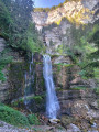 8.20 mi
+3,970 ft
-3,983 ft
7h 15
Difficult
Departure from Saint-Pierre-d'Entremont (Savoie) (Savoie)
8.20 mi
+3,970 ft
-3,983 ft
7h 15
Difficult
Departure from Saint-Pierre-d'Entremont (Savoie) (Savoie)
From the Cirque de Saint-Même and its waterfalls, across the Hauts de Chartreuse plateaus via 3 Pas to the Croix de l’Alpe (1,821 m).Stunning views.
⚠️ This route is partly unmarked, unmaintained and presents significant risks. Hikers undertake this route at their own risk. Please follow the official marked trails.
Sangles de Fouda Blanc and Pinet circular
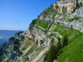 8.99 mi
+3,609 ft
-3,579 ft
8 hrs
Very difficult
Departure from Saint-Pierre-d'Entremont (Savoie) (Savoie)
8.99 mi
+3,609 ft
-3,579 ft
8 hrs
Very difficult
Departure from Saint-Pierre-d'Entremont (Savoie) (Savoie)
This circular allows you to take the longest route in the massif, linking the Sangle du Fouda Blanc and the Sangle du Pinet. The proposed return route allows you to visit the characteristic sites of the Pinet, which are its mushroom rocks and the arch of its sinkhole.
Please note that this is a challenging route: you will be between two cliffs for about two hours, where missteps are not an option. Dry terrain is essential.
Le Grand Manti
 5.81 mi
+2,812 ft
-2,782 ft
5h 05
5.81 mi
+2,812 ft
-2,782 ft
5h 05
 Moderate
Departure from Saint-Pierre-d'Entremont (Savoie) (Savoie)
Moderate
Departure from Saint-Pierre-d'Entremont (Savoie) (Savoie)
A pleasant walk in the Hauts de Chartreuse nature reserve.
Lost in the mountain pastures, the old boundary markers between Savoie and Dauphiné still look beautiful.
The Belles Ombres and Fouda Blanc route via the Grotte de l’Ours
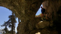 15.04 mi
+6,699 ft
-6,699 ft
10 hrs
15.04 mi
+6,699 ft
-6,699 ft
10 hrs
 Extremely difficult
Departure from Saint-Pierre-d'Entremont (Savoie) (Savoie)
Extremely difficult
Departure from Saint-Pierre-d'Entremont (Savoie) (Savoie)
A hike of superlatives, combining the most beautiful landscapes of the Northern Chartreuse with four little-visited arches, as well as magnificent limestone formations including the Dromadaire, the Griffes and the Grotte de l’Ours.
The route alternates between barely marked, idyllic paths, vertiginous ridges and vast sharp limestone pavements, and runs largely off the beaten track.
This hike requires a good level of fitness; please read the warning in the practical information carefully.
For more walks, use our search engine .
The GPS track and description are the property of this route's author. Please do not copy them without permission.

