


titous68

 Visorando Member
 Premium user
 - Location: Munster (68140)
- Gender: man
Sign up:
Published route(s)
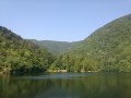
 Alfeld Lake - Rundkopf - Boedelen - Alfeld Lake
 4.45 mi
 +1,499 ft
 -1,483 ft
 3h 20
3h 20
 Difficult
 Departure from Sewen (Haut-Rhin)
Enjoy the hike! It's not very long, but there's quite a bit of elevation gain. The first part is quite steep, but the trails are pleasant
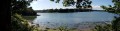
 Île Tudy - Sainte-Marine - Combrit
 12.07 mi
+266 ft
-276 ft
2.5 hrs
12.07 mi
+266 ft
-276 ft
2.5 hrs
 Moderate
Departure from Île-Tudy (Finistère)
Moderate
Departure from Île-Tudy (Finistère)
A short bike ride between the beach, the woods and the Bigouden countryside.
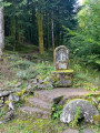
From Masevaux to Niederbruck via forest paths
 3.49 mi
+479 ft
-479 ft
2h 00
3.49 mi
+479 ft
-479 ft
2h 00
 Easy
Departure from Masevaux (Haut-Rhin)
Easy
Departure from Masevaux (Haut-Rhin)
Between Masevaux and Niederbruck, more than ten kilometres of new forest paths have recently been created. Here is a nice little route of about 6 km that partly follows these new paths...
Hike accessible via Niederbruck Centre station.
